
MyTopo
Black Ridge Colorado US Topo Map
Couldn't load pickup availability
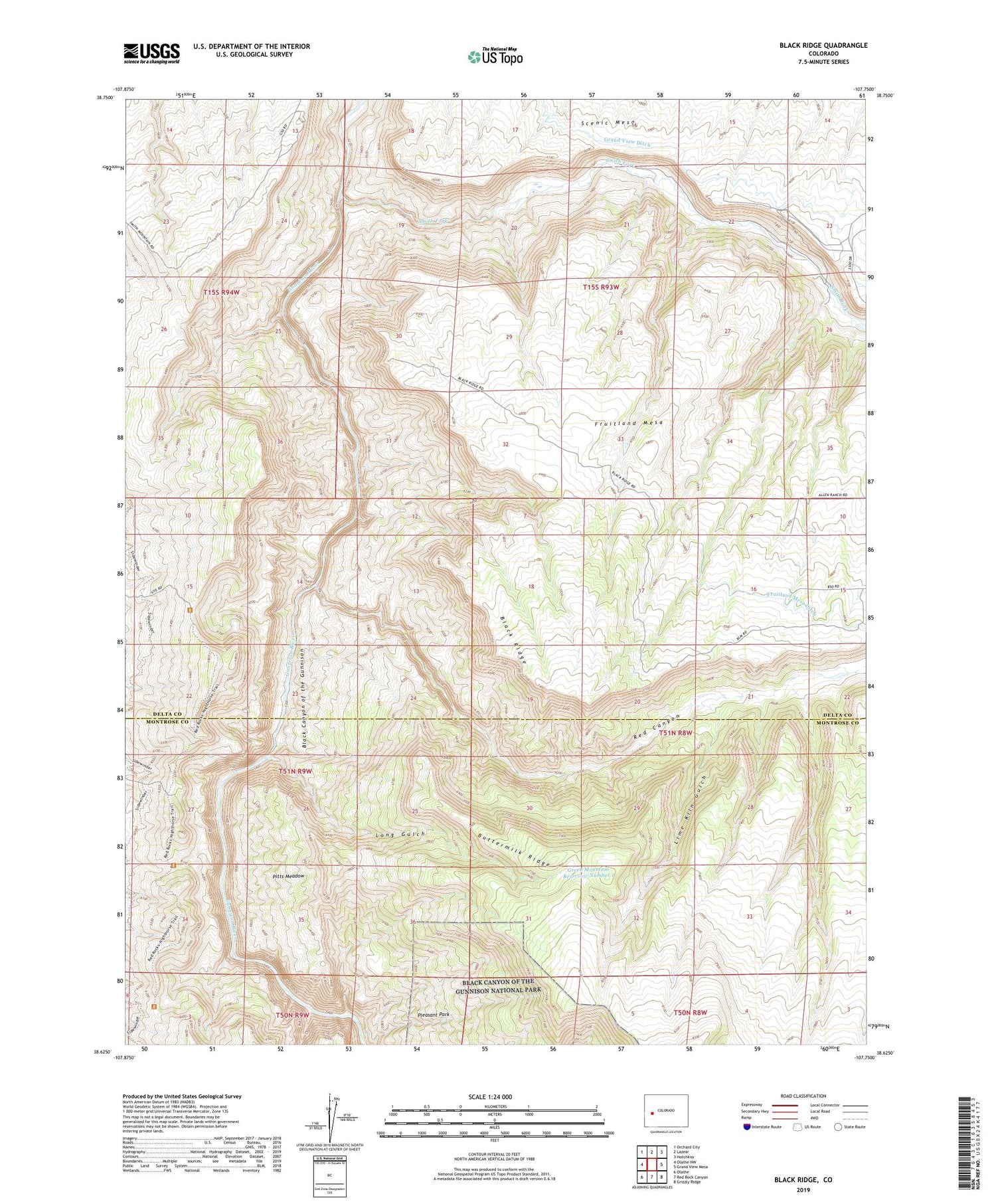
2022 topographic map quadrangle Black Ridge in the state of Colorado. Scale: 1:24000. Based on the newly updated USGS 7.5' US Topo map series, this map is in the following counties: Delta, Montrose. The map contains contour data, water features, and other items you are used to seeing on USGS maps, but also has updated roads and other features. This is the next generation of topographic maps. Printed on high-quality waterproof paper with UV fade-resistant inks.
Quads adjacent to this one:
West: Olathe NW
Northwest: Orchard City
North: Lazear
Northeast: Hotchkiss
East: Grand View Mesa
Southeast: Grizzly Ridge
South: Red Rock Canyon
Southwest: Olathe
This map covers the same area as the classic USGS quad with code o38107f7.
Contains the following named places: Atlas Mining Company Mine, Black Ridge, Buttermilk Ridge, Doty Mine, Fruitland Mesa, Fruitland Mesa Ditch, Green Mountain Reservoir Number 1, Gunnison Gorge Wilderness, Lime Kiln Gulch, Long Gulch, Messano Claims Mine, Pitts Meadow, Pleasant Park, Red Canyon, Scenic Mesa, Smith Fork


