MyTopo
Lazear Colorado US Topo Map
Couldn't load pickup availability
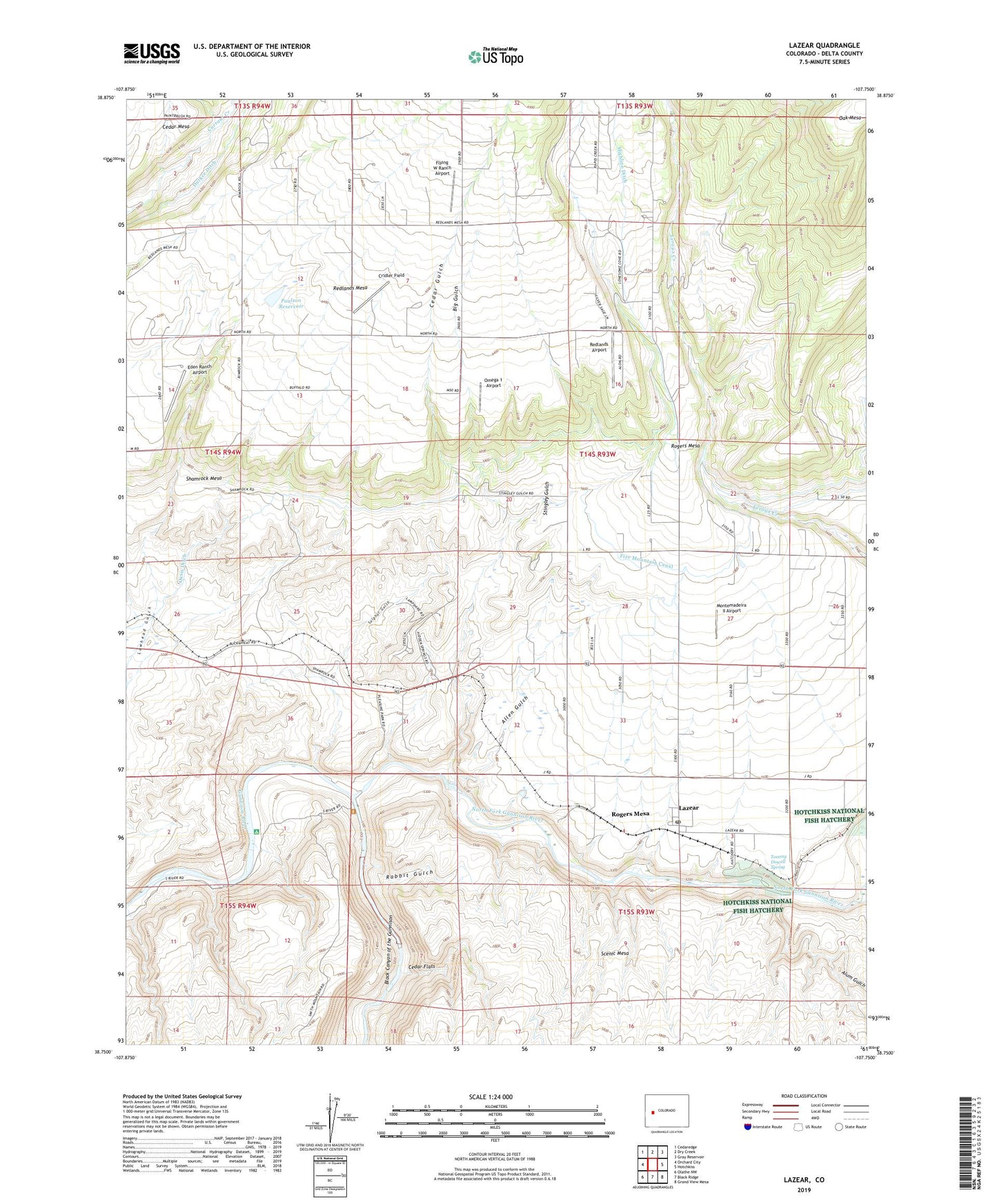
2022 topographic map quadrangle Lazear in the state of Colorado. Scale: 1:24000. Based on the newly updated USGS 7.5' US Topo map series, this map is in the following counties: Delta. The map contains contour data, water features, and other items you are used to seeing on USGS maps, but also has updated roads and other features. This is the next generation of topographic maps. Printed on high-quality waterproof paper with UV fade-resistant inks.
Quads adjacent to this one:
West: Orchard City
Northwest: Cedaredge
North: Dry Creek
Northeast: Gray Reservoir
East: Hotchkiss
Southeast: Grand View Mesa
South: Black Ridge
Southwest: Olathe NW
This map covers the same area as the classic USGS quad with code o38107g7.
Contains the following named places: Allen Gulch, Alum Gulch, Big Gulch, Black Canyon of the Gunnison, Cedar Flats, Cedar Gulch, Cridler Field, Delta County, Durkee Ditch, Eden Ranch Airport, Flying W Ranch Airport, Gunnison Forks Mine, Highline Ditch, Hurst School, Lazear, Lazear Census Designated Place, Lazear Post Office, Montemadeira II Airport, Mountain View Bible Church, North Fork Gunnison River, Oasis Ditch, Omega 1 Airport, Paulson Dam, Paulson Reservoir, Rabbit Gulch, Rainbow Run Trout Farm, Redlands Airport, Rogers Mesa, Rogers Mesa Community House, Rogers Mesa School, Shamrock Mesa, Spruce Point Tree Farm LLC Airport, Stingley Gulch, Sulphur Gulch, Sulphur Mine, Tommy Dowell Spring, West Redlands School