MyTopo
Orchard City Colorado US Topo Map
Couldn't load pickup availability
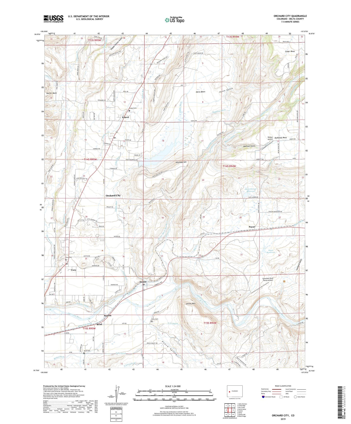
2022 topographic map quadrangle Orchard City in the state of Colorado. Scale: 1:24000. Based on the newly updated USGS 7.5' US Topo map series, this map is in the following counties: Delta. The map contains contour data, water features, and other items you are used to seeing on USGS maps, but also has updated roads and other features. This is the next generation of topographic maps. Printed on high-quality waterproof paper with UV fade-resistant inks.
Quads adjacent to this one:
West: North Delta
Northwest: Hells Kitchen
North: Cedaredge
Northeast: Dry Creek
East: Lazear
Southeast: Black Ridge
South: Olathe NW
Southwest: Delta
This map covers the same area as the classic USGS quad with code o38107g8.
Contains the following named places: Adobe Buttes Sanitary Landfill, Alfalfa Ditch, Alfalfa Run, Antelope Hill, Austin, Austin Post Office, Bona Fide Ditch, Cedar Run, Cory, Cory Cemetery, Cory Post Office, Crim Cemetery, Currant Creek, Davis and Spaulding Property Mine, Doughspoon Creek, Dry Creek, E O Lateral, Eckert, Eckert Cemetery, Eckert Post Office, Fairview School, Fruit Growers Dam, Fruit Growers Reservoir, Fuller Ditch Number 2, G K B Lateral, G K Lateral, Gallant Ditch, Gunnison River Farms Airport, Hallenbeck Pit, Happy Hollow Gulch, Harts Basin, Hawkins Ranch Airport, Highline Ditch, Lawhead Gulch, Madison Gulch, Morton Ditch, Oak Creek, Oasis Dam, Oasis Reservoir, Orchard City, Payne, Peach Valley, Posin Gulch, Read, Read Cemetery, Saint George Dam, Saint George Reservoir, Saxton, Smiths Mountain, Surface Creek, Town of Orchard City, Transfer Ditch, Widner Airport, ZIP Codes: 81410, 81418