MyTopo
Blue Hill Colorado US Topo Map
Couldn't load pickup availability
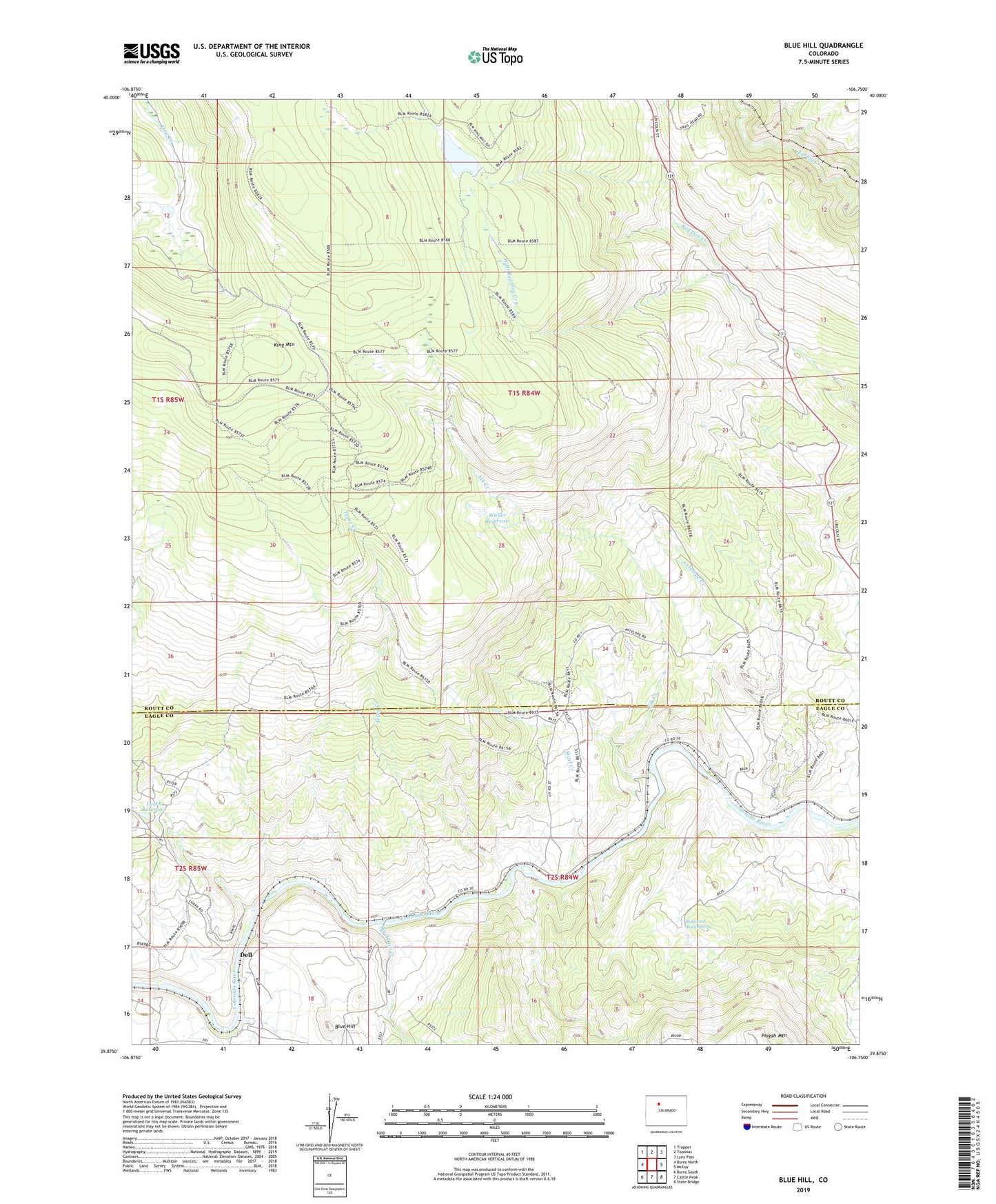
2022 topographic map quadrangle Blue Hill in the state of Colorado. Scale: 1:24000. Based on the newly updated USGS 7.5' US Topo map series, this map is in the following counties: Routt, Eagle. The map contains contour data, water features, and other items you are used to seeing on USGS maps, but also has updated roads and other features. This is the next generation of topographic maps. Printed on high-quality waterproof paper with UV fade-resistant inks.
Quads adjacent to this one:
West: Burns North
Northwest: Trapper
North: Toponas
Northeast: Lynx Pass
East: McCoy
Southeast: State Bridge
South: Castle Peak
Southwest: Burns South
This map covers the same area as the classic USGS quad with code o39106h7.
Contains the following named places: Antelope Creek, Balanced Rock Spring, Big Alkali Creek, Blue Hill, Dell, Elk Creek, Grimes Brooks Reservoir, Grimes-Brooks Dam, King Mountain, Leland Creek, Luark Dam, Luark Reservoir, Stifel Creek, Tepee Creek, Waller Reservoir, West Branch Red Dirt Creek, Wohler-Walier Dam