MyTopo
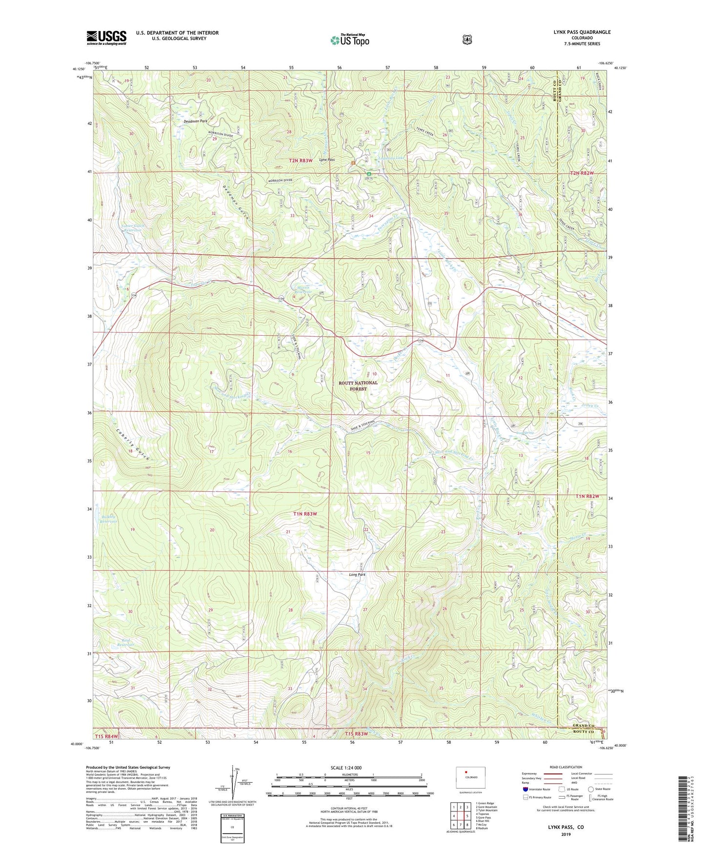
Lynx Pass Colorado US Topo Map
Couldn't load pickup availability
Also explore the Lynx Pass Forest Service Topo of this same quad for updated USFS data
2022 topographic map quadrangle Lynx Pass in the state of Colorado. Scale: 1:24000. Based on the newly updated USGS 7.5' US Topo map series, this map is in the following counties: Routt, Grand. The map contains contour data, water features, and other items you are used to seeing on USGS maps, but also has updated roads and other features. This is the next generation of topographic maps. Printed on high-quality waterproof paper with UV fade-resistant inks.
Quads adjacent to this one:
West: Toponas
Northwest: Green Ridge
North: Gore Mountain
Northeast: Tyler Mountain
East: Gore Pass
Southeast: Radium
South: McCoy
Southwest: Blue Hill
This map covers the same area as the classic USGS quad with code o40106a6.
Contains the following named places: Allen Ditch, Black Creek, Bulkley Dam, Bulkley Reservoir, Deadman Gulch, Deadman Park, Decker Creek, Horse Creek, Iron Spring, Jolley Creek, Lagunita Lake, Little Henry Creek, Little Rock Creek, Long Park, Lynx Pass, Lynx Pass Campground, Lynx Pass Forest Service Station, Maggie Ditch, Morris Dam, Morris Reservoir, Morrison Divide Trail, Porcupine Creek, Reid Reservoir, Rock Creek Campground, Shoe and Stocking Campground, Shoe and Stocking Creek, Tepee Creek, Tepee Creek Trail, Tie Creek, Tonier Gulch Dam, Tonier Gulch Reservoir, Toponas Creek Campground, Whiskey Creek