MyTopo
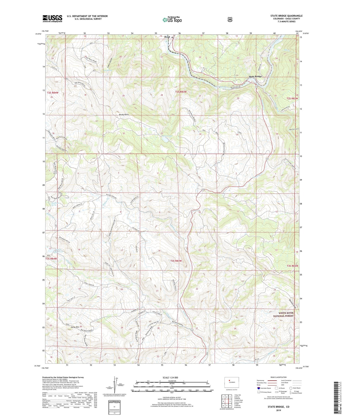
State Bridge Colorado US Topo Map
Couldn't load pickup availability
Also explore the State Bridge Forest Service Topo of this same quad for updated USFS data
2022 topographic map quadrangle State Bridge in the state of Colorado. Scale: 1:24000. Based on the newly updated USGS 7.5' US Topo map series, this map is in the following counties: Eagle. The map contains contour data, water features, and other items you are used to seeing on USGS maps, but also has updated roads and other features. This is the next generation of topographic maps. Printed on high-quality waterproof paper with UV fade-resistant inks.
Quads adjacent to this one:
West: Castle Peak
Northwest: Blue Hill
North: McCoy
Northeast: Radium
East: Lava Creek
Southeast: Edwards
South: Wolcott
Southwest: Eagle
This map covers the same area as the classic USGS quad with code o39106g6.
Contains the following named places: Bond, Bond Post Office, Castle Creek, Crazy Horse Creek, Deadhorse Spring, Elk Creek, Goodson Creek, High Trail Gulch, Iron Spring, Orestod, Oxford Lake, Piney River, State Bridge, Welsh Dam, Welsh Reservoir, Willow Creek, Windy Point