MyTopo
McCoy Colorado US Topo Map
Couldn't load pickup availability
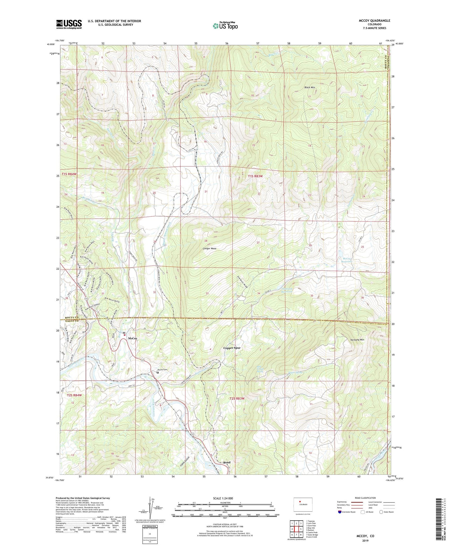
2022 topographic map quadrangle McCoy in the state of Colorado. Scale: 1:24000. Based on the newly updated USGS 7.5' US Topo map series, this map is in the following counties: Routt, Eagle, Grand. The map contains contour data, water features, and other items you are used to seeing on USGS maps, but also has updated roads and other features. This is the next generation of topographic maps. Printed on high-quality waterproof paper with UV fade-resistant inks.
Quads adjacent to this one:
West: Blue Hill
Northwest: Toponas
North: Lynx Pass
Northeast: Gore Pass
East: Radium
Southeast: Lava Creek
South: State Bridge
Southwest: Castle Peak
This map covers the same area as the classic USGS quad with code o39106h6.
Contains the following named places: Black Mountain, Burns and McCoy Mine, Cabin Gulch, Congor Mesa, Copper King Mine, Copper Queen Mine, Copper Spur, Crater, Egeria Creek, Kayser Mutual Ditch, Kayser Spring, McCoy, McCoy Cemetery, McCoy Census Designated Place, McCoy Dam, McCoy Pit and Quarry, McCoy Post Office, McCoy Reservoir, Red Dirt Creek, Rio Grande Mine, Rock Creek, Rock Creek Volunteer Fire Department, Split Trough Spring, Tipple, Tipton Ranch Mine, Volcano, Yarmany Reservoir, Yarmony Creek, Yarmony Dam, Yarmony Mountain, ZIP Code: 80463