MyTopo
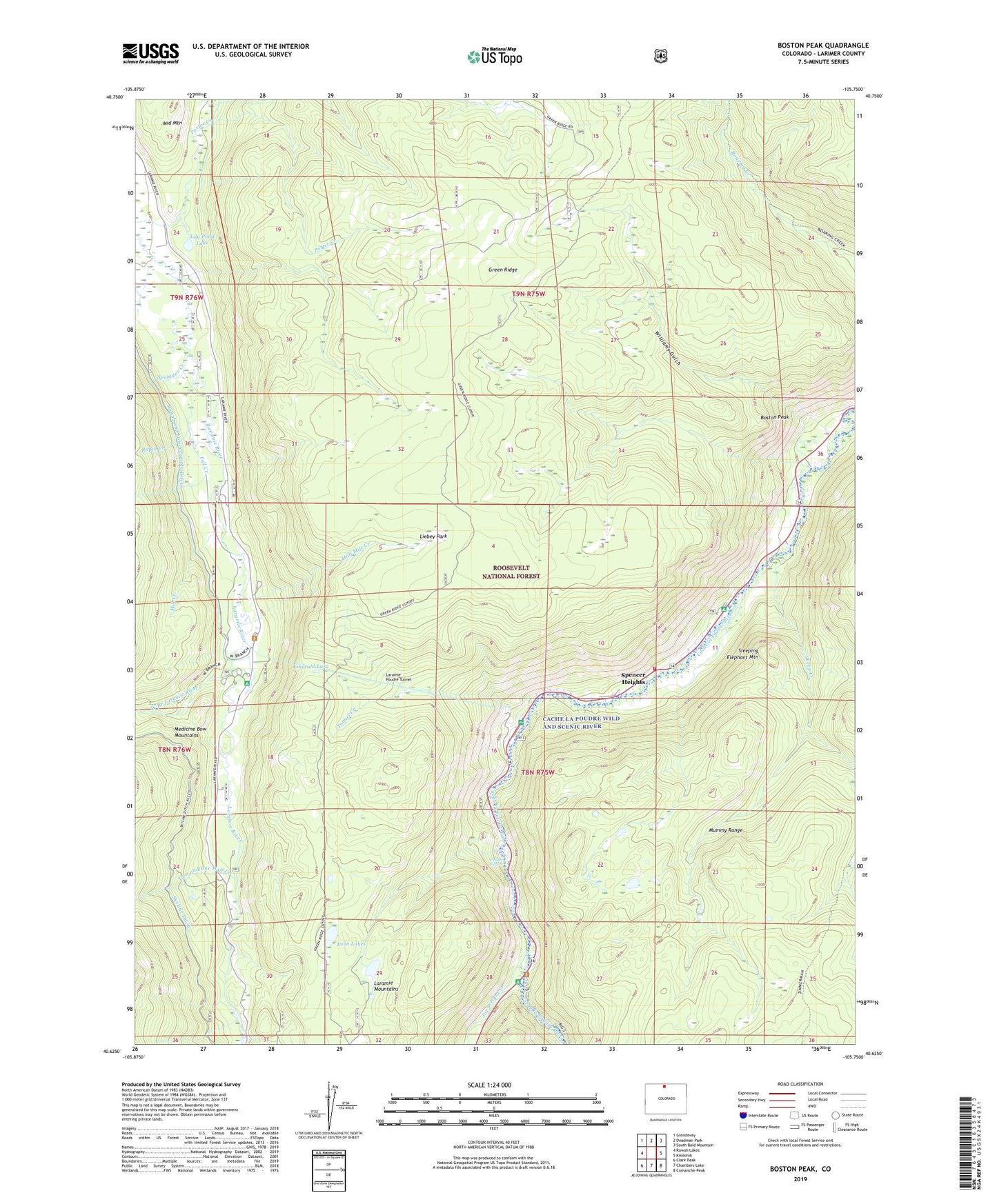
Boston Peak Colorado US Topo Map
Couldn't load pickup availability
Also explore the Boston Peak Forest Service Topo of this same quad for updated USFS data
2022 topographic map quadrangle Boston Peak in the state of Colorado. Scale: 1:24000. Based on the newly updated USGS 7.5' US Topo map series, this map is in the following counties: Larimer. The map contains contour data, water features, and other items you are used to seeing on USGS maps, but also has updated roads and other features. This is the next generation of topographic maps. Printed on high-quality waterproof paper with UV fade-resistant inks.
Quads adjacent to this one:
West: Rawah Lakes
Northwest: Glendevey
North: Deadman Park
Northeast: South Bald Mountain
East: Kinikinik
Southeast: Comanche Peak
South: Chambers Lake
Southwest: Clark Peak
This map covers the same area as the classic USGS quad with code o40105f7.
Contains the following named places: Aspen Glen Rest Area, Big South Campground, Big South Trailhead, Boston Peak, Brinker Creek, Emerald Lake, Fall Creek, Green Ridge, Green Ridge Trail, Half Mile Creek, Jimmy Creek, Joe Wright Creek, Laramie Poudre Tunnel, Liebey Park, Lily Pond Lake, Lucky Strike Claims, Mill Creek, North Fork Fall Creek, Poudre Canyon Fire Protection District Station 3 Spencer Heights, Poudre Falls, Rapid Creek, Rawah and Lower Supply Ditch, Rawah Trailhead, Reds Place, Roaring Fork Trail, Sheep Creek, Skyline Campground, Skyline Ditch, Sleeping Elephant Mountain, Sleping Elephant Campground, South Fork Fall Creek, Spencer Heights, Sportsman Lodge, Springer Creek, Trading Post, Tunnel Campground, Tunnel Creek, Tunnel Rest Area, Twin Lakes, Two and One Half Creek, West Branch Laramie River, West Branch Trailhead, Williams Gulch, Zimmerman Trail