MyTopo
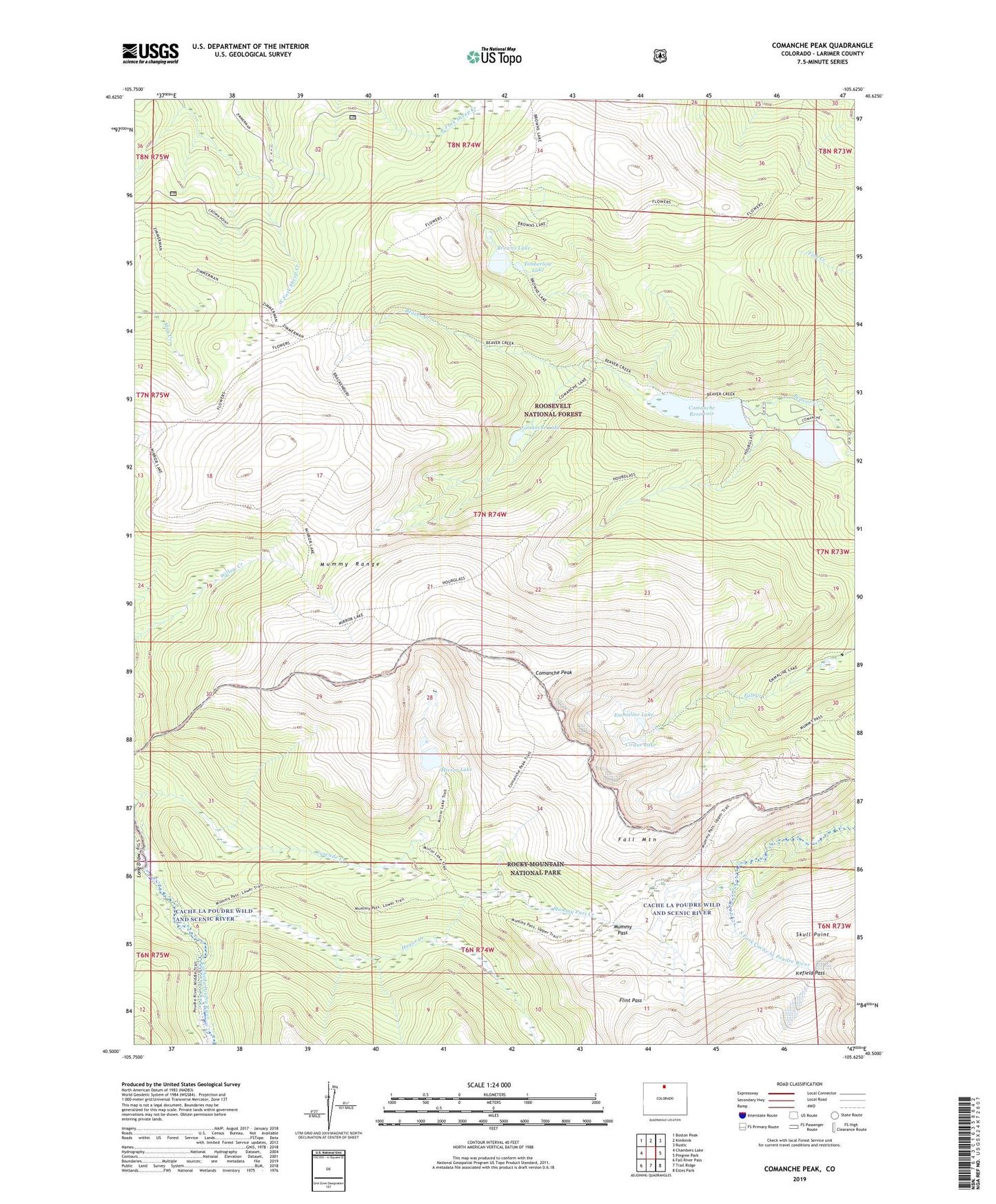
Comanche Peak Colorado US Topo Map
Couldn't load pickup availability
Also explore the Comanche Peak Forest Service Topo of this same quad for updated USFS data
2022 topographic map quadrangle Comanche Peak in the state of Colorado. Scale: 1:24000. Based on the newly updated USGS 7.5' US Topo map series, this map is in the following counties: Larimer. The map contains contour data, water features, and other items you are used to seeing on USGS maps, but also has updated roads and other features. This is the next generation of topographic maps. Printed on high-quality waterproof paper with UV fade-resistant inks.
Quads adjacent to this one:
West: Chambers Lake
Northwest: Boston Peak
North: Kinikinik
Northeast: Rustic
East: Pingree Park
Southeast: Estes Park
South: Trail Ridge
Southwest: Fall River Pass
This map covers the same area as the classic USGS quad with code o40105e6.
Contains the following named places: Brackenbury Cabin Trail, Browns Lake, Cirque Lake, Comanche Dam, Comanche Lake, Comanche Peak, Comanche Peak Wilderness, Comanche Reservoir, Emmaline Lake, Emmaline Lake Trail, Fall Mountain, Flint Pass, Flowers Trail, Hague Creek, Hourglass Dam, Hourglass Reservoir, Hourglass Trail, Icefield Pass, La Poudre Pass Creek, Long Draw, Mirror Lake, Mirror Lake Trail, Mummy Pass, Mummy Pass Creek, Mummy Pass Trail, Mummy Range, Skull Point, Timberline Lake