MyTopo
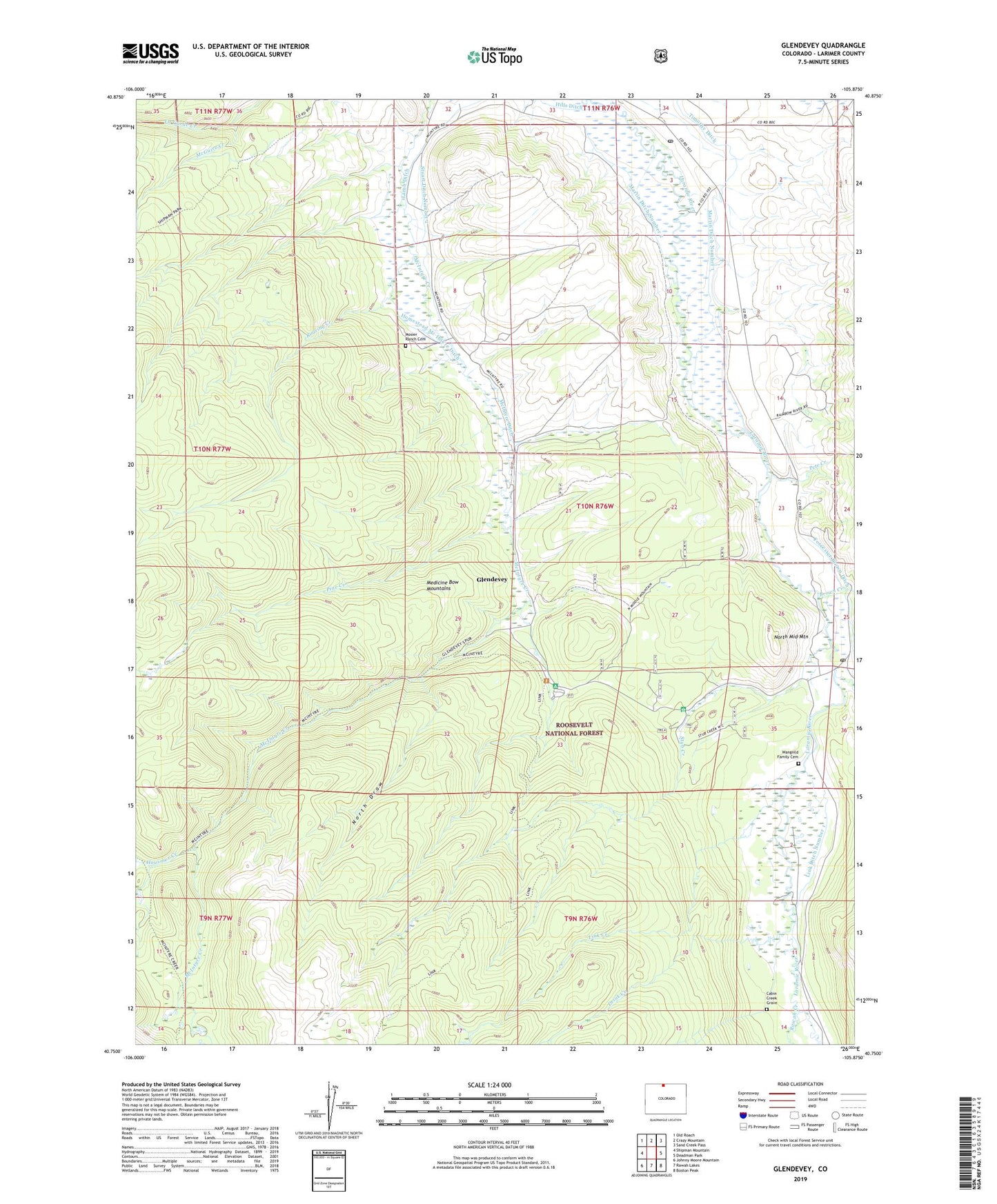
Glendevey Colorado US Topo Map
Couldn't load pickup availability
Also explore the Glendevey Forest Service Topo of this same quad for updated USFS data
2022 topographic map quadrangle Glendevey in the state of Colorado. Scale: 1:24000. Based on the newly updated USGS 7.5' US Topo map series, this map is in the following counties: Larimer. The map contains contour data, water features, and other items you are used to seeing on USGS maps, but also has updated roads and other features. This is the next generation of topographic maps. Printed on high-quality waterproof paper with UV fade-resistant inks.
Quads adjacent to this one:
West: Shipman Mountain
Northwest: Old Roach
North: Crazy Mountain
Northeast: Sand Creek Pass
East: Deadman Park
Southeast: Boston Peak
South: Rawah Lakes
Southwest: Johnny Moore Mountain
This map covers the same area as the classic USGS quad with code o40105g8.
Contains the following named places: Big Mc Intyre Burn, British Creek, Brown Creek, Browns Park Campground, Cabin Creek Grave, Davy Ditch, Drink Creek, Forrester Brown Ditch, Four Corners, Freewater Bridge Fisherman Parking, Glendevey, Glendevey Post Office, Homestead Mc Intyre Ditch, Hooligan Roost Campground, Housmer Creek, Jinks Creek, Lamb Ditch, Link Creek, Link Ditch Number 1, Link McIntyre Trailhead, Little British Creek, Lone Tree Creek, Martin Ditch Number 1, Martin Ditch Number 2, McGuire Creek, McIntyre Ditch, McIntyre Trail, Mosier Ranch Cemetery, North Draw, North Middle Mountain, Nunn Creek, Pass Creek, Pete Creek, Pine Creek, Rawah Creek, Roaring Creek, Stuart Creek, Stuart Ditch Number 1, Stuart Ditch Number 2, Stub Creek, Stub Creek Forest Service Facility, Timothy Ditch, Wangnild Family Cemetery