MyTopo
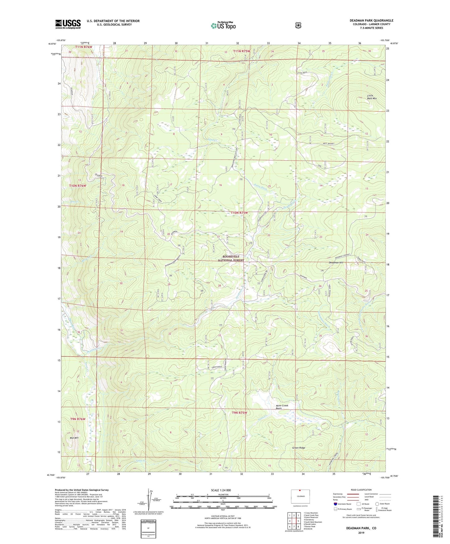
Deadman Park Colorado US Topo Map
Couldn't load pickup availability
Also explore the Deadman Park Forest Service Topo of this same quad for updated USFS data
2022 topographic map quadrangle Deadman Park in the state of Colorado. Scale: 1:24000. Based on the newly updated USGS 7.5' US Topo map series, this map is in the following counties: Larimer. The map contains contour data, water features, and other items you are used to seeing on USGS maps, but also has updated roads and other features. This is the next generation of topographic maps. Printed on high-quality waterproof paper with UV fade-resistant inks.
Quads adjacent to this one:
West: Glendevey
Northwest: Crazy Mountain
North: Sand Creek Pass
Northeast: Eaton Reservoir
East: South Bald Mountain
Southeast: Kinikinik
South: Boston Peak
Southwest: Rawah Lakes
Contains the following named places: Columbine Ditch, Deadman Creek, Deadman Hill, Deadman Picnic Area, Eaton Ditch, Eaton Ditch Camp, Little Bald Mountain, Lower Nunn Creek Trail, Middle Mountain, Nunn Creek Basin