
MyTopo
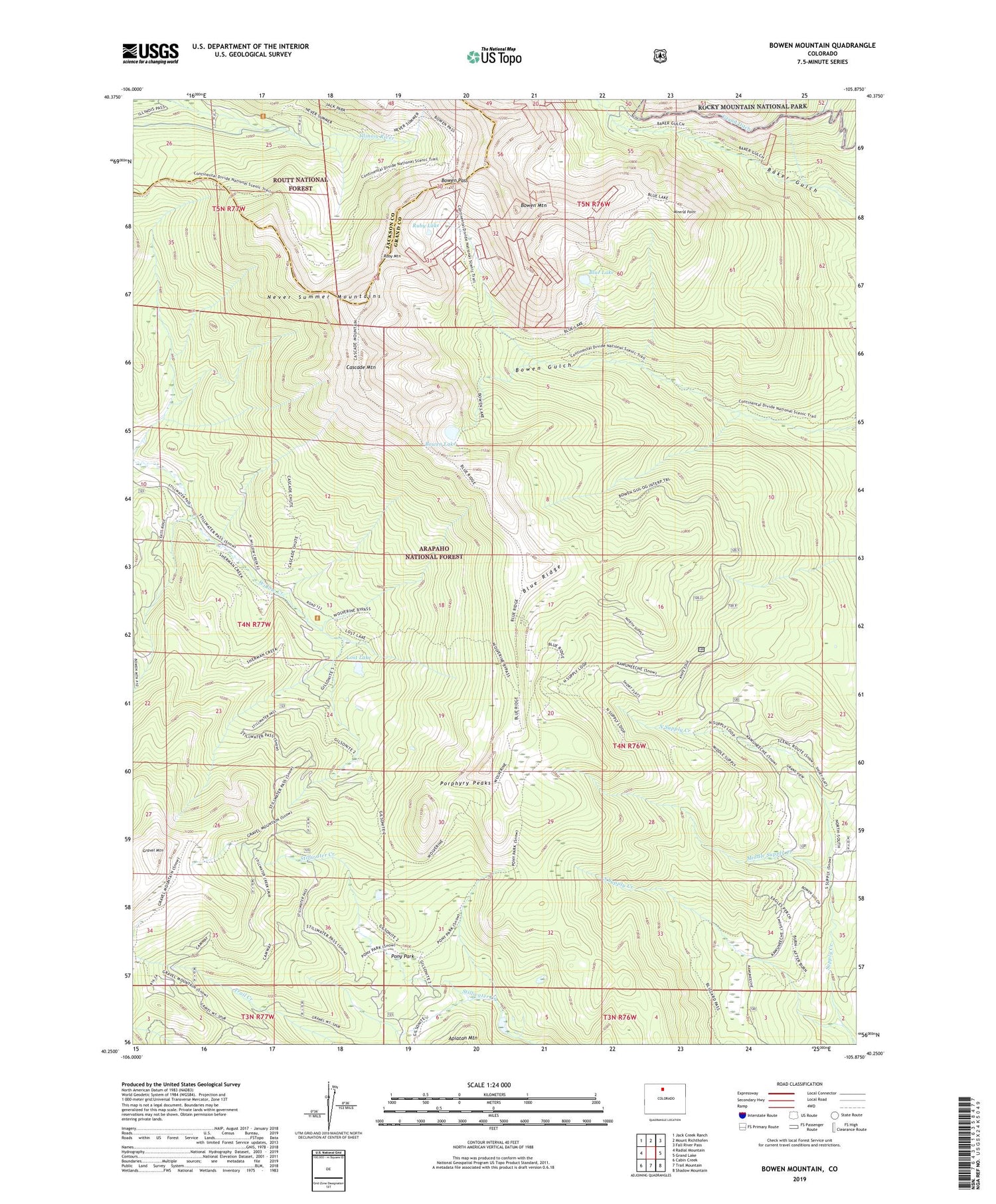
Bowen Mountain Colorado US Topo Map
Couldn't load pickup availability
Also explore the Bowen Mountain Forest Service Topo of this same quad for updated USFS data
2022 topographic map quadrangle Bowen Mountain in the state of Colorado. Scale: 1:24000. Based on the newly updated USGS 7.5' US Topo map series, this map is in the following counties: Grand, Jackson. The map contains contour data, water features, and other items you are used to seeing on USGS maps, but also has updated roads and other features. This is the next generation of topographic maps. Printed on high-quality waterproof paper with UV fade-resistant inks.
Quads adjacent to this one:
West: Radial Mountain
Northwest: Jack Creek Ranch
North: Mount Richthofen
Northeast: Fall River Pass
East: Grand Lake
Southeast: Shadow Mountain
South: Trail Mountain
Southwest: Cabin Creek
This map covers the same area as the classic USGS quad with code o40105c8.
Contains the following named places: Blue Lake, Blue Ridge, Bowen Lake, Bowen Mountain, Bowen Pass, Bowen Trail, Cascade Mountain, Gilsonite Trail, Gravel Mountain, Illinois River Trail, Lost Lake, Middle Supply Creek, Mineral Point, Mineral Point Trail, North Supply Creek, Pony Park, Porphyry Peaks, Ruby Lake, Ruby Mountain, South Supply Creek, Supply Creek Trail, Wolverine Mine, Wolverine Trail


