MyTopo
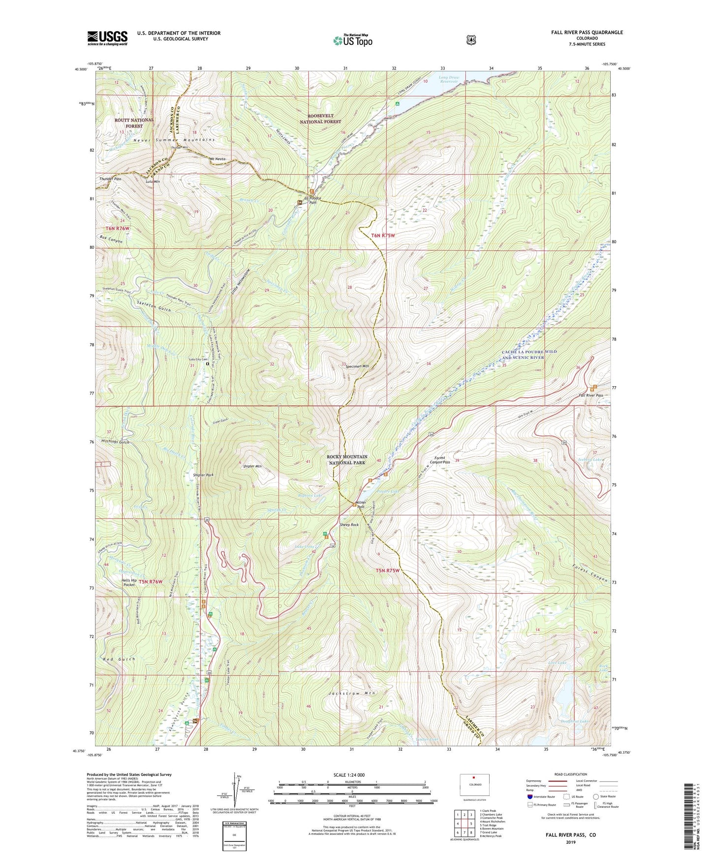
Fall River Pass Colorado US Topo Map
Couldn't load pickup availability
Also explore the Fall River Pass Forest Service Topo of this same quad for updated USFS data
2022 topographic map quadrangle Fall River Pass in the state of Colorado. Scale: 1:24000. Based on the newly updated USGS 7.5' US Topo map series, this map is in the following counties: Larimer, Grand, Jackson. The map contains contour data, water features, and other items you are used to seeing on USGS maps, but also has updated roads and other features. This is the next generation of topographic maps. Printed on high-quality waterproof paper with UV fade-resistant inks.
Quads adjacent to this one:
West: Mount Richthofen
Northwest: Clark Peak
North: Chambers Lake
Northeast: Comanche Peak
East: Trail Ridge
Southeast: McHenrys Peak
South: Grand Lake
Southwest: Bowen Mountain
This map covers the same area as the classic USGS quad with code o40105d7.
Contains the following named places: Arrowhead Lake, Beaver Creek, Bennett Creek, Big Dutch Creek, Bighorn Lake, Box Canyon, Crater Gulch, Ditch Camp, Doughnut Lake, Fall River Pass, Farview Curve, Forest Canyon Pass, Gore Range Overlook, Grand Ditch, Grand View Campground, Hells Hip Pocket, Hitchings Gulch, Iceberg Lake, Jackstraw Mountain, La Poudre Pass, La Poudre Pass Ranger Station, La Poudre Pass Trail, Lady Creek, Lake Irene, Little Dutch Creek, Little Yellowstone, Long Draw Reservoir, Lost Creek, Love Lake, Lulu City, Lulu City Cemetery, Lulu Creek, Lulu Mountain, Medicine Bow Curve, Middle Dutch Creek, Milner Pass, Milner Pass Road Camp, Mosquito Creek, Mount Neota, Neota Creek, Neota Trailhead, Opposition Creek, Phantom Creek, Phantom Valley Ranch, Phantom Valley Trading Post, Poudre Lake, Red Gulch, Red Mountain Trail, Sawmill Creek, Sheep Rock, Shipler Mountain, Shipler Park, Skeleton Gulch, Specimen Creek, Specimen Mountain, Specimen Mountain Trail, Squeak Creek, The Crater, Thunder Mountain, Thunder Pass, Thunder Pass Trail, Timber Creek, Timber Creek Campground, Upper Michigan Ditch