MyTopo
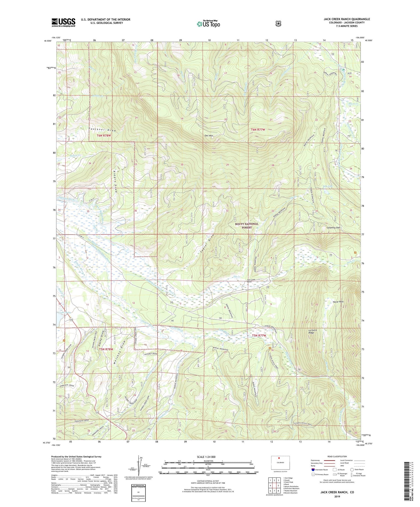
Jack Creek Ranch Colorado US Topo Map
Couldn't load pickup availability
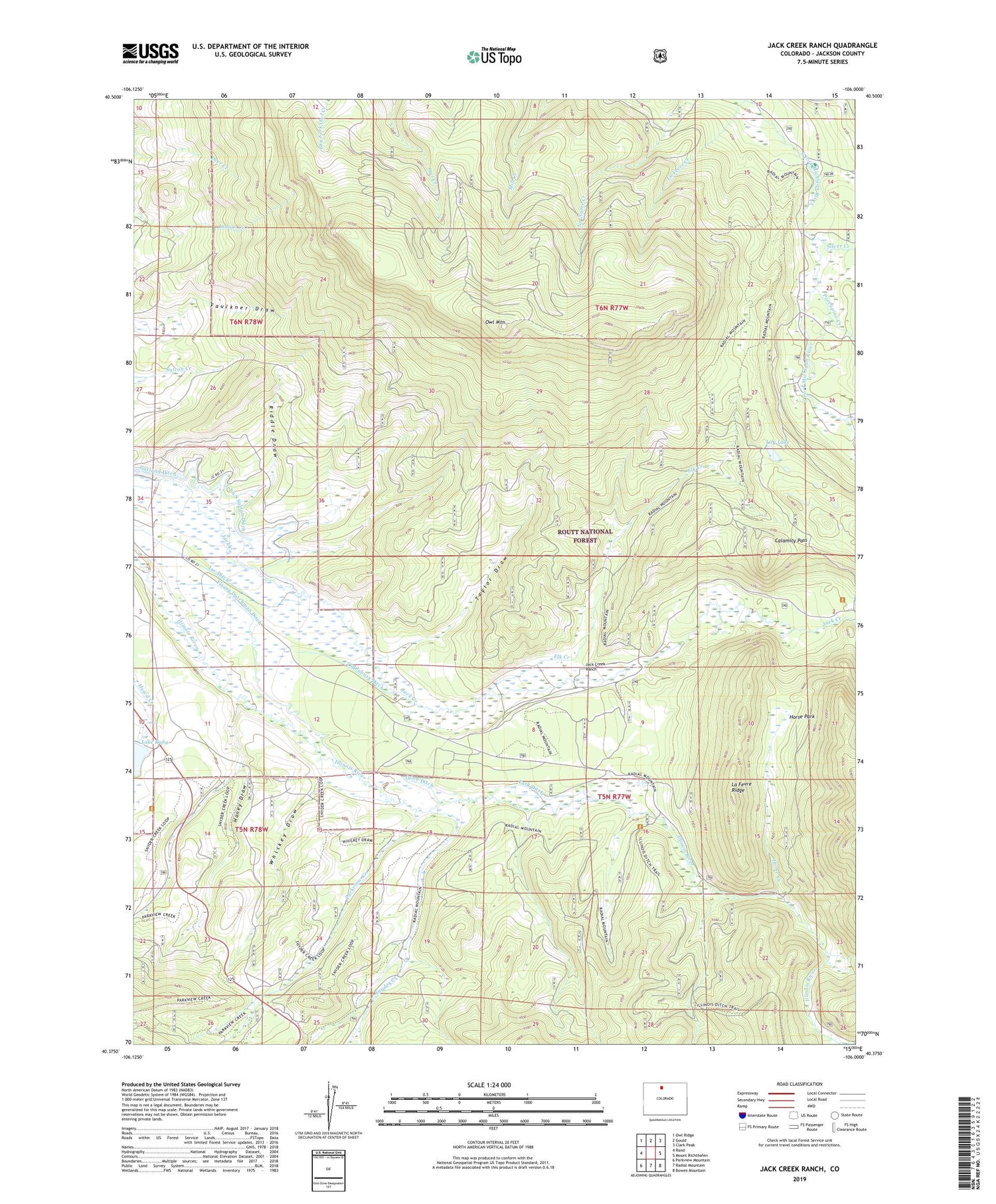
Also explore the Jack Creek Ranch Forest Service Topo of this same quad for updated USFS data
2022 topographic map quadrangle Jack Creek Ranch in the state of Colorado. Scale: 1:24000. Based on the newly updated USGS 7.5' US Topo map series, this map is in the following counties: Jackson. The map contains contour data, water features, and other items you are used to seeing on USGS maps, but also has updated roads and other features. This is the next generation of topographic maps. Printed on high-quality waterproof paper with UV fade-resistant inks.
Quads adjacent to this one:
West: Rand
Northwest: Owl Ridge
North: Gould
Northeast: Clark Peak
East: Mount Richthofen
Southeast: Bowen Mountain
South: Radial Mountain
Southwest: Parkview Mountain
This map covers the same area as the classic USGS quad with code o40106d1.
Contains the following named places: Brocker Place, Calamity Pass, Cattail Number 1 Dam, Cattail Pond Dam, Cattail Reservoir, Cattail Reservoir Number 1, Donath Lake, Donath Lake Dam, Elk Creek, Fairport Dam, Fairport Reservoir, Flying Dutchman Ditch, Garland Ditch, Haney Draw, Horse Creek, Horse Park, Horseshoe Number 2 Dam, Jack Creek Ranch, Jay Ditch, La Fevre Creek, La Fevre Ridge, Lake Loveland, Lake Loveland Dam, Lake Roslyn, Lake Roslyn Dam, Lake Ruby, Lily Lake, Oldenburg Ditch, Olive Ditch, Owl Mountain, Owl Mountain Lookout, Park Ditch, Parkview Campground, Parkview Creek, Parkview Ditch, Pines Campground, Porcupine Creek, Riddle Draw, Rist-Benson Dam, Roslyn Ranch, Silver Creek, Snyder Creek, South Side Reservoir, Taylor Draw, Teller City Campground, Upper South Fork Campground, Whiskey Draw