MyTopo
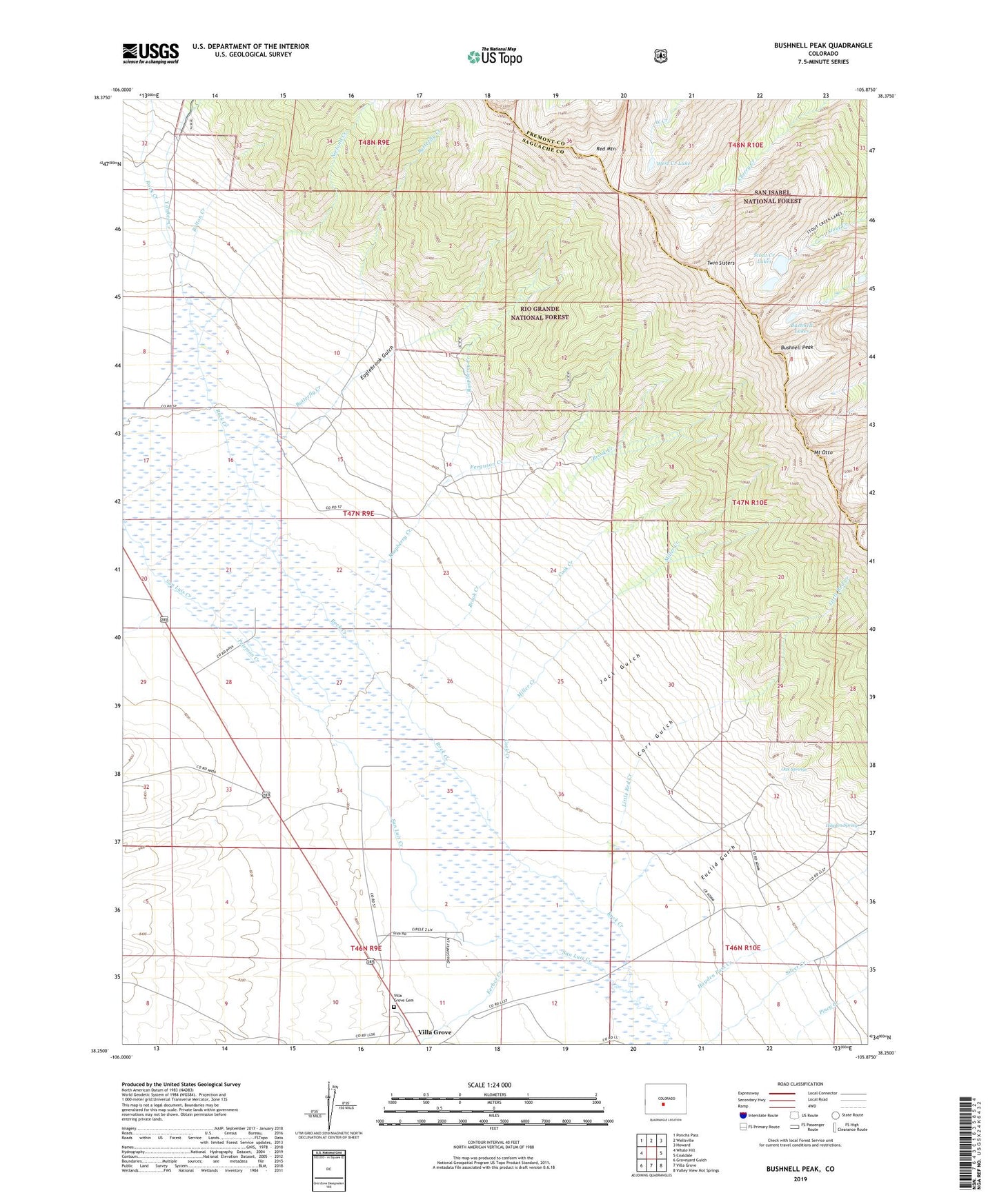
Bushnell Peak Colorado US Topo Map
Couldn't load pickup availability
Also explore the Bushnell Peak Forest Service Topo of this same quad for updated USFS data
2022 topographic map quadrangle Bushnell Peak in the state of Colorado. Scale: 1:24000. Based on the newly updated USGS 7.5' US Topo map series, this map is in the following counties: Saguache, Fremont. The map contains contour data, water features, and other items you are used to seeing on USGS maps, but also has updated roads and other features. This is the next generation of topographic maps. Printed on high-quality waterproof paper with UV fade-resistant inks.
Quads adjacent to this one:
West: Whale Hill
Northwest: Poncha Pass
North: Wellsville
Northeast: Howard
East: Coaldale
Southeast: Valley View Hot Springs
South: Villa Grove
Southwest: Graveyard Gulch
This map covers the same area as the classic USGS quad with code o38105c8.
Contains the following named places: Bolton Creek, Brook Creek, Bushnell Lakes, Bushnell Peak, Butterfly Creek, Carr Gulch, Cook Creek, Eaglebrook Gulch, Euclid Gulch, Ferguson Creek, Hayden Pass Creek, Hayden Spring, Jack Gulch, Kerber Creek, Little Red Creek, Miller Creek, Mount Otto, Nieland Creek, North Rock Creek, Oak Springs, Peterson Creek, Raspberry Creek, Red Creek, Red Mountain, Rock Creek, South Rock Creek, Stout Creek Lakes, Twin Sisters, Villa Grove Cemetery, West Creek Lake, Yankee Creek