MyTopo
Valley View Hot Springs Colorado US Topo Map
Couldn't load pickup availability
Also explore the Valley View Hot Springs Forest Service Topo of this same quad for updated USFS data
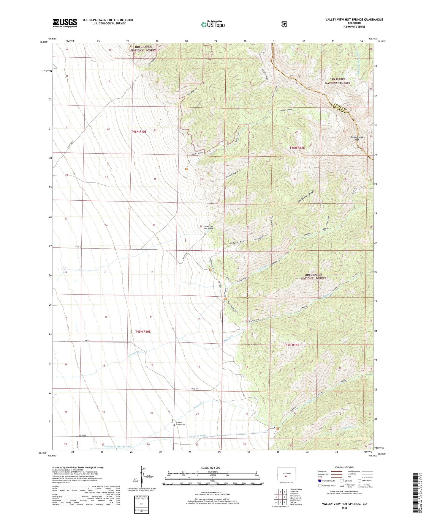
2022 topographic map quadrangle Valley View Hot Springs in the state of Colorado. Scale: 1:24000. Based on the newly updated USGS 7.5' US Topo map series, this map is in the following counties: Saguache, Custer. The map contains contour data, water features, and other items you are used to seeing on USGS maps, but also has updated roads and other features. This is the next generation of topographic maps. Printed on high-quality waterproof paper with UV fade-resistant inks.
Quads adjacent to this one:
West: Villa Grove
Northwest: Bushnell Peak
North: Coaldale
Northeast: Cotopaxi
East: Electric Peak
Southeast: Rito Alto Peak
South: Mirage
Southwest: Moffat North
This map covers the same area as the classic USGS quad with code o38105b7.
Contains the following named places: Anna Lee Mine, Aspen Gulch, Black Canyon, Cotton Creek, Cotton Creek Cemetery, Cotton Creek Ditch, Cottonwood Peak, Faith Mine, Garner Creek, Hot Springs Canyon, Lime Canyon, Major Creek, Millie Luna Mine, Old Bennet Mine, Orient Canyon, Orient Mine, Steel Canyon, Sylvia Mine, Valley View Hot Springs