
MyTopo
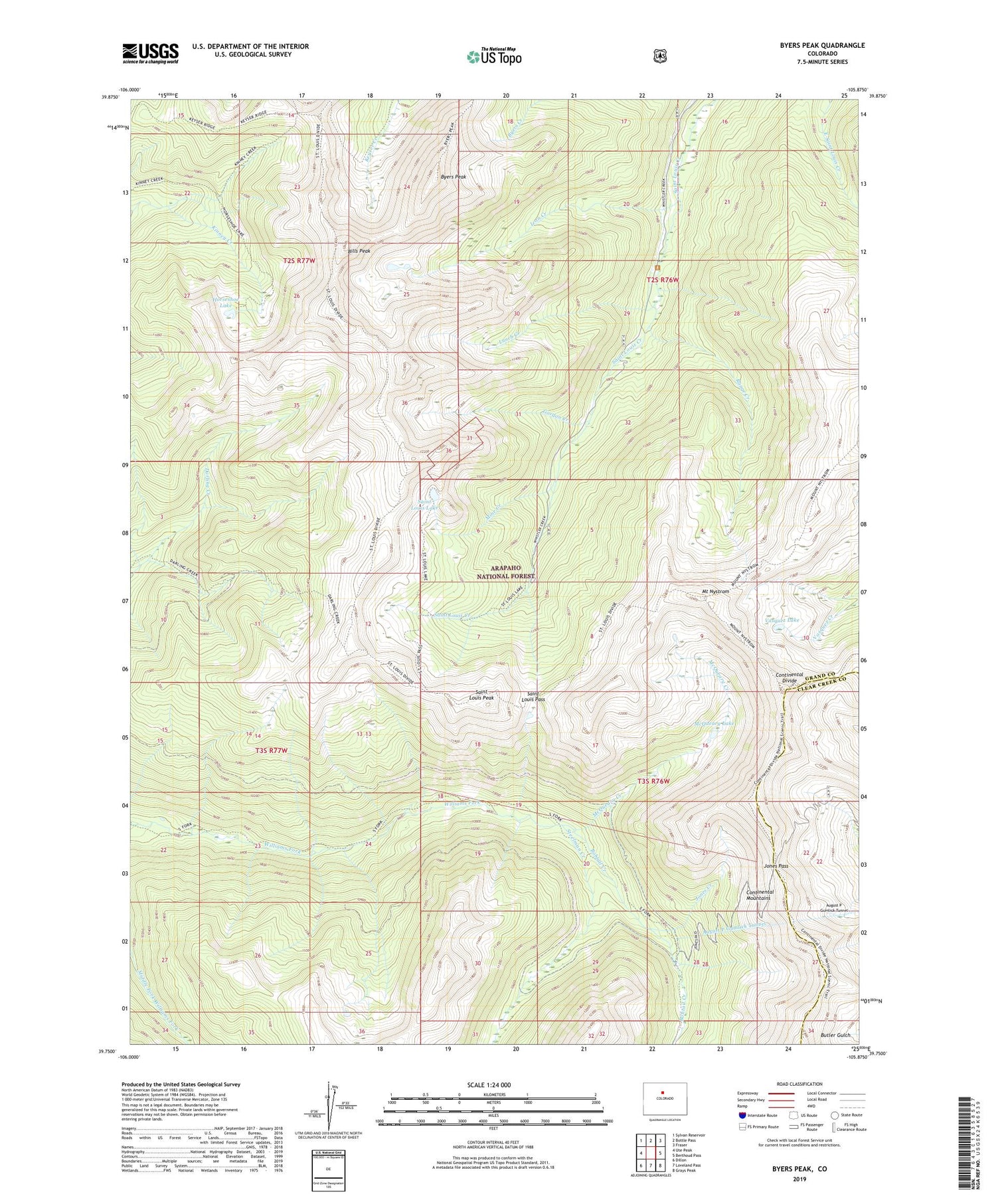
Byers Peak Colorado US Topo Map
Couldn't load pickup availability
Also explore the Byers Peak Forest Service Topo of this same quad for updated USFS data
2022 topographic map quadrangle Byers Peak in the state of Colorado. Scale: 1:24000. Based on the newly updated USGS 7.5' US Topo map series, this map is in the following counties: Grand, Clear Creek. The map contains contour data, water features, and other items you are used to seeing on USGS maps, but also has updated roads and other features. This is the next generation of topographic maps. Printed on high-quality waterproof paper with UV fade-resistant inks.
Quads adjacent to this one:
West: Ute Peak
Northwest: Sylvan Reservoir
North: Bottle Pass
Northeast: Fraser
East: Berthoud Pass
Southeast: Grays Peak
South: Loveland Pass
Southwest: Dillon
This map covers the same area as the classic USGS quad with code o39105g8.
Contains the following named places: Arapaho National Forest, August P Gumlick Tunnel, Bills Peak, Bobtail Creek, Bobtail Mine, Byers Peak, Byers Peak Trail, Byers Peak Wilderness, Darling Creek Trail, Fraser Experimental Forest, Gordon Creek, Horseshoe Lake, Iron Creek, Jones Creek, Jones Pass, Kinney Creek Trail, Lunch Creek, McQueary Creek, McQueary Lake, Mine Creek, Mount Nystrom, Range Creek, Saint Louis Lake, Saint Louis Pass, Saint Louis Peak, Saint Louis Trail, Steelman Creek, Vasquez Lake


