MyTopo
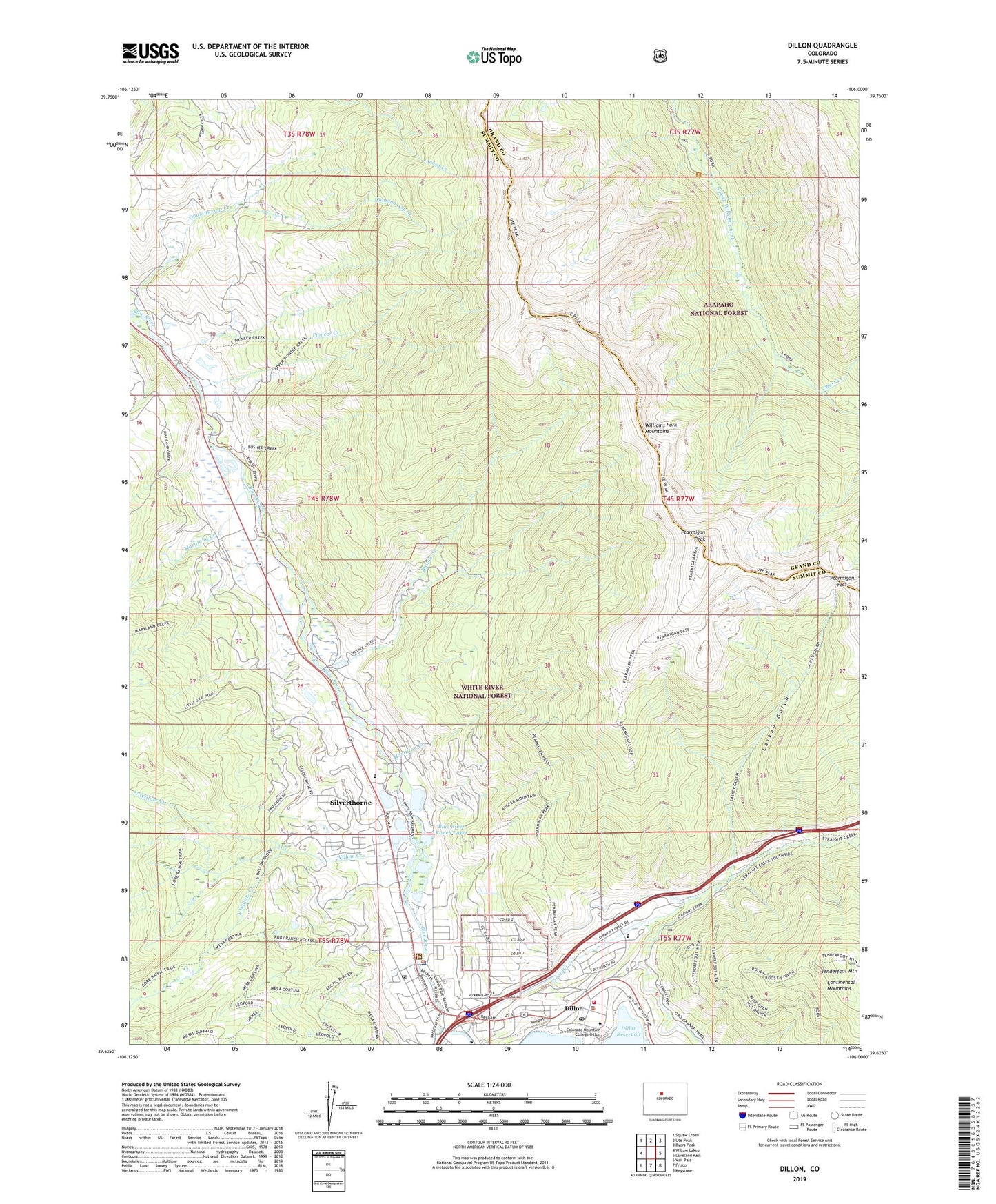
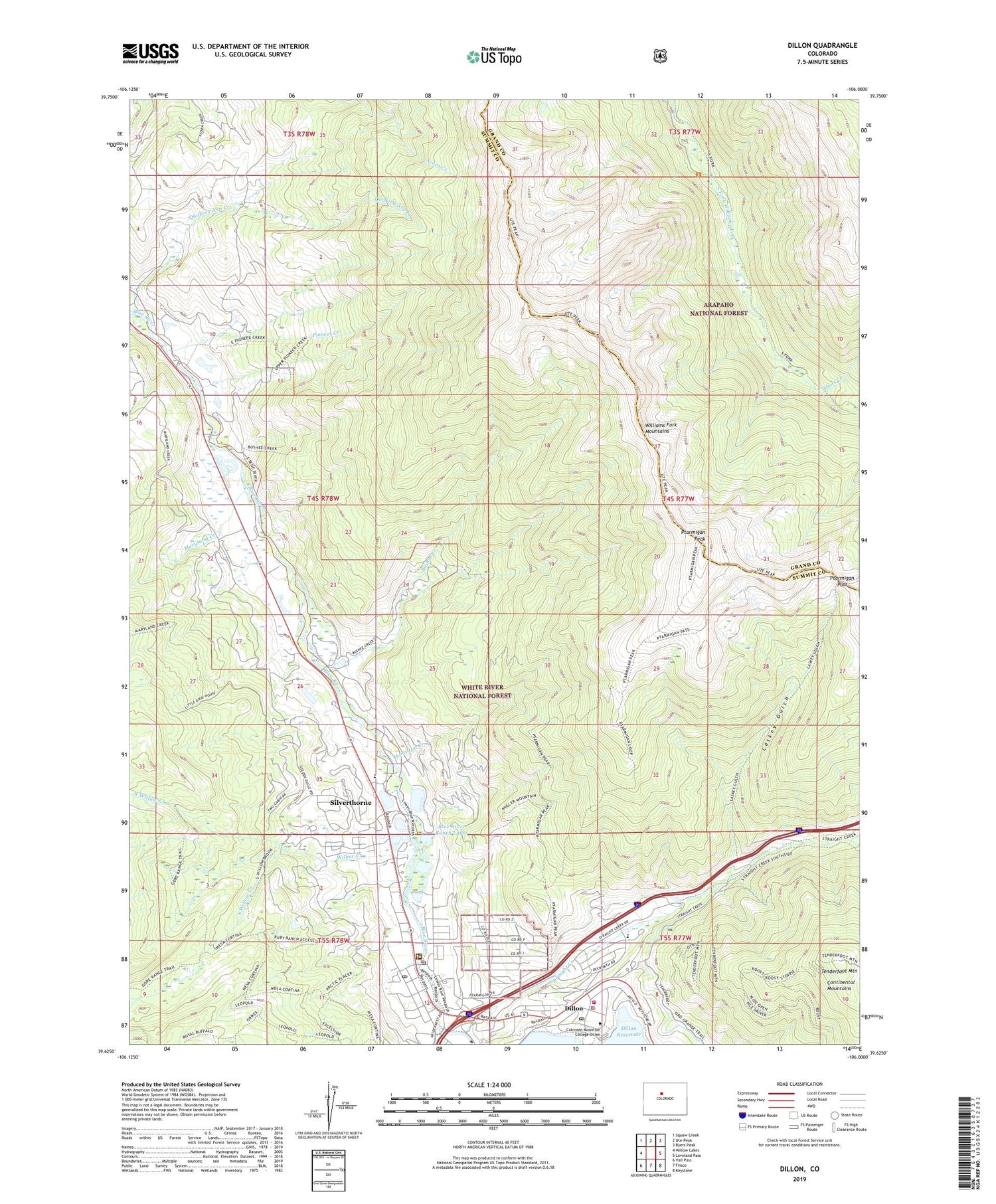
Dillon Colorado US Topo Map
Couldn't load pickup availability
Also explore the Dillon Forest Service Topo of this same quad for updated USFS data
2022 topographic map quadrangle Dillon in the state of Colorado. Scale: 1:24000. Based on the newly updated USGS 7.5' US Topo map series, this map is in the following counties: Summit, Grand. The map contains contour data, water features, and other items you are used to seeing on USGS maps, but also has updated roads and other features. This is the next generation of topographic maps. Printed on high-quality waterproof paper with UV fade-resistant inks.
Quads adjacent to this one:
West: Willow Lakes
Northwest: Squaw Creek
North: Ute Peak
Northeast: Byers Peak
East: Loveland Pass
Southeast: Keystone
South: Frisco
Southwest: Vail Pass
This map covers the same area as the classic USGS quad with code o39106f1.
Contains the following named places: Baker School, Blue River Ranch Lakes, Bushee Creek, Dillon, Dillon Forest Service Facility, Dillon Police Department, Dillon Post Office, Hamilton Creek, Lake Dillon Fire - Rescue Station 10, Lake Dillon Fire - Rescue Station 8, Laskey Gulch, Maryland Creek, Mesa-Cortina Trail, Middle Willow Creek, North Willow Creek, Pioneer Creek, Ptarmigan Pass, Ptarmigan Peak, Ptarmigan Peak Wilderness, Ptarmigan Trail, Short Creek, Silverthorne, Silverthorne Elementary School, Silverthorne Library, Silverthorne Post Office, Silverton Police Department, Silverton Recreation Center, Silverton Town Hall, Skookum Mine, South Willow Creek, Straight Creek, Summit County, Tenderfoot Mountain, Town of Silverthorne, Willow Creek, ZIP Code: 80497