MyTopo
Cabin Gulch Colorado US Topo Map
Couldn't load pickup availability
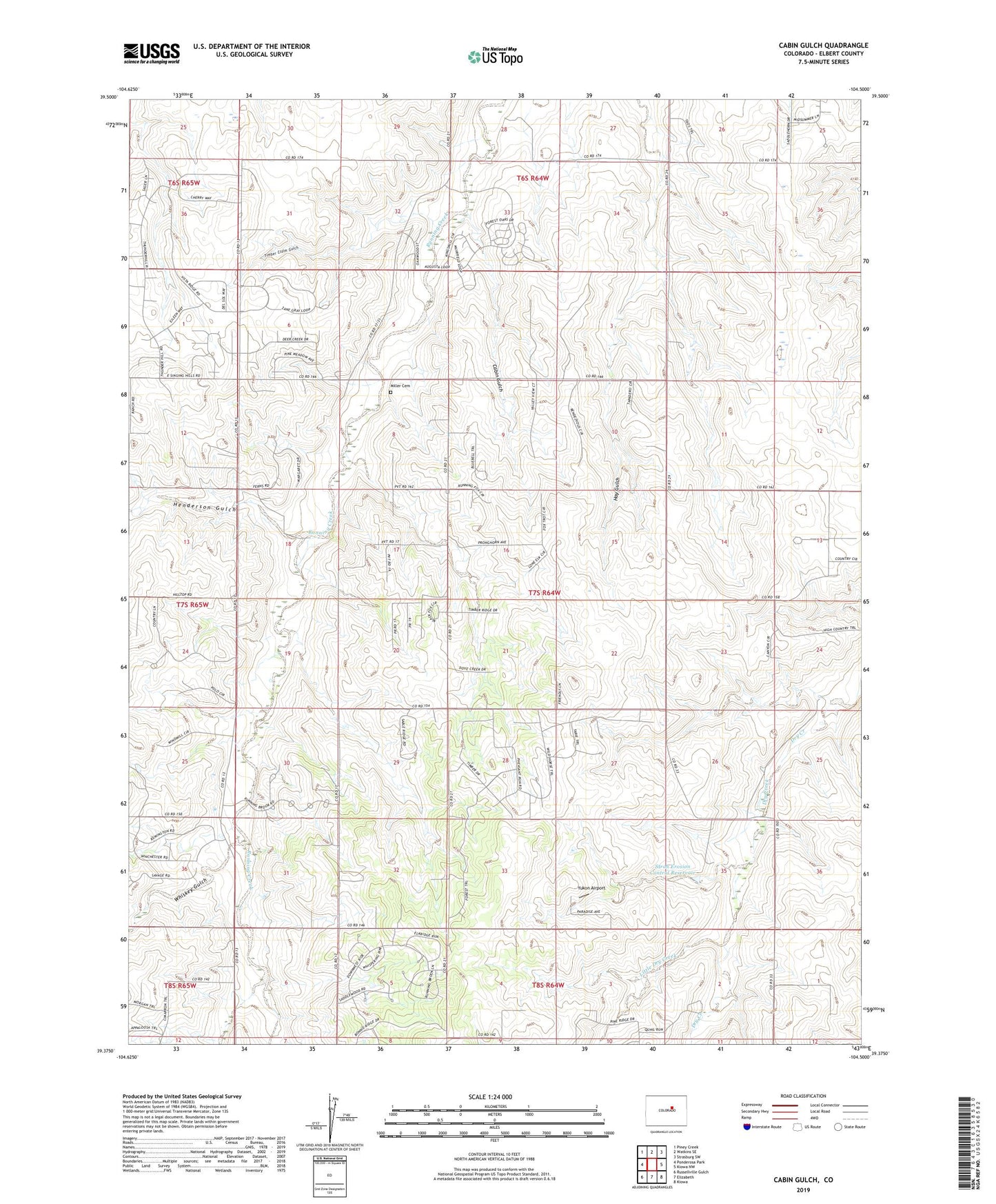
2022 topographic map quadrangle Cabin Gulch in the state of Colorado. Scale: 1:24000. Based on the newly updated USGS 7.5' US Topo map series, this map is in the following counties: Elbert. The map contains contour data, water features, and other items you are used to seeing on USGS maps, but also has updated roads and other features. This is the next generation of topographic maps. Printed on high-quality waterproof paper with UV fade-resistant inks.
Quads adjacent to this one:
West: Ponderosa Park
Northwest: Piney Creek
North: Watkins SE
Northeast: Strasburg SW
East: Kiowa NW
Southeast: Kiowa
South: Elizabeth
Southwest: Russellville Gulch
This map covers the same area as the classic USGS quad with code o39104d5.
Contains the following named places: Cabin Gulch, Donald E Stroh Erosion Control Dam Number 2, Gold Creek, Henderson Gulch, Little Dry Creek, Miller Cemetery, Stroh Erosion Control Reservoir, Timber Claim Gulch, Whiskey Gulch, Yukon Airport, ZIP Code: 80107