MyTopo
Elizabeth Colorado US Topo Map
Couldn't load pickup availability
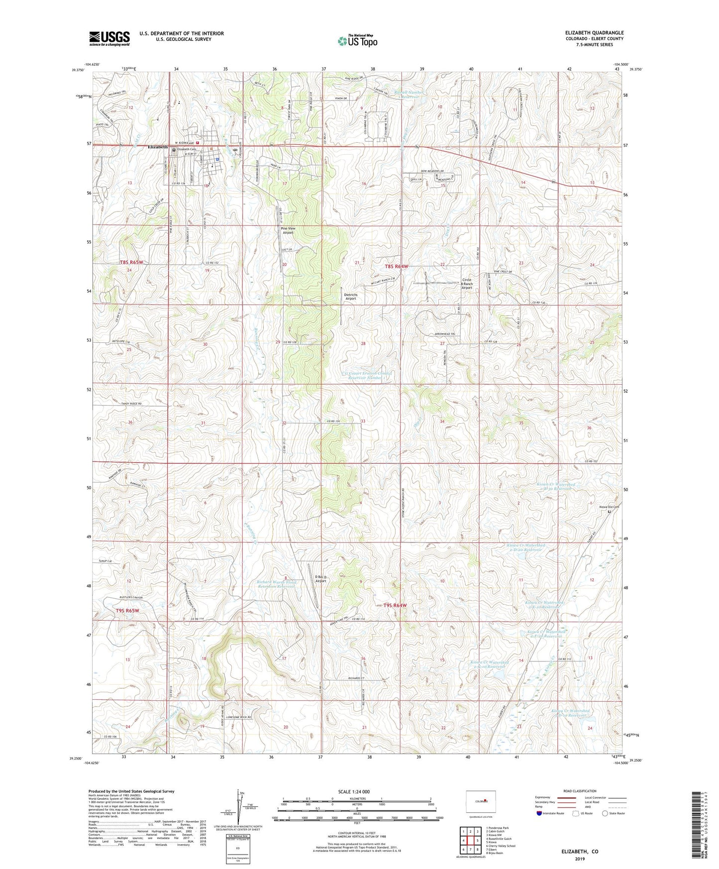
2022 topographic map quadrangle Elizabeth in the state of Colorado. Scale: 1:24000. Based on the newly updated USGS 7.5' US Topo map series, this map is in the following counties: Elbert. The map contains contour data, water features, and other items you are used to seeing on USGS maps, but also has updated roads and other features. This is the next generation of topographic maps. Printed on high-quality waterproof paper with UV fade-resistant inks.
Quads adjacent to this one:
West: Russellville Gulch
Northwest: Ponderosa Park
North: Cabin Gulch
Northeast: Kiowa NW
East: Kiowa
Southeast: Bijou Basin
South: Elbert
Southwest: Cherry Valley School
This map covers the same area as the classic USGS quad with code o39104c5.
Contains the following named places: C G Cozart Erosion Control Number 1 Dam, C G Cozart Erosion Control Reservoir Number 1, Circle 8 Ranch Airport, D Bar D Airport, Dead Stick Ranch Airport, Dietrichs Airport, Elizabeth, Elizabeth Cemetery, Elizabeth Emergency Heliport, Elizabeth Fire Rescue Station 71, Elizabeth High School, Elizabeth Middle School, Elizabeth Police Department, Elizabeth Post Office, Frontier High School, Kiowa Creek Watershed 2-B-30 Dam, Kiowa Creek Watershed 2-B-30 Reservoir, Kiowa Creek Watershed 2-D-20 Dam, Kiowa Creek Watershed 2-D-20 Reservoir, Kiowa Creek Watershed 2-E-10 Dam, Kiowa Creek Watershed 2-E-10 Reservoir, Kiowa Creek Watershed 2-F-20 Dam, Kiowa Creek Watershed 2-F-20 Reservoir, Kiowa Creek Watershed 2-G-10 Dam, Kiowa Creek Watershed 2-G-10 Reservoir, Kiowa Creek Watershed 3-D-10 Dam, Kiowa Creek Watershed 3-D-10 Reservoir, Kiowa Old Cemetery, Pine View Airport, Richard Warne Flood Retention Dam, Richard Warne Flood Retention Reservoir, Running Creek Elementary School, Russell Number 1 Dam, Russell Number 1 Reservoir, Town of Elizabeth