MyTopo
Ponderosa Park Colorado US Topo Map
Couldn't load pickup availability
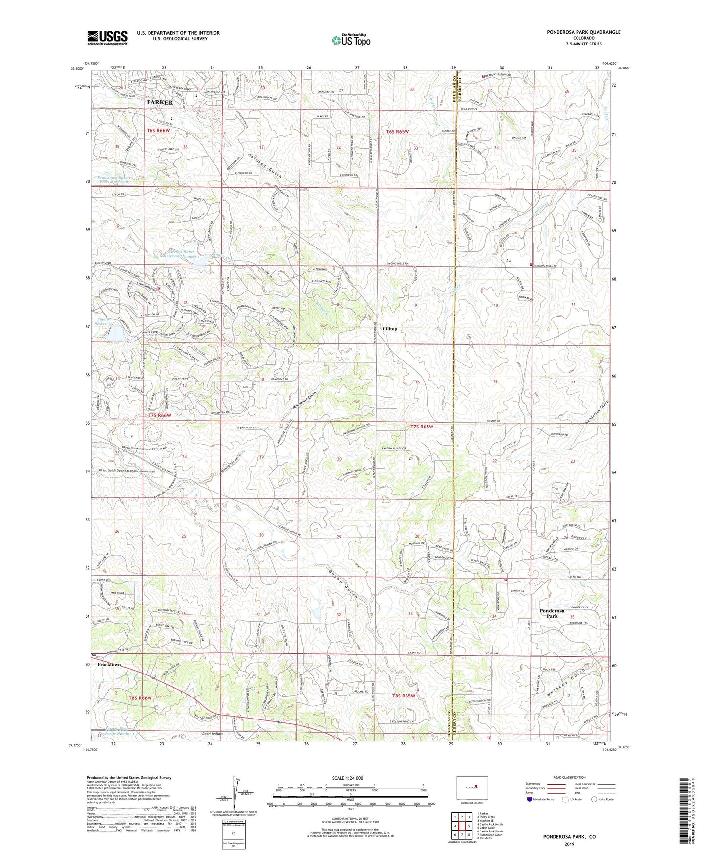
2022 topographic map quadrangle Ponderosa Park in the state of Colorado. Scale: 1:24000. Based on the newly updated USGS 7.5' US Topo map series, this map is in the following counties: Douglas, Elbert. The map contains contour data, water features, and other items you are used to seeing on USGS maps, but also has updated roads and other features. This is the next generation of topographic maps. Printed on high-quality waterproof paper with UV fade-resistant inks.
Quads adjacent to this one:
West: Castle Rock North
Northwest: Parker
North: Piney Creek
Northeast: Watkins SE
East: Cabin Gulch
Southeast: Elizabeth
South: Russellville Gulch
Southwest: Castle Rock South
This map covers the same area as the classic USGS quad with code o39104d6.
Contains the following named places: Bayou Hills, Burning Tree Ranch, Burning Tree Ranch Census Designated Place, Cimarron Middle School, Circle 2 Ranch Detention Dam Number 1, Circle 2 Ranch Reservoir Number 1, Country Acres, Country Acres Census Designated Place, Crestview, Elizabeth Fire Rescue Station 72, Elizabeth Fire Rescue Station 73, Franktown Census Designated Place, Franktown Elementary School, Franktown Parker FPS-1 Dam, Franktown Parker FPS-1 Reservoir, Franktown Post Office, Hidden Vilage, Hidden Village Census Designated Place, Hilltop, Hilltop Heliport, KWHD-TV (Castle Rock), Legend High School, Moonshine Gulch, Mountain View Elementary School, Parker Division, Parker Highlands, Pawnee Hills, Pinery Dam, Pinery Reservoir, Ponderosa Park, Ponderosa Park Census Designated Place, Prairie Trail Ranches, Rattlesnake Fire Protection District Station 253, Sagewood Middle School, Singing Hills Elementary School, South Metro Fire Rescue Authority Station 43, The Pinery, Village Pines, Walker Pit, Windy Hills, Windy Hills Census Designated Place