MyTopo
North Rattlesnake Butte Colorado US Topo Map
Couldn't load pickup availability
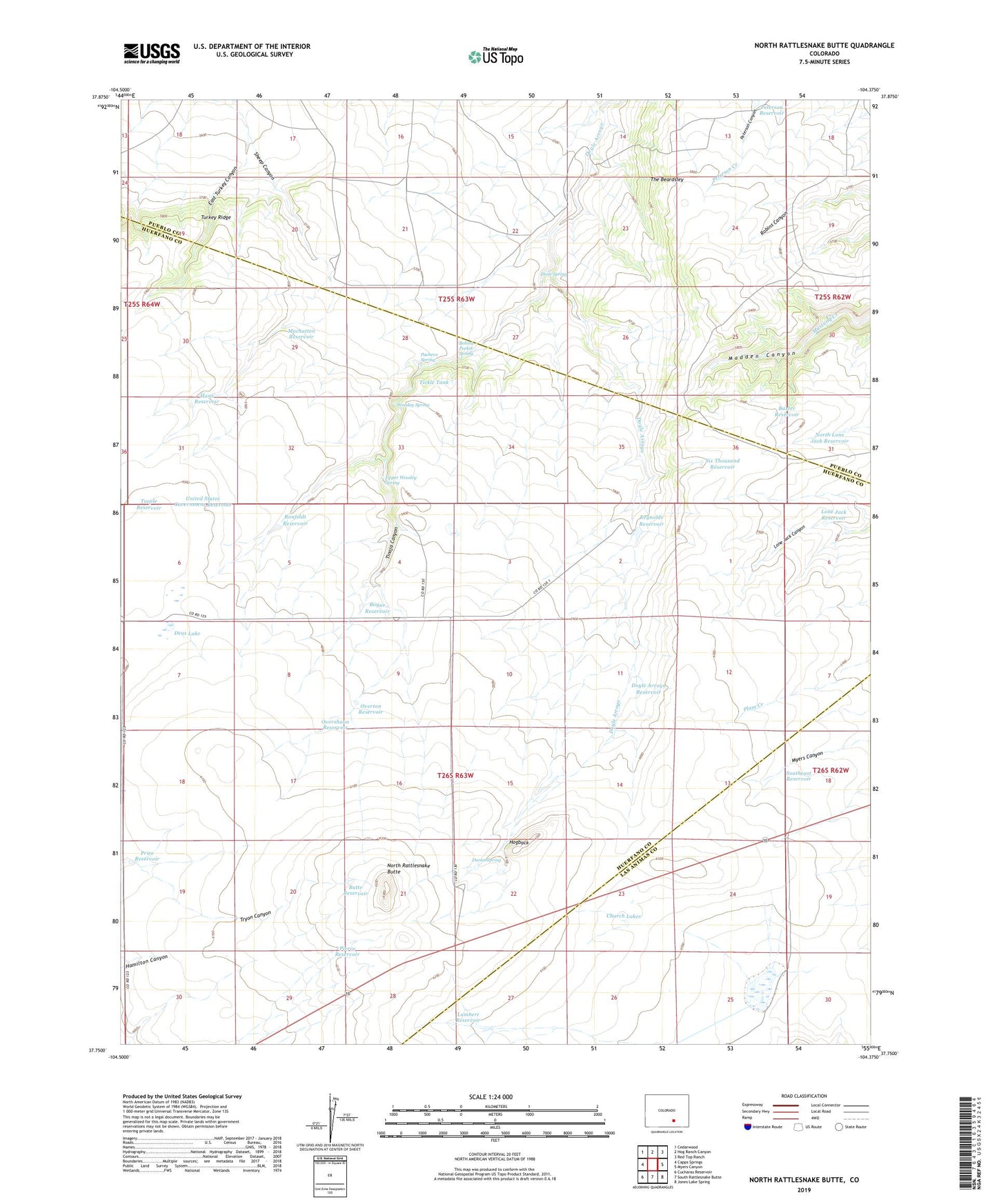
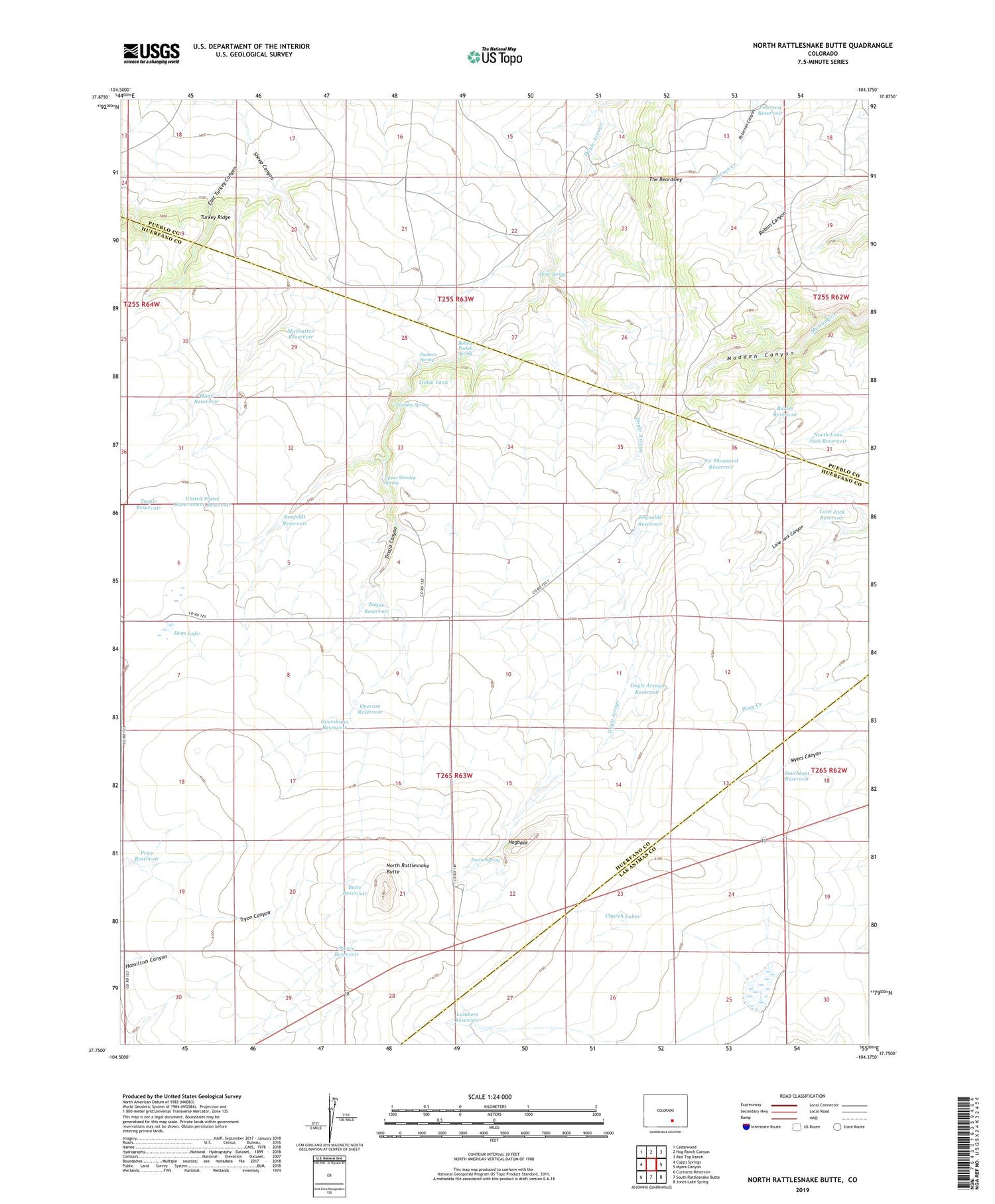
2022 topographic map quadrangle North Rattlesnake Butte in the state of Colorado. Scale: 1:24000. Based on the newly updated USGS 7.5' US Topo map series, this map is in the following counties: Huerfano, Pueblo, Las Animas. The map contains contour data, water features, and other items you are used to seeing on USGS maps, but also has updated roads and other features. This is the next generation of topographic maps. Printed on high-quality waterproof paper with UV fade-resistant inks.
Quads adjacent to this one:
West: Capps Springs
Northwest: Cedarwood
North: Hog Ranch Canyon
Northeast: Red Top Ranch
East: Myers Canyon
Southeast: Jones Lake Spring
South: South Rattlesnake Butte
Southwest: Cucharas Reservoir
This map covers the same area as the classic USGS quad with code o37104g4.
Contains the following named places: Baxter Reservoir, Becker Well, Black Ridge, Bobins Pocket Spring, Bogue Reservoir, Butte Reservoir, Center Well, Chase Ranch, Church Lakes, Deus Lake, Dime Spring, Doyle Arroyo Reservoir, Duran Spring, East Turkey Canyon, Gold Mine Reservoir, Hans Reservoir, Hogback, Lambert Reservoir, Lone Jack Reservoir, Machatten Reservoir, Machatten Well, North Lone Jack Reservoir, North Rattlesnake Butte, Overshaun Reservoir, Overton Reservoir, Oxbow Well, Pacheco Spring, Peterson Reservoir, Pierce Reservoir, Price Reservoir, Reynolds Reservoir, Ronfeldt Reservoir, Six Thousand Reservoir, South Canyon Lake, Southeast Reservoir, Teeple Reservoir, Teeple Well, The Beardsley, Tickle Tank, Tinaja Canyon, United States Government Reservoir, Upper Woodey Spring, West Well, Woodey Spring