MyTopo
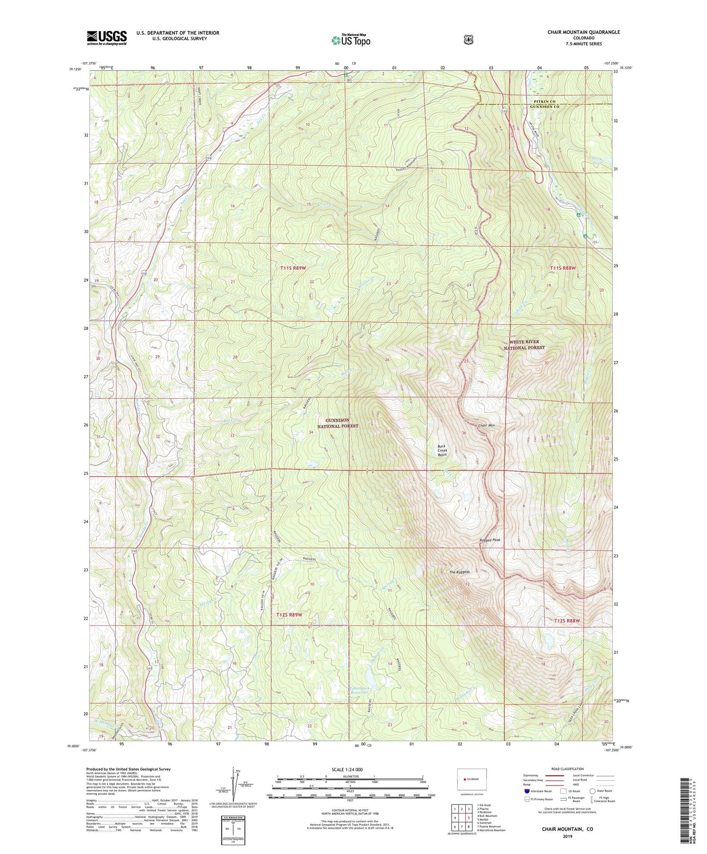
Chair Mountain Colorado US Topo Map
Couldn't load pickup availability
Also explore the Chair Mountain Forest Service Topo of this same quad for updated USFS data
2022 topographic map quadrangle Chair Mountain in the state of Colorado. Scale: 1:24000. Based on the newly updated USGS 7.5' US Topo map series, this map is in the following counties: Gunnison, Pitkin. The map contains contour data, water features, and other items you are used to seeing on USGS maps, but also has updated roads and other features. This is the next generation of topographic maps. Printed on high-quality waterproof paper with UV fade-resistant inks.
Quads adjacent to this one:
West: Bull Mountain
Northwest: Elk Knob
North: Placita
Northeast: Redstone
East: Marble
Southeast: Marcellina Mountain
South: Paonia Reservoir
Southwest: Somerset
This map covers the same area as the classic USGS quad with code o39107a3.
Contains the following named places: Anthracite Fuel Company Properties, Bogan Flats Campground, Buck Creek, Buck Creek Basin, Chair Creek, Chair Creek Tunnel Mine, Chair Mountain, Chair Mountain Ranch, Deadman Gulch, Grouse Creek, Jacobs Ranch, Lee Creek, McClure Campground, Perry Pond, Ragged Peak, Spring Creek, The Raggeds, Tomahawk Dam, Tomahawk Reservoir, Tuscarora Mine, Volk Ranch