MyTopo
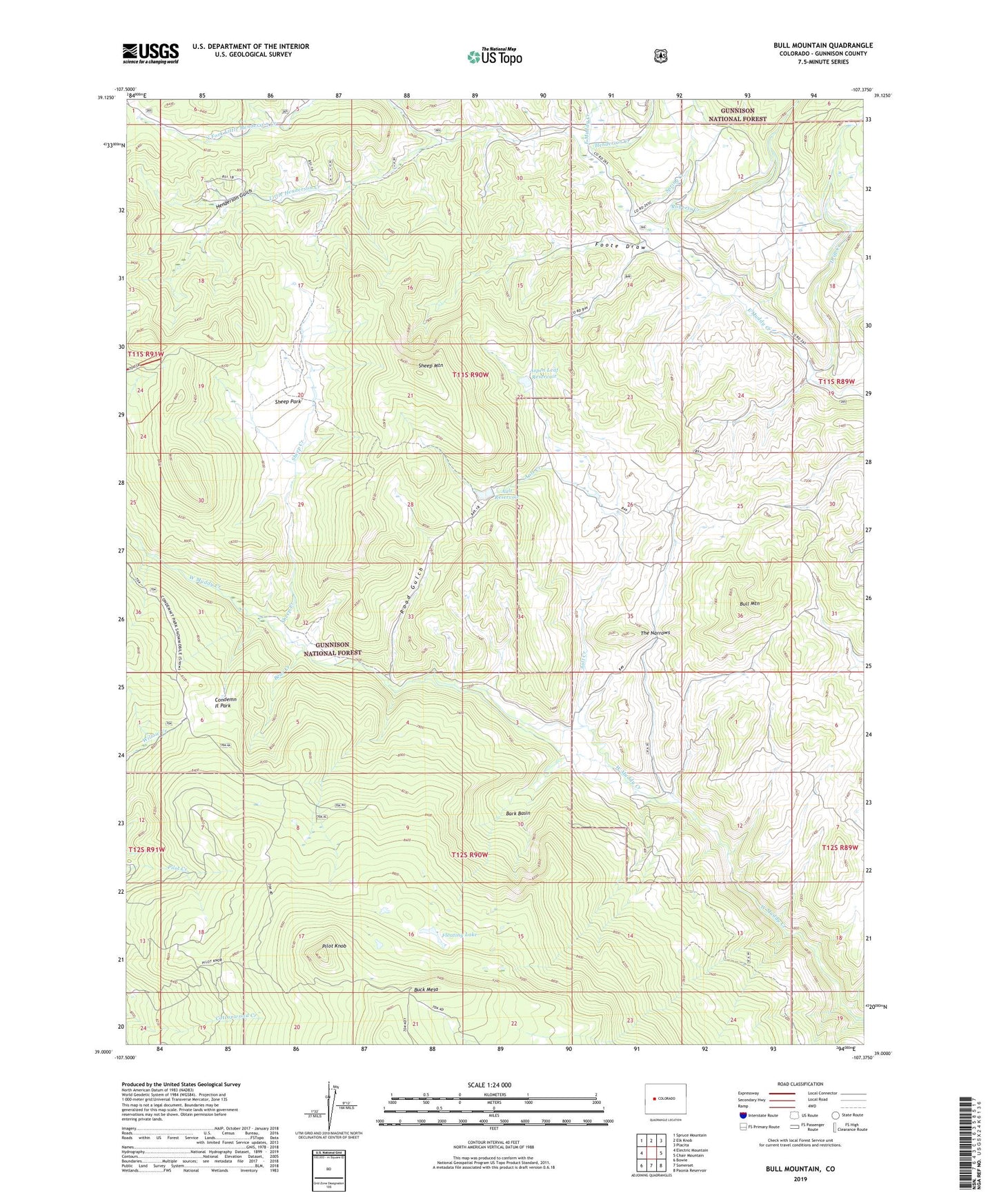
Bull Mountain Colorado US Topo Map
Couldn't load pickup availability
Also explore the Bull Mountain Forest Service Topo of this same quad for updated USFS data
2022 topographic map quadrangle Bull Mountain in the state of Colorado. Scale: 1:24000. Based on the newly updated USGS 7.5' US Topo map series, this map is in the following counties: Gunnison. The map contains contour data, water features, and other items you are used to seeing on USGS maps, but also has updated roads and other features. This is the next generation of topographic maps. Printed on high-quality waterproof paper with UV fade-resistant inks.
Quads adjacent to this one:
West: Electric Mountain
Northwest: Spruce Mountain
North: Elk Knob
Northeast: Placita
East: Chair Mountain
Southeast: Paonia Reservoir
South: Somerset
Southwest: Bowie
This map covers the same area as the classic USGS quad with code o39107a4.
Contains the following named places: Aspen Leaf Dam, Aspen Leaf Reservoir, Ault Creek, Ault Dam, Ault Reservoir, Bark Basin, Bear Creek, Brown Cow Camp, Bull Mountain, Buzzard Creek, Cockroft Cow Camp, Condemn It Park, Drift Creek, Floating Lake, Foote Draw, Harry Parker Place, Henderson Creek, Henderson Gulch, Hotchkiss Sheep Camp, Little Henderson Creek, North Fork Little Henderson Creek, Patterson Place, Pilot Knob, Ragged Mountain, Road Gulch, Roberts Creek, Sheep Creek, Sheep Mountain, Sheep Park, Spring Creek, The Narrows, Willow Creek