MyTopo
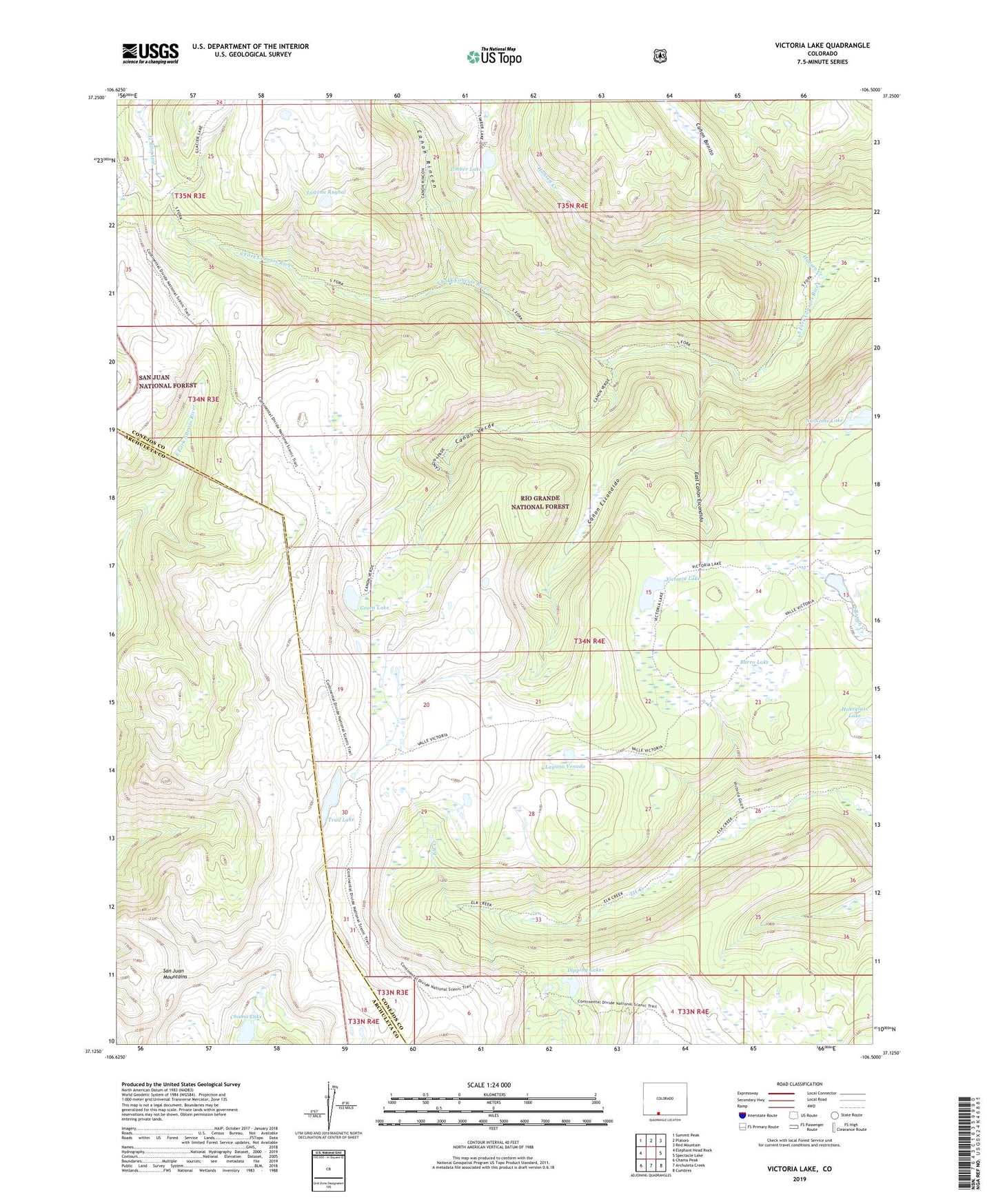
Victoria Lake Colorado US Topo Map
Couldn't load pickup availability
Also explore the Victoria Lake Forest Service Topo of this same quad for updated USFS data
2022 topographic map quadrangle Victoria Lake in the state of Colorado. Scale: 1:24000. Based on the newly updated USGS 7.5' US Topo map series, this map is in the following counties: Conejos, Archuleta. The map contains contour data, water features, and other items you are used to seeing on USGS maps, but also has updated roads and other features. This is the next generation of topographic maps. Printed on high-quality waterproof paper with UV fade-resistant inks.
Quads adjacent to this one:
West: Elephant Head Rock
Northwest: Summit Peak
North: Platoro
Northeast: Red Mountain
East: Spectacle Lake
Southeast: Cumbres
South: Archuleta Creek
Southwest: Chama Peak
This map covers the same area as the classic USGS quad with code o37106b5.
Contains the following named places: Alverjones Lake, Burro Lake, Canon Bonito, Canon Escondido, Canon Rincon, Canon Verde, Chama Lake, Dipping Lakes, East Canon Escondido, Elk Creek Trail, Green Lake, Hansen Creek, Hourglass Lake, Laguna Ruybal, Laguna Venado, Lisa Lake, Margo Lake, No Name Lake, South Fork Trail, Timber Lake, Trail Lake, Victoria Gulch, Victoria Lake