
MyTopo
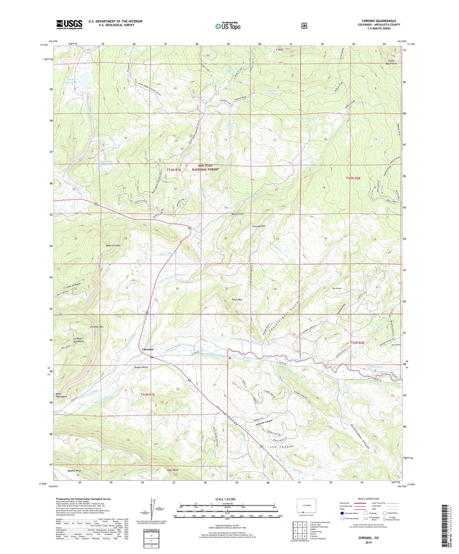
Chromo Colorado US Topo Map
Couldn't load pickup availability
Also explore the Chromo Forest Service Topo of this same quad for updated USFS data
2022 topographic map quadrangle Chromo in the state of Colorado. Scale: 1:24000. Based on the newly updated USGS 7.5' US Topo map series, this map is in the following counties: Archuleta. The map contains contour data, water features, and other items you are used to seeing on USGS maps, but also has updated roads and other features. This is the next generation of topographic maps. Printed on high-quality waterproof paper with UV fade-resistant inks.
Quads adjacent to this one:
West: Edith
Northwest: Serviceberry Mountain
North: Harris Lake
Northeast: Elephant Head Rock
East: Chama Peak
Southeast: Chromo Mountain
South: Monero
Southwest: Dulce
This map covers the same area as the classic USGS quad with code o37106a7.
Contains the following named places: Bigbee Ditch Number 1, Buckhammer Canyon, Captain Beal Gulch, Chromo, Chromo Mountain, Chromo Post Office, Cornish Gulch, Cornish Hill, Eaklor Ditch, Elmer Ditch, Enterprise Ditch, Gardner Lake, Jawbone Canyon, Klondike Draw, La Mesa del Medio, Little Navajo River, Little Oso Dam, Log Canyon, Mesa Cortado, Mesa Pedregosa, Midland Ditch, Navajo Peak Trailhead, Oil Well Creek, Oso Tunnel, Pagosa Fire Protection District Station 7 - Chromo, Sappington Dam, Sappington Reservoir, Shahan Ditch, Southside Ditch, Spence Creek, Spence Dam, Spence Reservoir, Spring Creek, Spring Creek Lakes, Spring Valley, Stinking Springs, Stove Creek, Tater Mountain, Twin Lakes, Underwood Ditch, V Rock, Vigil Mesa


