MyTopo
Cheesman Lake Colorado US Topo Map
Couldn't load pickup availability
Also explore the Cheesman Lake Forest Service Topo of this same quad for updated USFS data
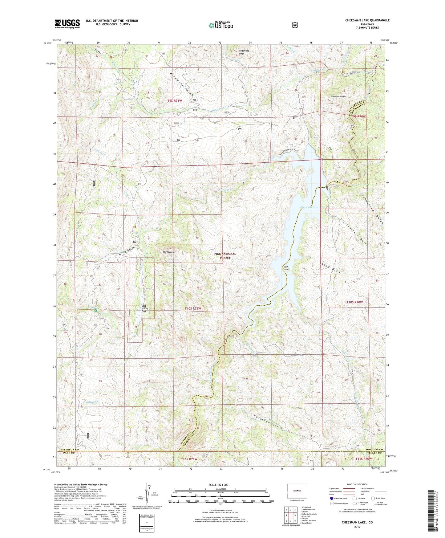
2022 topographic map quadrangle Cheesman Lake in the state of Colorado. Scale: 1:24000. Based on the newly updated USGS 7.5' US Topo map series, this map is in the following counties: Jefferson, Douglas, Teller, Park. The map contains contour data, water features, and other items you are used to seeing on USGS maps, but also has updated roads and other features. This is the next generation of topographic maps. Printed on high-quality waterproof paper with UV fade-resistant inks.
Quads adjacent to this one:
West: McCurdy Mountain
Northwest: Windy Peak
North: Green Mountain
Northeast: Deckers
East: Westcreek
Southeast: Signal Butte
South: Hackett Mountain
Southwest: Tarryall
This map covers the same area as the classic USGS quad with code o39105b3.
Contains the following named places: Cabin Creek, Cheesman Dam, Cheesman Lake, Cheesman Mountain, Douglas Creek, Field Creek, Flickenstein Gulch, Flying G Ranch, Goose Creek, Little Turkey Creek, Lost Valley Park, Lost Valley Ranch, Molly Gulch, Molly Gulch Campground, Monument Gulch, North Twin Creek, Northrup Gulch, Pine Creek, Sand Draw, Schoonover Gulch, Sheeprock, Sixmile Creek, Spruce Grove Campground, Sugarloaf Peak, The Island, Turkey Creek, Twin Creek, Wigwam Campground, Wigwam Club, Wigwam Creek, Wildcat Creek