
MyTopo
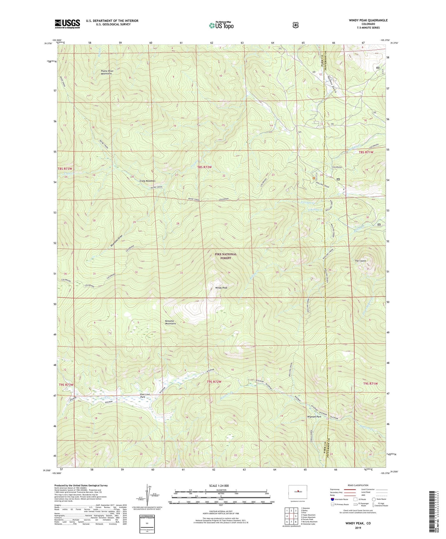
Windy Peak Colorado US Topo Map
Couldn't load pickup availability
Also explore the Windy Peak Forest Service Topo of this same quad for updated USFS data
2022 topographic map quadrangle Windy Peak in the state of Colorado. Scale: 1:24000. Based on the newly updated USGS 7.5' US Topo map series, this map is in the following counties: Park, Jefferson. The map contains contour data, water features, and other items you are used to seeing on USGS maps, but also has updated roads and other features. This is the next generation of topographic maps. Printed on high-quality waterproof paper with UV fade-resistant inks.
Quads adjacent to this one:
West: Topaz Mountain
Northwest: Shawnee
North: Bailey
Northeast: Pine
East: Green Mountain
Southeast: Cheesman Lake
South: McCurdy Mountain
Southwest: Farnum Peak
This map covers the same area as the classic USGS quad with code o39105c4.
Contains the following named places: Aspen Lode Pegmatite Mine, Bancroft Ranch, Bluestem Draw, Craig Meadows, East Lost Park, Lone and Lonesome Lodes Pegmatite Mine, Maxwell Ditch, North Rolling Creek, Pine Ridge Trail, Rolling Creek Trail, Soderstrom Ranch, Sunnyside Ranch, Sylvania of the Rockies, The Castle, Upper Craig Creek Ditch, Wigwam Park, Windy Peak


