MyTopo
Chicos Well Colorado US Topo Map
Couldn't load pickup availability
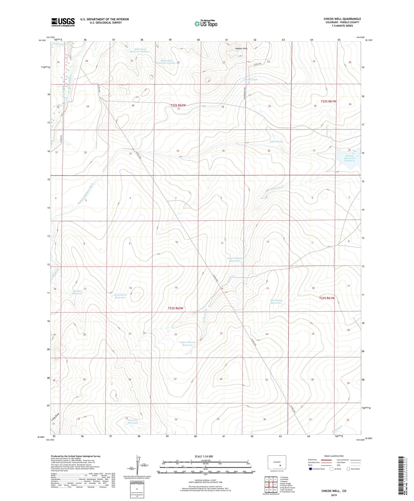
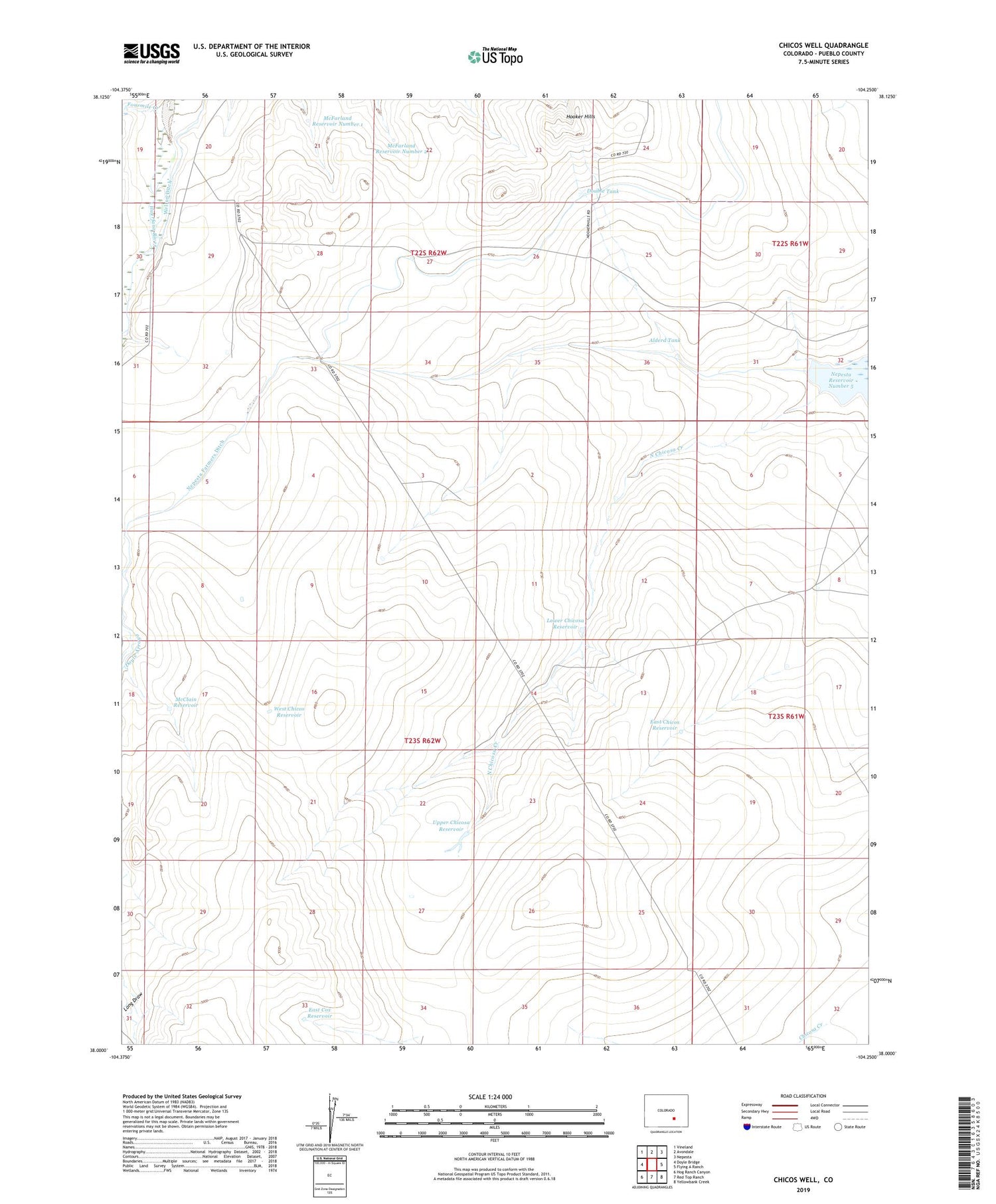
2022 topographic map quadrangle Chicos Well in the state of Colorado. Scale: 1:24000. Based on the newly updated USGS 7.5' US Topo map series, this map is in the following counties: Pueblo. The map contains contour data, water features, and other items you are used to seeing on USGS maps, but also has updated roads and other features. This is the next generation of topographic maps. Printed on high-quality waterproof paper with UV fade-resistant inks.
Quads adjacent to this one:
West: Doyle Bridge
Northwest: Vineland
North: Avondale
Northeast: Nepesta
East: Flying A Ranch
Southeast: Yellowbank Creek
South: Red Top Ranch
Southwest: Hog Ranch Canyon
This map covers the same area as the classic USGS quad with code o38104a3.
Contains the following named places: Alderd Tank, Alderd Well, Chicosa Number 5 Dam, Double Tank, Doyle Arroya Feeder Ditch, East Chicos Reservoir, East Cox Reservoir, East Cox Windmill, Fountain Well, Fourmile Creek, Goodwin Reservoir, Huerfano Valley Division, Long Draw, Lower Chicosa Reservoir, McClain Reservoir, McFarland Reservoir Number 1, McFarland Reservoir Number 2, Nepesta Farmers Ditch, Nepesta Reservoir Number 5, Upper Chicosa Reservoir, West Chicos Reservoir