MyTopo
Dulce New Mexico US Topo Map
Couldn't load pickup availability
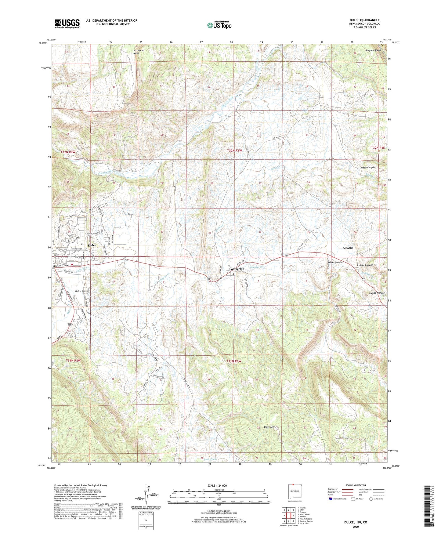
2023 topographic map quadrangle Dulce in the state of New Mexico. Scale: 1:24000. Based on the newly updated USGS 7.5' US Topo map series, this map is in the following counties: Rio Arriba, Archuleta. The map contains contour data, water features, and other items you are used to seeing on USGS maps, but also has updated roads and other features. This is the next generation of topographic maps. Printed on high-quality waterproof paper with UV fade-resistant inks.
Quads adjacent to this one:
West: Wirt Canyon
Northwest: Trujillo
North: Edith
Northeast: Chromo
East: Monero
Southeast: Horse Lake
South: Cordova Canyon
Southwest: John Mills Lake
This map covers the same area as the classic USGS quad with code o36106h8.
Contains the following named places: Amargo, Amargo Post Office, Atole Pond, Belino-Peisker Mine, Caranta Lease, Cornell Prospect, Coyote Creek, Cuesta Monero, Dulce, Dulce Airport, Dulce Assembly of God Church, Dulce Baptist Indian Mission, Dulce Canyon, Dulce Elementary School, Dulce Fire Department, Dulce High School, Dulce Middle School, Dulce Mountain, Dulce Post Office, Dulce Weather Station, Indian Sanitarium, Jicarilla Apache Historic District, Jicarilla Apache Reformed Church, Jicarilla Apache Reservation Historical Marker, Jicarilla Library, Jicarilla Museum, KCIE-FM (Dulce), Lower Mundo Dam, Lumberton, Lumberton Census Designated Place, Lumberton Post Office, Lumberton Prospect, Saint Francis Elementary School, Tafoya Mine, Tafoya Prospect, Webb Canyon, Webb Creek