MyTopo
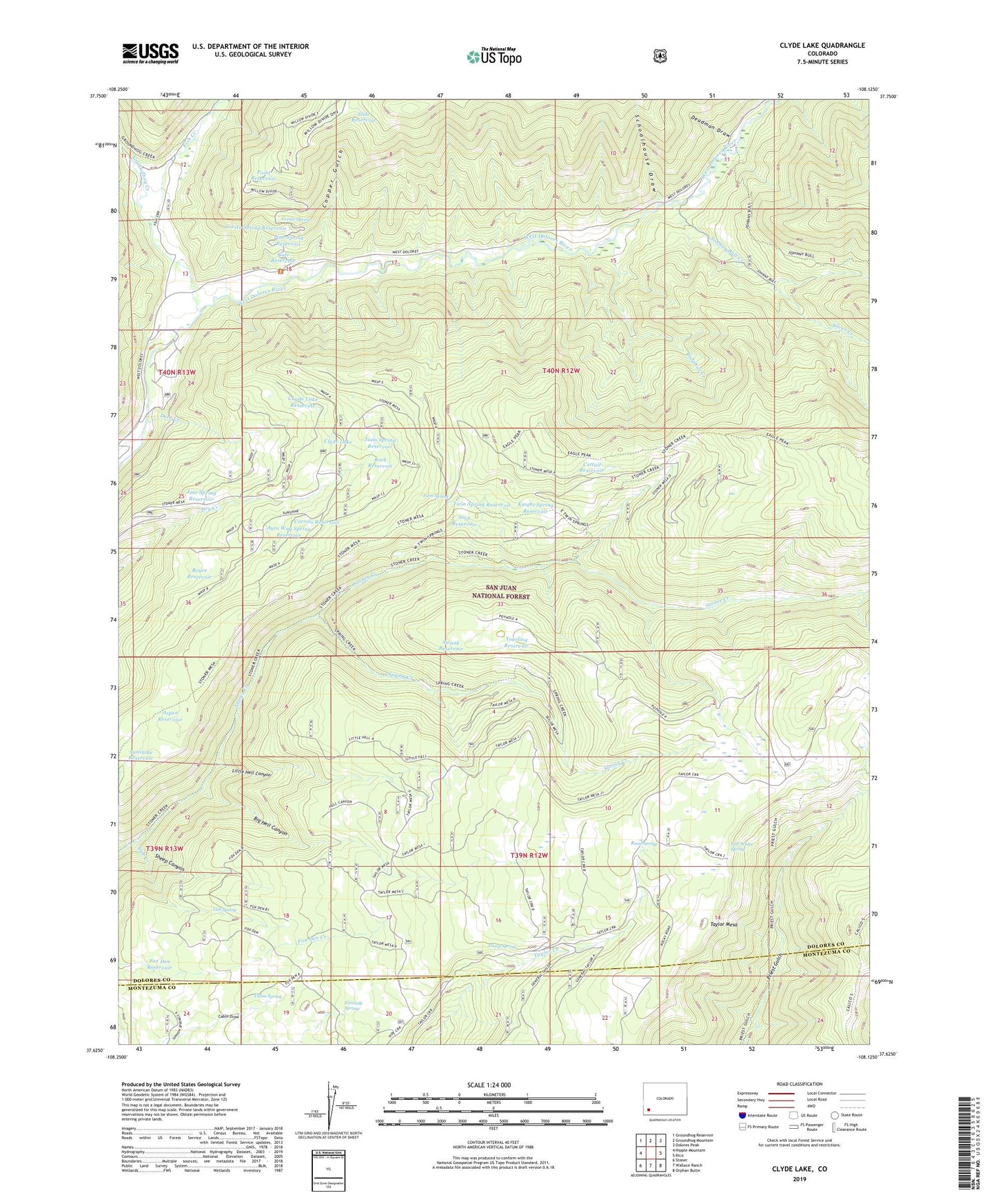
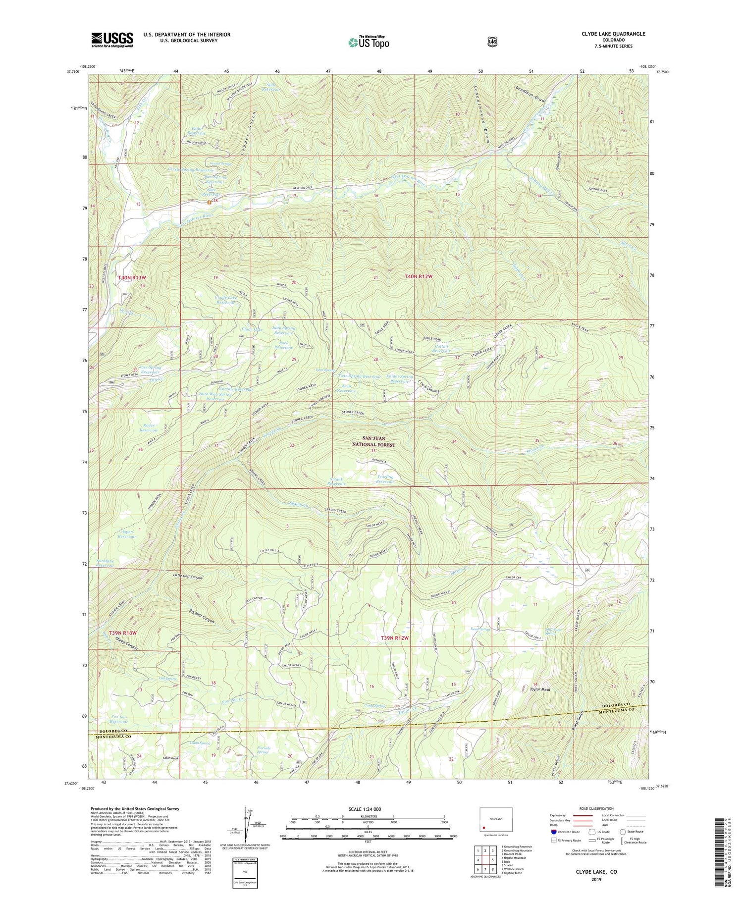
Clyde Lake Colorado US Topo Map
Couldn't load pickup availability
Also explore the Clyde Lake Forest Service Topo of this same quad for updated USFS data
2022 topographic map quadrangle Clyde Lake in the state of Colorado. Scale: 1:24000. Based on the newly updated USGS 7.5' US Topo map series, this map is in the following counties: Dolores, Montezuma. The map contains contour data, water features, and other items you are used to seeing on USGS maps, but also has updated roads and other features. This is the next generation of topographic maps. Printed on high-quality waterproof paper with UV fade-resistant inks.
Quads adjacent to this one:
West: Nipple Mountain
Northwest: Groundhog Reservoir
North: Groundhog Mountain
Northeast: Dolores Peak
East: Rico
Southeast: Orphan Butte
South: Wallace Ranch
Southwest: Stoner
This map covers the same area as the classic USGS quad with code o37108f2.
Contains the following named places: Aspen Reservoir, Auto Way Spring Reservoir, Big Hell Canyon, Cabin Spring, Camp Spring, Cattail Reservoir, Cleveland Reservoir, Clyde Lake, CLyde Lake Reservoir, Copper Gulch, Corrals Reservoir, Cresto Ranch, Cresto Spring, Cresto Spring Reservoir, Cub Creek, Cub Spring, Deadman Draw, Deer Creek, Eagle Peak Trail, Fish Creek, Fivemile Spring, Fox Den Reservoir, Gate Reservoir, Groundhog Creek, Johnny Bull Creek, Jose Spring Reservoir, Juan Spring Reservoir, Knight Spring Reservoir, Little Hell Canyon, Little Silver Mine, Miller Ranch, Pine Spring Reservoir, Pipe Creek Trail, Point Reservoir, Priest Gulch Trail, Privateer Mine, Road Spring, Rock Reservoir, Royce Reservoir, Schoolhouse Draw, Seep Reservoir, Sheep Canyon, Silver Creek, Slide Reservoir, Soft Water Spring, Spring Creek, Spring Creek Trail, Stoner Mesa Trail, Sulphur Creek, Sunshine Reservoir, Swank Reservoir, Taylor Mesa, Teaser Mine, Twin Spring, Twin Spring Reservoir, Twin Spring Trail, Yearling Reservoir, ZIP Code: 81323