MyTopo
Stoner Colorado US Topo Map
Couldn't load pickup availability
Also explore the Stoner Forest Service Topo of this same quad for updated USFS data
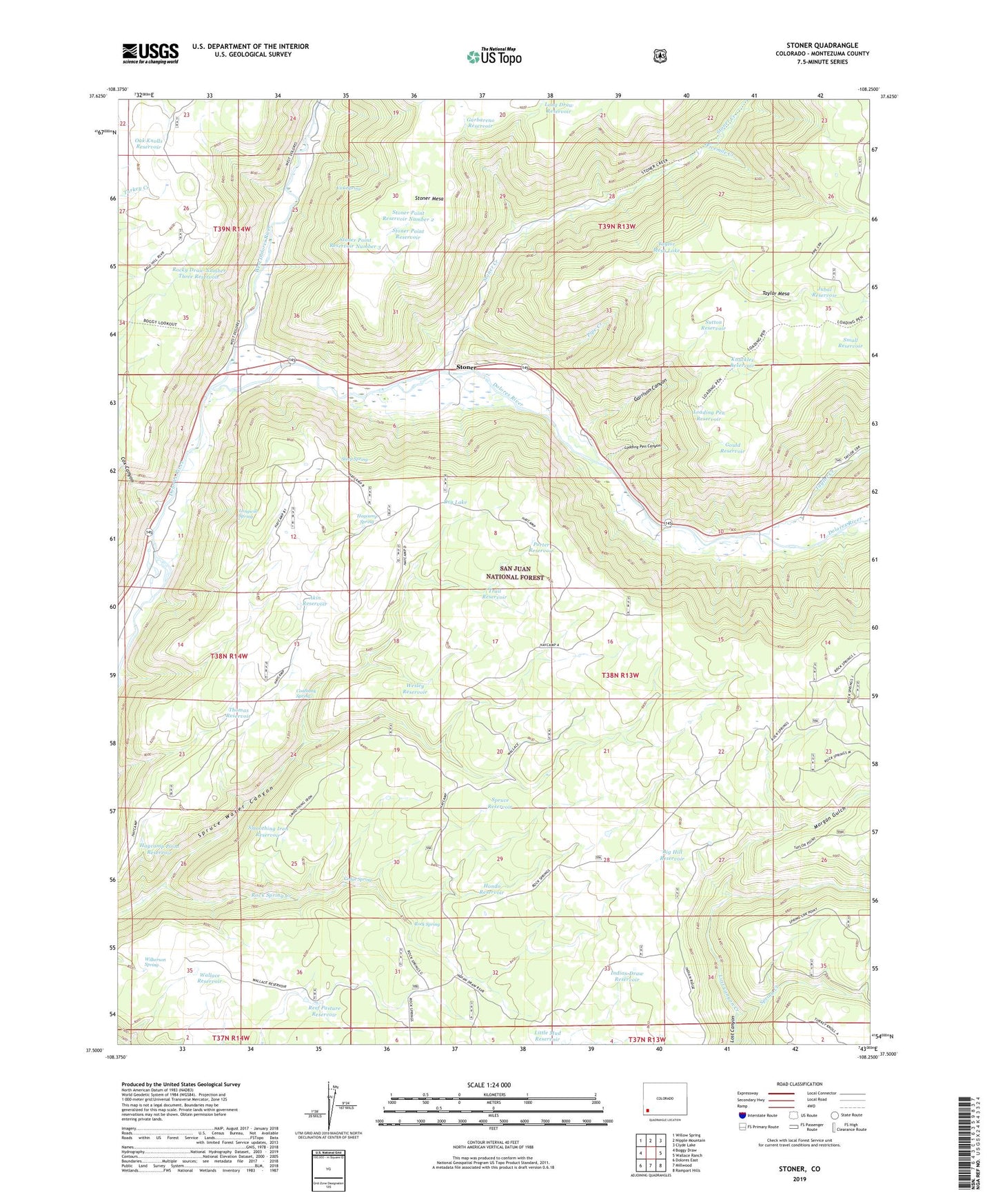
2022 topographic map quadrangle Stoner in the state of Colorado. Scale: 1:24000. Based on the newly updated USGS 7.5' US Topo map series, this map is in the following counties: Montezuma. The map contains contour data, water features, and other items you are used to seeing on USGS maps, but also has updated roads and other features. This is the next generation of topographic maps. Printed on high-quality waterproof paper with UV fade-resistant inks.
Quads adjacent to this one:
West: Boggy Draw
Northwest: Willow Spring
North: Nipple Mountain
Northeast: Clyde Lake
East: Wallace Ranch
Southeast: Rampart Hills
South: Millwood
Southwest: Dolores East
This map covers the same area as the classic USGS quad with code o37108e3.
Contains the following named places: Akin Reservoir, Big Hill Reservoir, Cedar Spring, Coalbank Spring, Cox Canyon, Dolores Division, Dry Lake, Fivemile Creek, Garbareno Reservoir, Garrison Canyon, Gould Reservoir, Haycamp Point Reservoir, Haycamp Spring, Hondo Reservoir, Indian Draw Reservoir, Jubal Reservoir, Knuckles Reservoir, Little Mud Reservoir, Loading Pen Canyon, Loading Pen Reservoir, Long Draw Reservoir, Longwill Reservoir, Longwill Spring, Morgan Gulch, Myler Reservoir, Oak Knolls Reservoir, Pipe Creek, Porter Reservoir, Reef Pasture Reservoir, Rock Spring, Rock Spring Creek, Rocky Draw Number Three Reservoir, Small Reservoir, Smoothing Iron Reservoir, Spring Creek, Spruce Reservoir, Steep Spring, Stoner, Stoner Creek, Stoner Guard Station, Stoner Point Reservoir, Stoner Point Reservoir Number 2, Stoner Point Reservoir Number 3, Stoner Ski Area, Sutton Reservoir, Taylor Creek, Taylor Mesa Lake, The Forks Campground, Thomas Reservoir, Trail Reservoir, Vick Spring, Wallace Reservoir, Wesley Reservoir, West Dolores River, Wilkerson Spring