
MyTopo
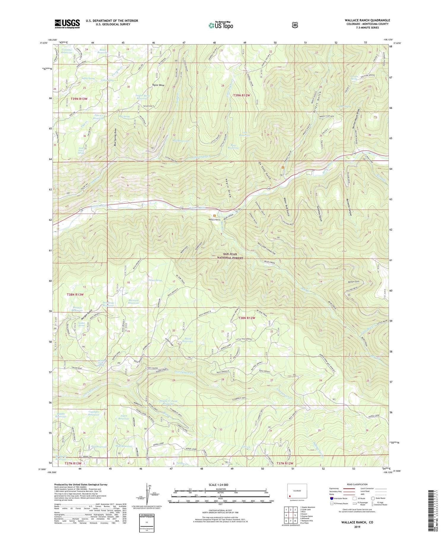
Wallace Ranch Colorado US Topo Map
Couldn't load pickup availability
Also explore the Wallace Ranch Forest Service Topo of this same quad for updated USFS data
2022 topographic map quadrangle Wallace Ranch in the state of Colorado. Scale: 1:24000. Based on the newly updated USGS 7.5' US Topo map series, this map is in the following counties: Montezuma. The map contains contour data, water features, and other items you are used to seeing on USGS maps, but also has updated roads and other features. This is the next generation of topographic maps. Printed on high-quality waterproof paper with UV fade-resistant inks.
Quads adjacent to this one:
West: Stoner
Northwest: Nipple Mountain
North: Clyde Lake
Northeast: Rico
East: Orphan Butte
Southeast: La Plata
South: Rampart Hills
Southwest: Millwood
This map covers the same area as the classic USGS quad with code o37108e2.
Contains the following named places: Aspen Reservoir, Aspen Spring, Barnard Reservoir, Bauer Reservoir, Bear Creek, Bear Reservoir, Black Reservoir, Blue Spring, Blue Spring Draw, Burnette Canyon, Calico Spring, Circle K Ranch, Copinger Reservoir, Cushman Gulch, Dipping Vat Creek, Dolores River Placer, Drift Fence Spring, Driveway Reservoir, Ellermeyer Gulch, Fish Creek, Fivemile Reservoir, Greenlee Reservoir, High Reservoir, Little Bear Creek, Little Bear Trail, Little Taylor Creek, Lost Canyon Stock Driveway, Lost Reservoir, Low Reservoir, Lower Pole Reservoir, Middle Reservoir, Missouri Girl Mine, Morgan Reservoir, Morrison Trail, Mud Reservoir, Munson Gulch, Negro Draw, Ox Shoe Gulch, Pipe Creek Reservoir, Priest Gulch, Priest Gulch Campground, Priest Gulch Trailhead, Quarry, Ramsay Reservoir, Rio Lado, Roy Reservoir, Section House Draw, Siphon Spring, Spring Creek Point Reservoir, Spring Creek Reservoir, Spruce Spring, Stewart Gulch, Taylor Mesa Reservoir, Turkey Point Spring, Twin Fir Spring, Upper Pole Reservoir, Walker Spring, Wallace Ranch, Water Tank Gulch


