MyTopo
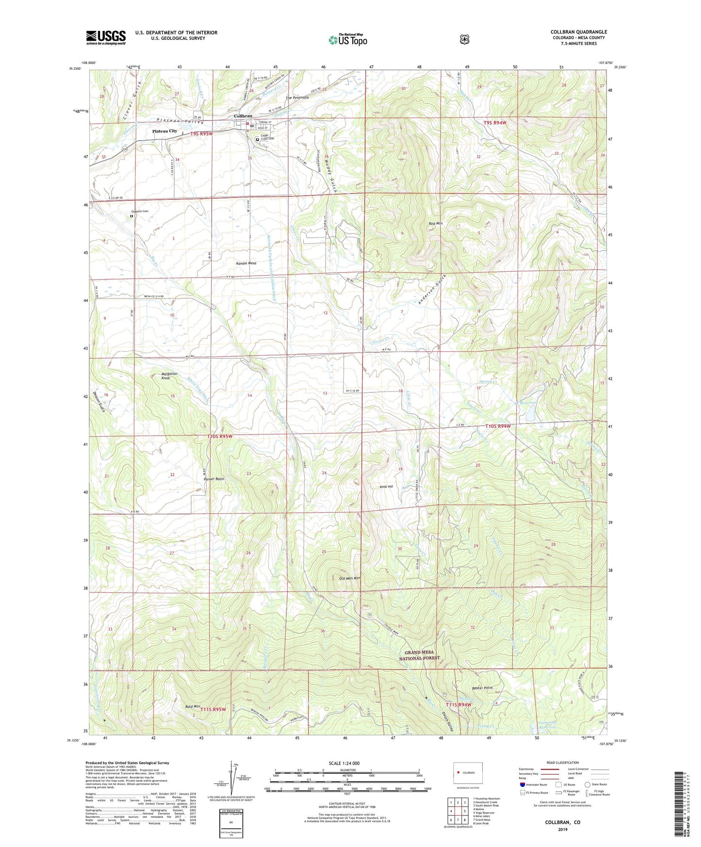
Collbran Colorado US Topo Map
Couldn't load pickup availability
Also explore the Collbran Forest Service Topo of this same quad for updated USFS data
2022 topographic map quadrangle Collbran in the state of Colorado. Scale: 1:24000. Based on the newly updated USGS 7.5' US Topo map series, this map is in the following counties: Mesa. The map contains contour data, water features, and other items you are used to seeing on USGS maps, but also has updated roads and other features. This is the next generation of topographic maps. Printed on high-quality waterproof paper with UV fade-resistant inks.
Quads adjacent to this one:
West: Molina
Northwest: Housetop Mountain
North: Hawxhurst Creek
Northeast: South Mamm Peak
East: Vega Reservoir
Southeast: Leon Peak
South: Grand Mesa
Southwest: Mesa Lakes
This map covers the same area as the classic USGS quad with code o39107b8.
Contains the following named places: Anderson Gulch, Bald Mountain, Baxter Creek, Baxter Point, Berthold Updyke and Landon Ditch, Buzzard Creek, Carpenter Dam, Carpenter Reservoir, Cedar Crest Cemetery, Clover Gulch, Collbran, Collbran Division, Collbran Job Corps, Collbran Post Office, Death Valley, Eagalite Cemetery, Grove Creek, Kansas Mesa, Kimball Creek, Knob Hill, Little Creek, Little Creek School, Maigatter Knob, Mosquito Creek, Muddy Gulch, Negro Creek, Oak Creek, Old Man Mountain, Parker Basin, Parker Basin School, Plateau City, Plateau Valley Fire Protection District - Station 91, Pleasant View School, Pretty Creek, Red Mountain, Silver Gage Ditch, Spring Creek, Swanee Creek, Town of Collbran, Twin Peaks Bible and Missionary Camp, Y T Dam, YT Reservoir