MyTopo
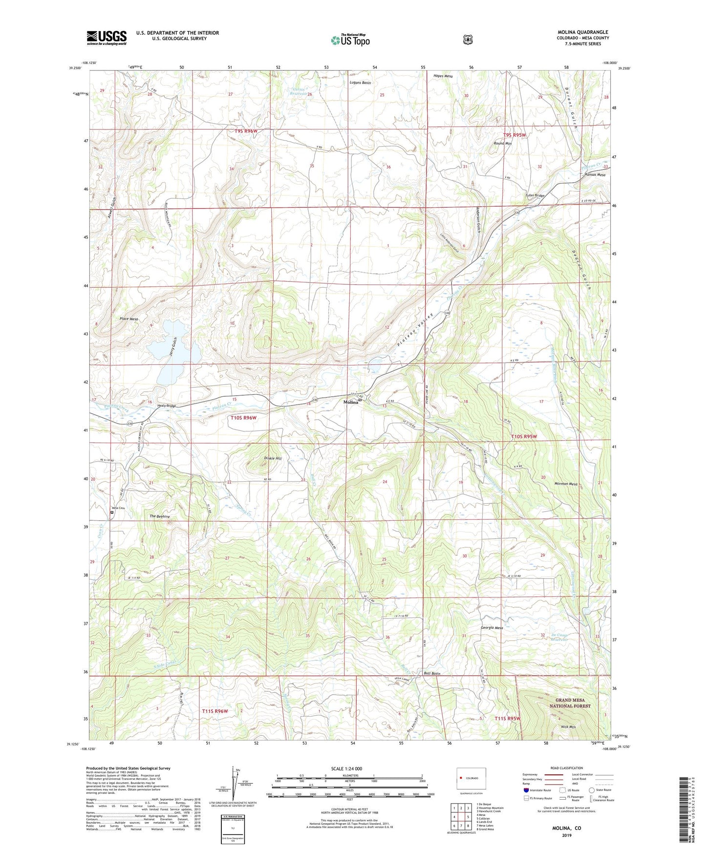
Molina Colorado US Topo Map
Couldn't load pickup availability
Also explore the Molina Forest Service Topo of this same quad for updated USFS data
2022 topographic map quadrangle Molina in the state of Colorado. Scale: 1:24000. Based on the newly updated USGS 7.5' US Topo map series, this map is in the following counties: Mesa. The map contains contour data, water features, and other items you are used to seeing on USGS maps, but also has updated roads and other features. This is the next generation of topographic maps. Printed on high-quality waterproof paper with UV fade-resistant inks.
Quads adjacent to this one:
West: Mesa
Northwest: De Beque
North: Housetop Mountain
Northeast: Hawxhurst Creek
East: Collbran
Southeast: Grand Mesa
South: Mesa Lakes
Southwest: Lands End
This map covers the same area as the classic USGS quad with code o39108b1.
Contains the following named places: Anderson Gulch, Big Creek, Bull Basin, Bull Creek, Bull Creek School, Colclasure Homestead, Cottonwood Creek, Curtin Reservoir, De Camp Reservoir, Deacon Gulch, Dinkle Hill, Durant Gulch, Eagalite School, Fuller Bridge, Fuller Hill, Georgia Mesa, Georgia Mesa School, Halfway House, Hayes Mesa, Healy Bridge, Jerry Creek Number 1 Dam, Jerry Creek Number 1 Reservoir, Jerry Creek Number 2 Dam, Jerry Creek Number 2 Reservoir, Jerry Gulch, Little Anderson Gulch, Lugans Basin, McCall Ranch, McKenny Homestead, Mesa Cemetery, Miller Homestead, Molina, Molina Deposit Mine, Molina Post Office, Monroe Homestead, Mormon Mesa, Mormon Mesa Ditch, Mormon Mesa School, Place Mesa, Round Mountain, Spring Creek, Tanner Homestead, Taylor Homestead, The Beehive