MyTopo
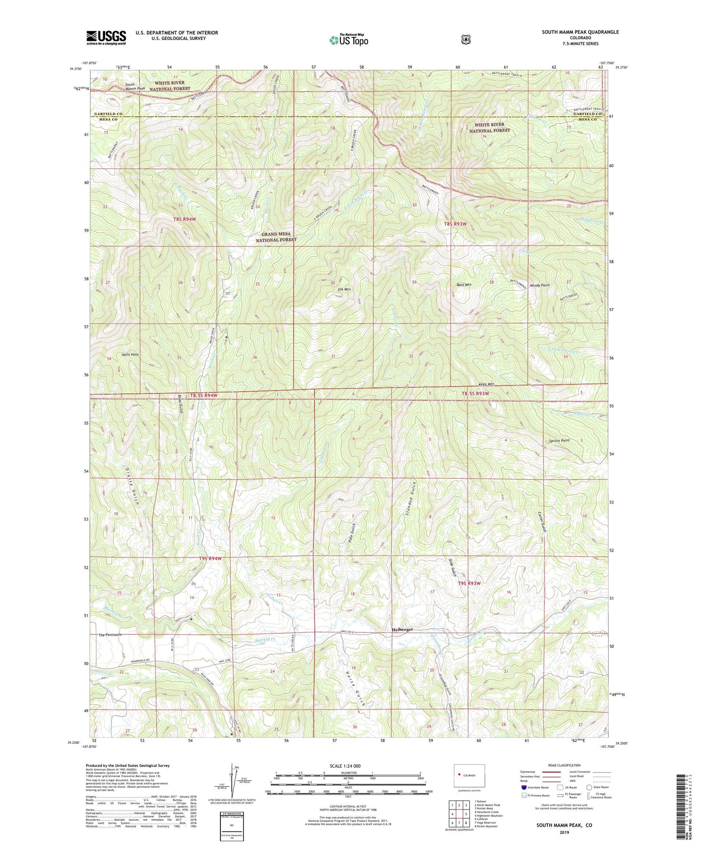
South Mamm Peak Colorado US Topo Map
Couldn't load pickup availability
Also explore the South Mamm Peak Forest Service Topo of this same quad for updated USFS data
2022 topographic map quadrangle South Mamm Peak in the state of Colorado. Scale: 1:24000. Based on the newly updated USGS 7.5' US Topo map series, this map is in the following counties: Mesa, Garfield. The map contains contour data, water features, and other items you are used to seeing on USGS maps, but also has updated roads and other features. This is the next generation of topographic maps. Printed on high-quality waterproof paper with UV fade-resistant inks.
Quads adjacent to this one:
West: Hawxhurst Creek
Northwest: Rulison
North: North Mamm Peak
Northeast: Hunter Mesa
East: Hightower Mountain
Southeast: Porter Mountain
South: Vega Reservoir
Southwest: Collbran
This map covers the same area as the classic USGS quad with code o39107c7.
Contains the following named places: Bald Mountain, Bald Mountain Trail, Battlement Trail, Bloss Gulch, Brush Creek, Brush Creek Cow Camp, Brush Creek Trail, Carter Gulch, Clover School, Collier Creek, East Fork Brush Creek, Elk Mountain, Grassy Gulch, Groundhog Creek, Groundhog Gulch, Harrison Creek, Heiberger, Hells Hole, Horse Gulch, Keep Mountain, Little Baldy, Pole Gulch, Slide Gulch, South Mamm Peak, Spruce Point, Standup Gulch, West Brush Creek, Windy Point