MyTopo
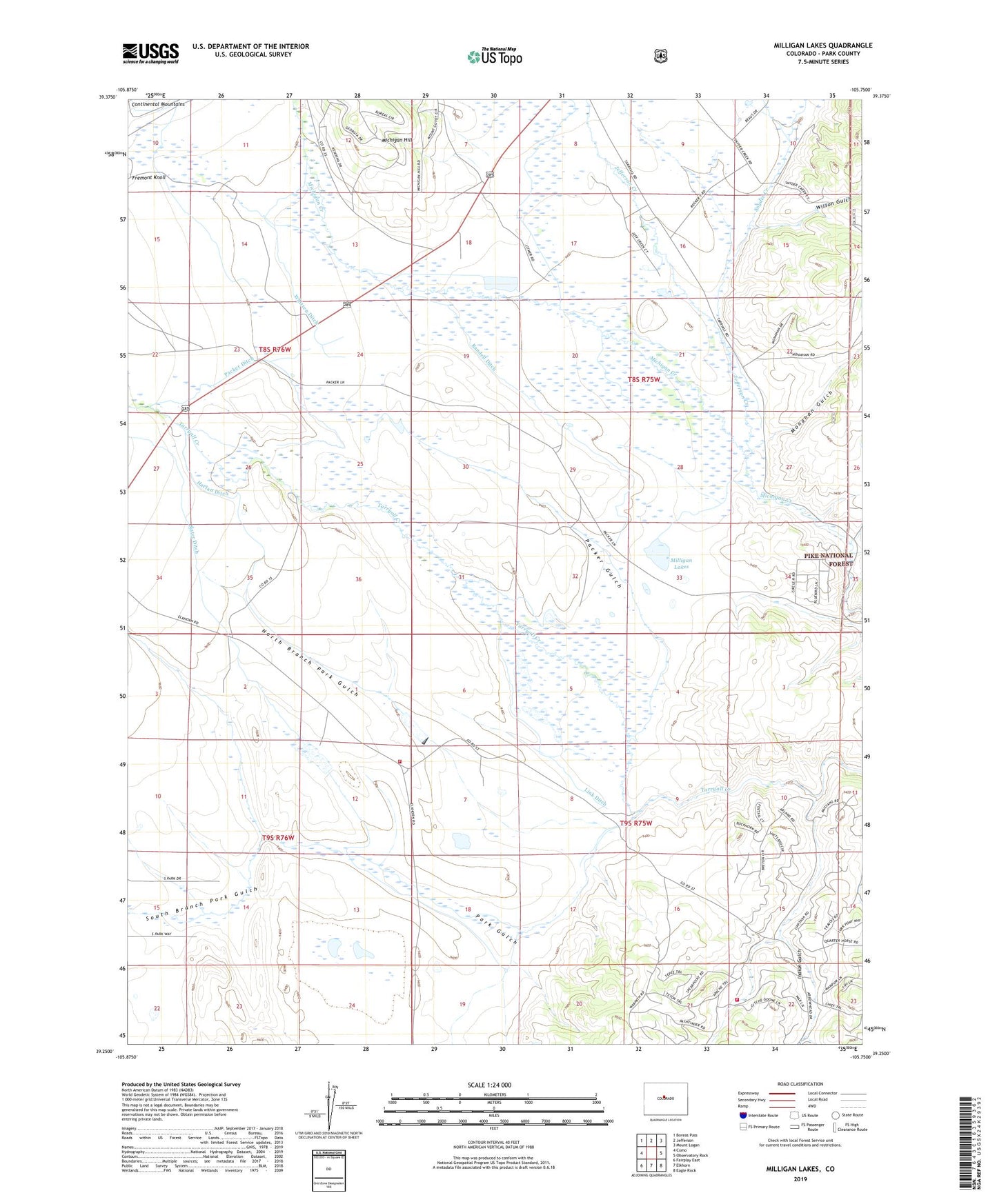
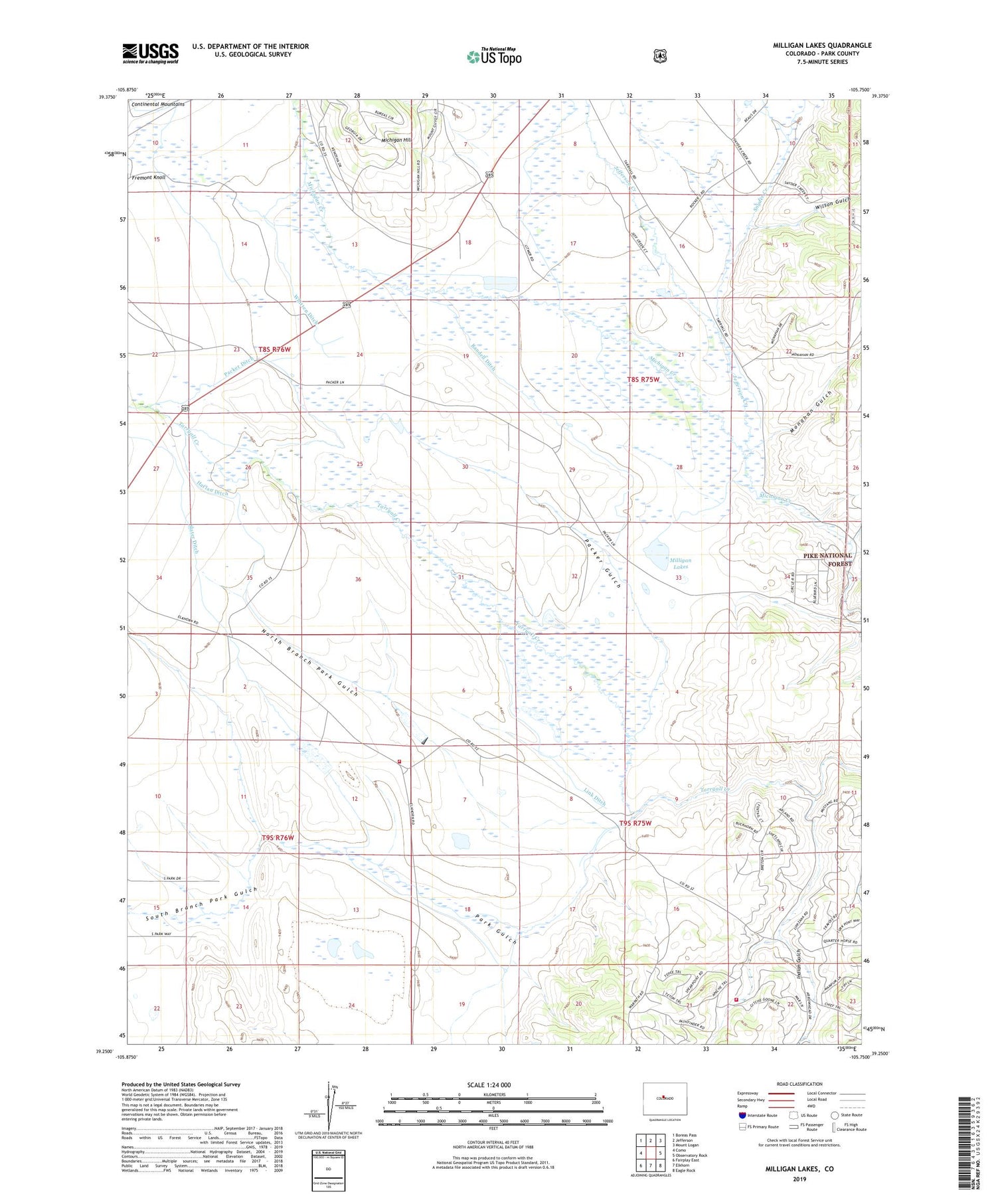
Milligan Lakes Colorado US Topo Map
Couldn't load pickup availability
Also explore the Milligan Lakes Forest Service Topo of this same quad for updated USFS data
2022 topographic map quadrangle Milligan Lakes in the state of Colorado. Scale: 1:24000. Based on the newly updated USGS 7.5' US Topo map series, this map is in the following counties: Park. The map contains contour data, water features, and other items you are used to seeing on USGS maps, but also has updated roads and other features. This is the next generation of topographic maps. Printed on high-quality waterproof paper with UV fade-resistant inks.
Quads adjacent to this one:
West: Como
Northwest: Boreas Pass
North: Jefferson
Northeast: Mount Logan
East: Observatory Rock
Southeast: Eagle Rock
South: Elkhorn
Southwest: Fairplay East
This map covers the same area as the classic USGS quad with code o39105c7.
Contains the following named places: American Mine, Cline Dam, Cline Reservoir, Coleman Ranch, Collard Ranch, Como Mine Number Five, Como Mine Number Four, Como Mine Number One, Como Mine Number Seven, Como Mine Number Six, Como Mine Number Two, Crosier Hawxhurst Ditch, Dunbar Number 1 Ditch, Fairplay Division, Fremont Knoll, Furman Ranch, Gibson Ditch, Harlan Ditch, Indian Gulch, Jefferson - Como Fire Protection District Station 5 Elkhorn Road, Jefferson - Como Fire Protection District Station 7 Indian Mountain, Jefferson Creek, King Mine, Link Ditch, Michigan Campground, Milligan Lakes, Monahan Gulch, North Branch Park Gulch, Packer Ditch, Packer Gulch, Park Gulch, Petrie Ditch, Portis Ranch, Quelland Ranch, Randell Ditch, Rocker Seven Ranch, Sessions Ditch, Sheppard Ranch, Slash 6 Ranch, Slater Ditch, Snyder Creek, South Branch Park Gulch, Tarryall Ranch Reservoir Number 1, Tarryall Ranch Reservoir Number 1 Dam, Taylor Ditch, Taylors Jefferson Creek Ditch, Wahl Ranch, Whitten Ditch, Wilson Gulch