
MyTopo
Cooper Mountain Colorado US Topo Map
Couldn't load pickup availability
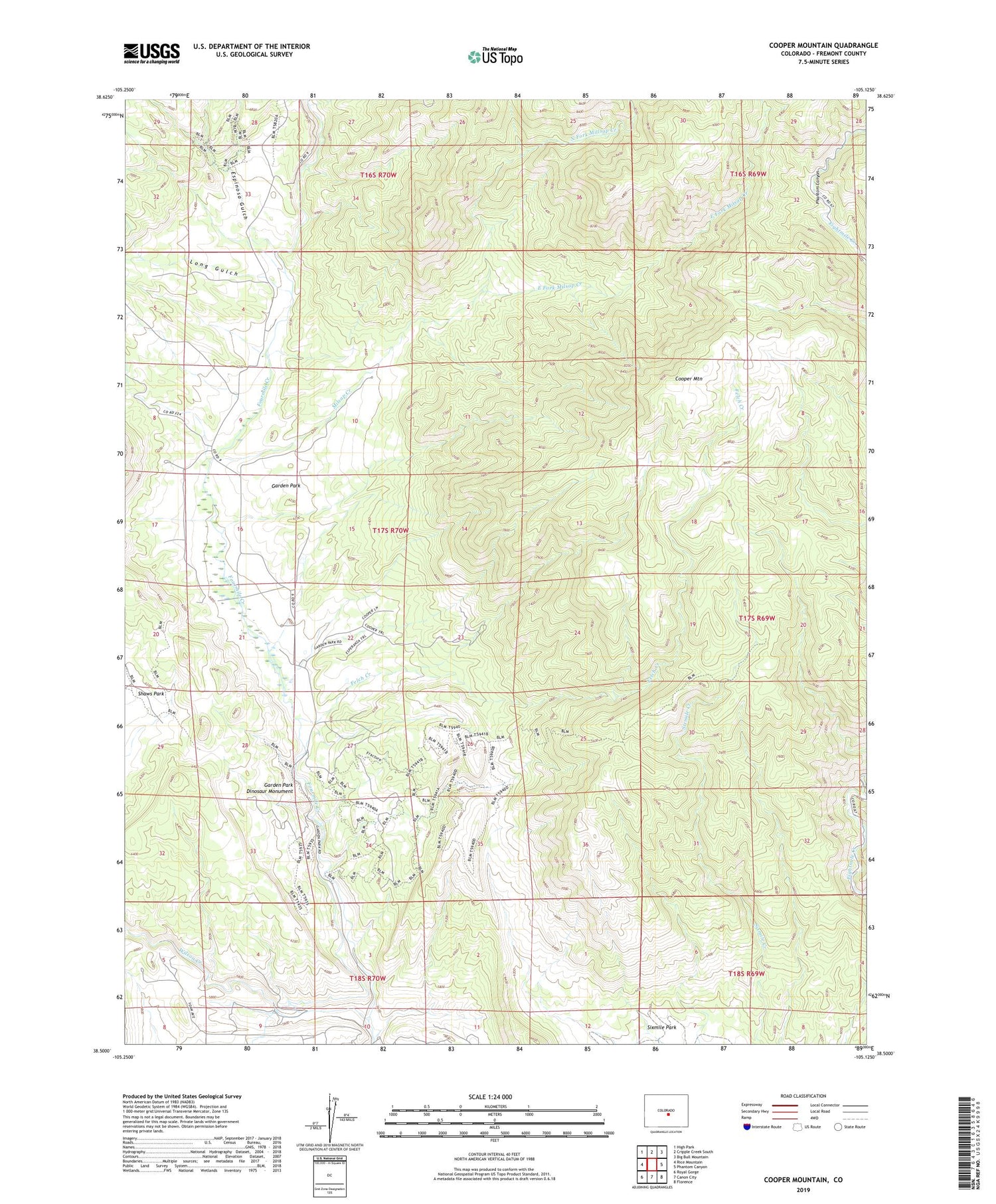
2022 topographic map quadrangle Cooper Mountain in the state of Colorado. Scale: 1:24000. Based on the newly updated USGS 7.5' US Topo map series, this map is in the following counties: Fremont. The map contains contour data, water features, and other items you are used to seeing on USGS maps, but also has updated roads and other features. This is the next generation of topographic maps. Printed on high-quality waterproof paper with UV fade-resistant inks.
Quads adjacent to this one:
West: Rice Mountain
Northwest: High Park
North: Cripple Creek South
Northeast: Big Bull Mountain
East: Phantom Canyon
Southeast: Florence
South: Canon City
Southwest: Royal Gorge
This map covers the same area as the classic USGS quad with code o38105e2.
Contains the following named places: Chess Ranch, Colexco Mine, Cooper Mountain, Deer Hill Mine, Diamond Flint Mine, Dilley Ranch, East Fork Milsap Creek, Espinosa Gulch, Felch Creek, Freek Ranch, Garden Park, Garden Park Corral, Garden Park Dinosaur Monument, Garden Park School, Long Gulch, Milsap Creek, North Fork Millsap Creek, University of Kansas Geology Summer Camp, Wilson Creek


