MyTopo
Rice Mountain Colorado US Topo Map
Couldn't load pickup availability
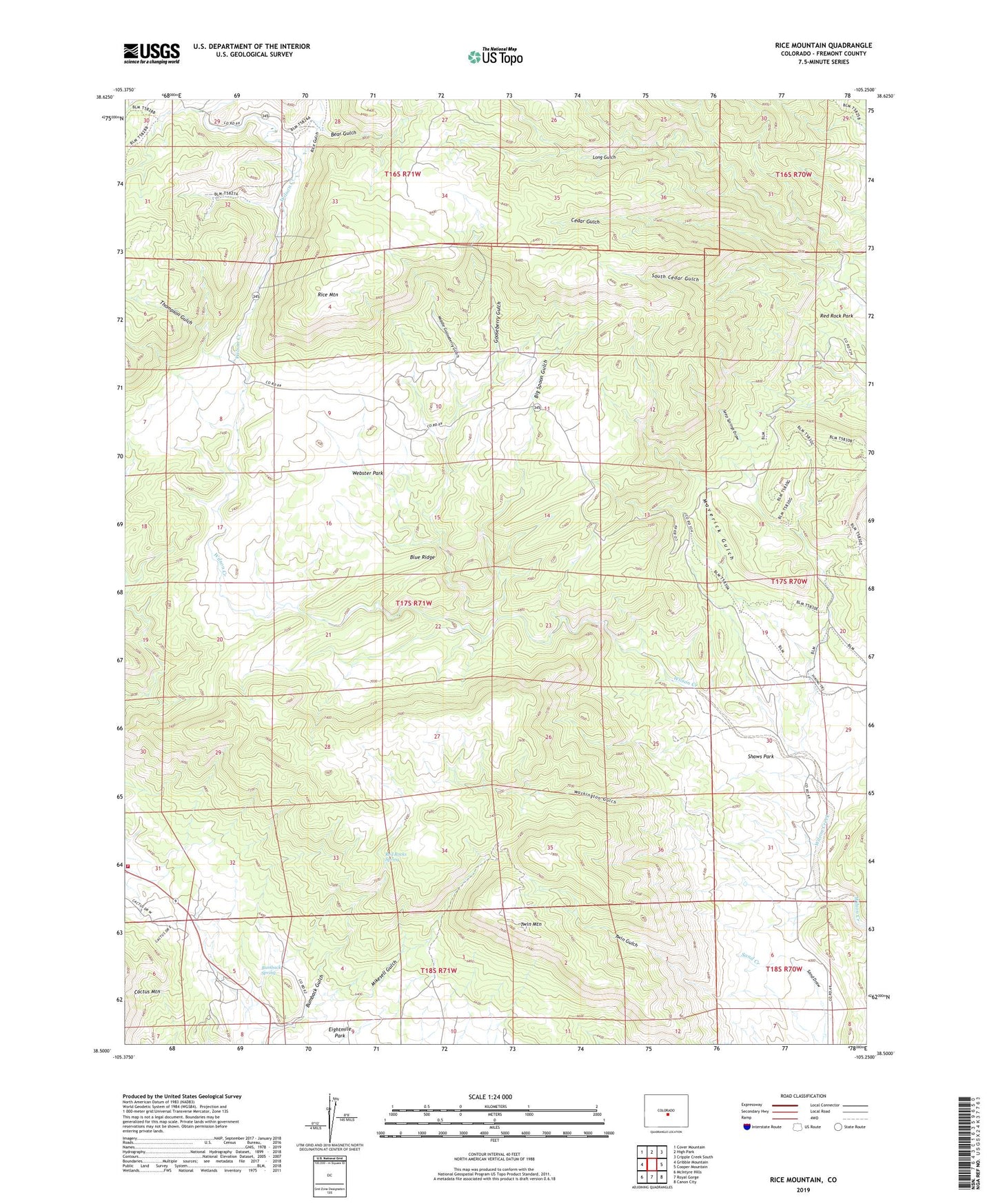
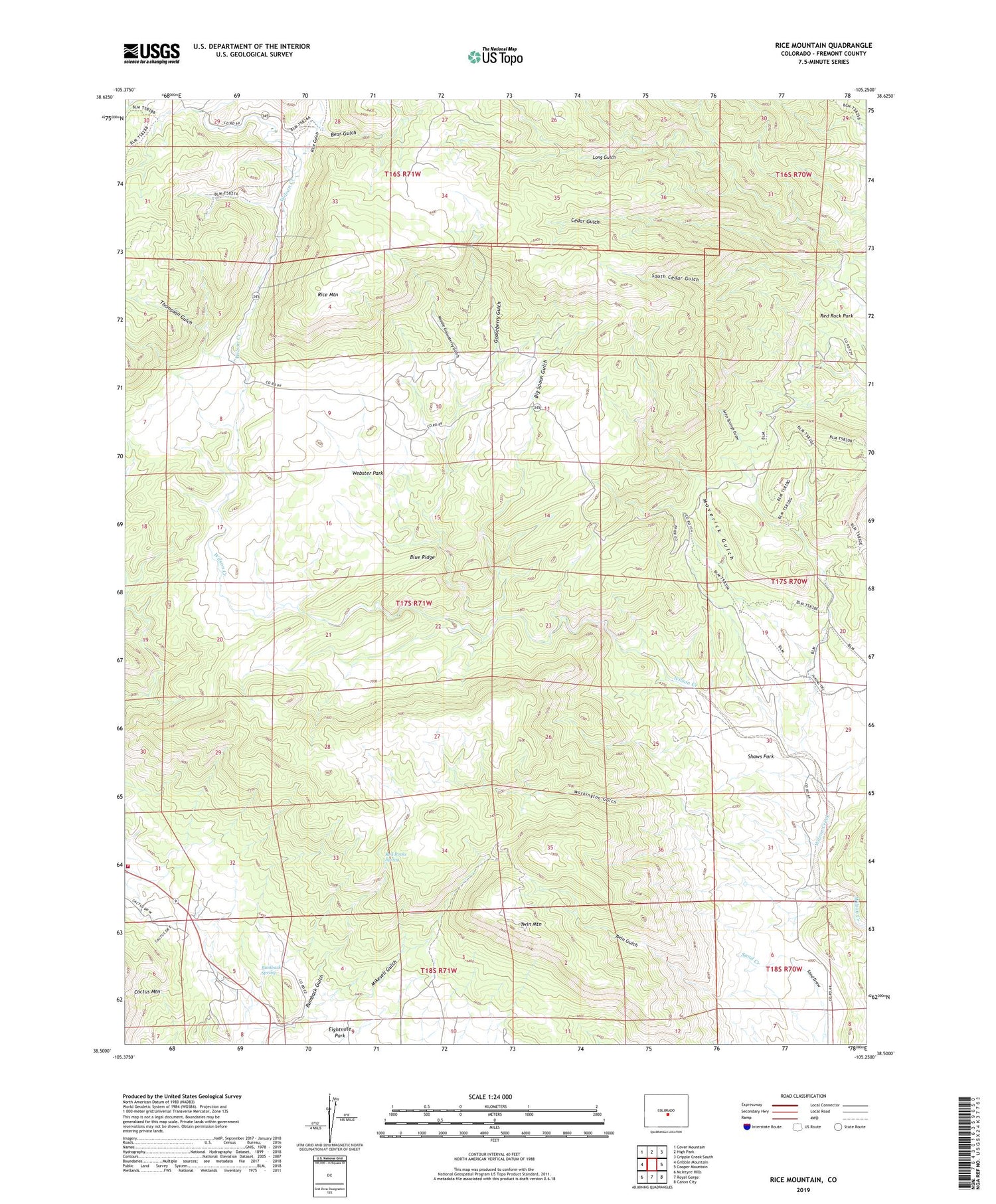
2022 topographic map quadrangle Rice Mountain in the state of Colorado. Scale: 1:24000. Based on the newly updated USGS 7.5' US Topo map series, this map is in the following counties: Fremont. The map contains contour data, water features, and other items you are used to seeing on USGS maps, but also has updated roads and other features. This is the next generation of topographic maps. Printed on high-quality waterproof paper with UV fade-resistant inks.
Quads adjacent to this one:
West: Gribble Mountain
Northwest: Cover Mountain
North: High Park
Northeast: Cripple Creek South
East: Cooper Mountain
Southeast: Canon City
South: Royal Gorge
Southwest: McIntyre Hills
This map covers the same area as the classic USGS quad with code o38105e3.
Contains the following named places: Bear Gulch, Big Spoon Gulch, Blue Ridge, Bumback Spring, Cedar Gulch, Chicken Claim, Gooseberry Gulch, Hoppy Claim, Little Johnny Dam, Little Johnny Reservoir, Maverick Gulch, Middle Gooseberry Gulch, Mikesell Gulch, Red Cliff Thirty Mine, Red Rock Park, Red Rocks Spring, Rice Gulch, Rice Mountain, Seep Springs Draw, Shaws Park, South Cedar Gulch, Tallahassee Volunteer Fire Protection Main Fire Station, Thompson Gulch, Twin Gulch, Twin Mountain, Washington Gulch, Webster Park, Wilson Creek School