MyTopo
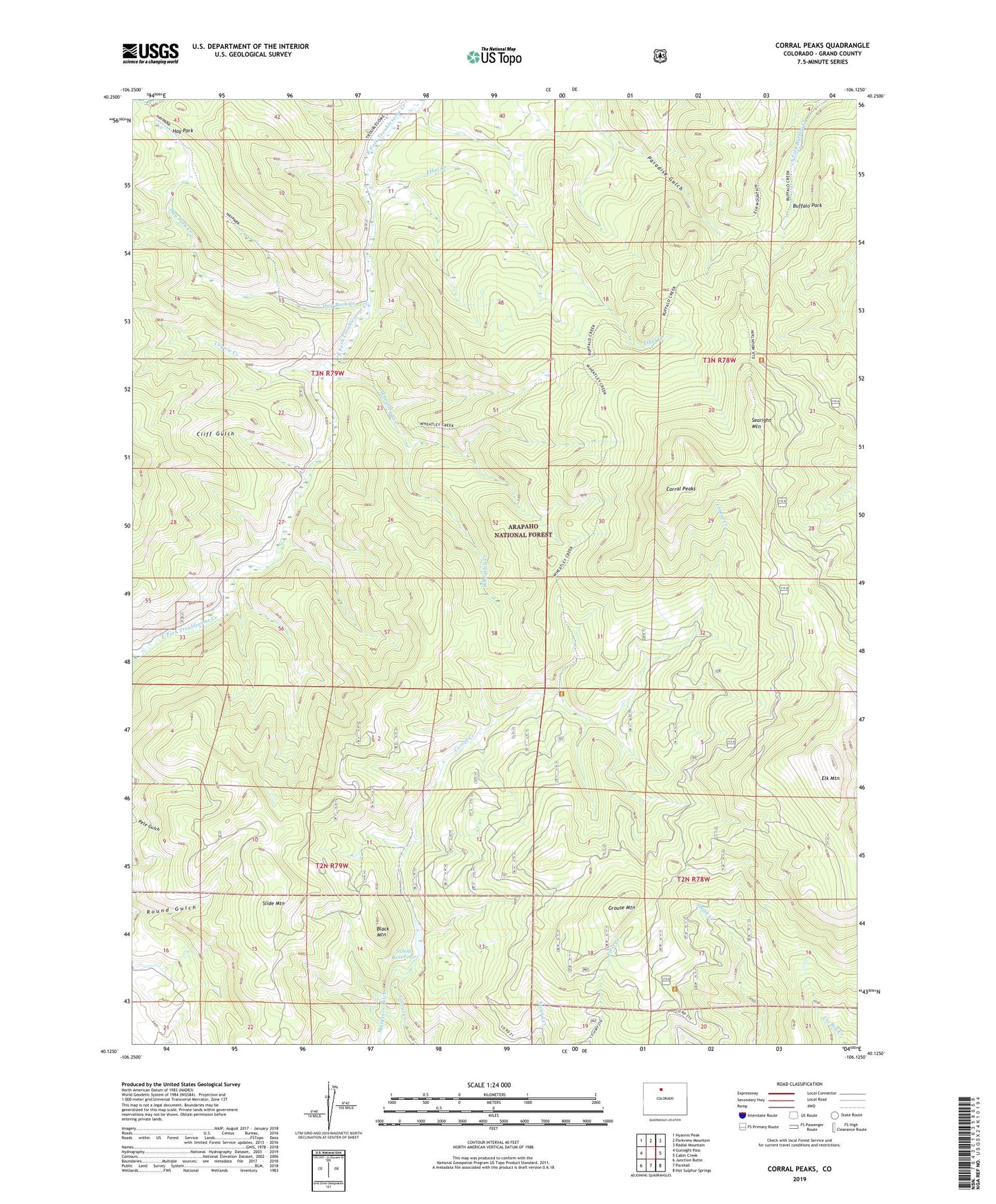
Corral Peaks Colorado US Topo Map
Couldn't load pickup availability
Also explore the Corral Peaks Forest Service Topo of this same quad for updated USFS data
2022 topographic map quadrangle Corral Peaks in the state of Colorado. Scale: 1:24000. Based on the newly updated USGS 7.5' US Topo map series, this map is in the following counties: Grand. The map contains contour data, water features, and other items you are used to seeing on USGS maps, but also has updated roads and other features. This is the next generation of topographic maps. Printed on high-quality waterproof paper with UV fade-resistant inks.
Quads adjacent to this one:
West: Gunsight Pass
Northwest: Hyannis Peak
North: Parkview Mountain
Northeast: Radial Mountain
East: Cabin Creek
Southeast: Hot Sulphur Springs
South: Parshall
Southwest: Junction Butte
This map covers the same area as the classic USGS quad with code o40106b2.
Contains the following named places: Black Mountain, Buffalo Park, Cliff Gulch, Corral Peaks, Coyote Creek, East Fork Cow Camp, Elk Mountain, Elk Mountain Trail, Ethel Creek, Grouse Mountain, Grouse Mountain Heliport, Hay Park, Hay Park Creek, Hay Park Trail, Scholl Dam, Scholl Reservoir, Searight Mountain, Slide Mountain, Wheatley Creek, Wheatley Ranch