MyTopo
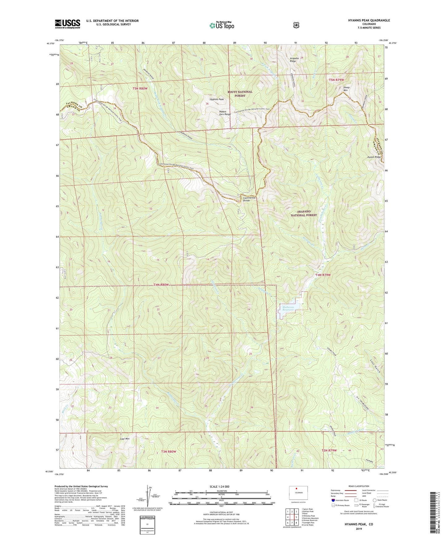
Hyannis Peak Colorado US Topo Map
Couldn't load pickup availability
Also explore the Hyannis Peak Forest Service Topo of this same quad for updated USFS data
2022 topographic map quadrangle Hyannis Peak in the state of Colorado. Scale: 1:24000. Based on the newly updated USGS 7.5' US Topo map series, this map is in the following counties: Grand, Jackson. The map contains contour data, water features, and other items you are used to seeing on USGS maps, but also has updated roads and other features. This is the next generation of topographic maps. Printed on high-quality waterproof paper with UV fade-resistant inks.
Quads adjacent to this one:
West: Whiteley Peak
Northwest: Spicer Peak
North: Buffalo Peak
Northeast: Rand
East: Parkview Mountain
Southeast: Corral Peaks
South: Gunsight Pass
Southwest: Hinman Reservoir
This map covers the same area as the classic USGS quad with code o40106c3.
Contains the following named places: Arapaho Creek Trail, Birdseye Creek, Black Creek, Coal Mountain, Coldwater Creek, Glomerate Creek, Hendricks Ranch, Hyannis Peak, Matheson Dam, Matheson Reservoir, Poison Creek, Porphyry Creek, Rabbit Ears Creek, Sheep Creek, Sheep Mountain