MyTopo
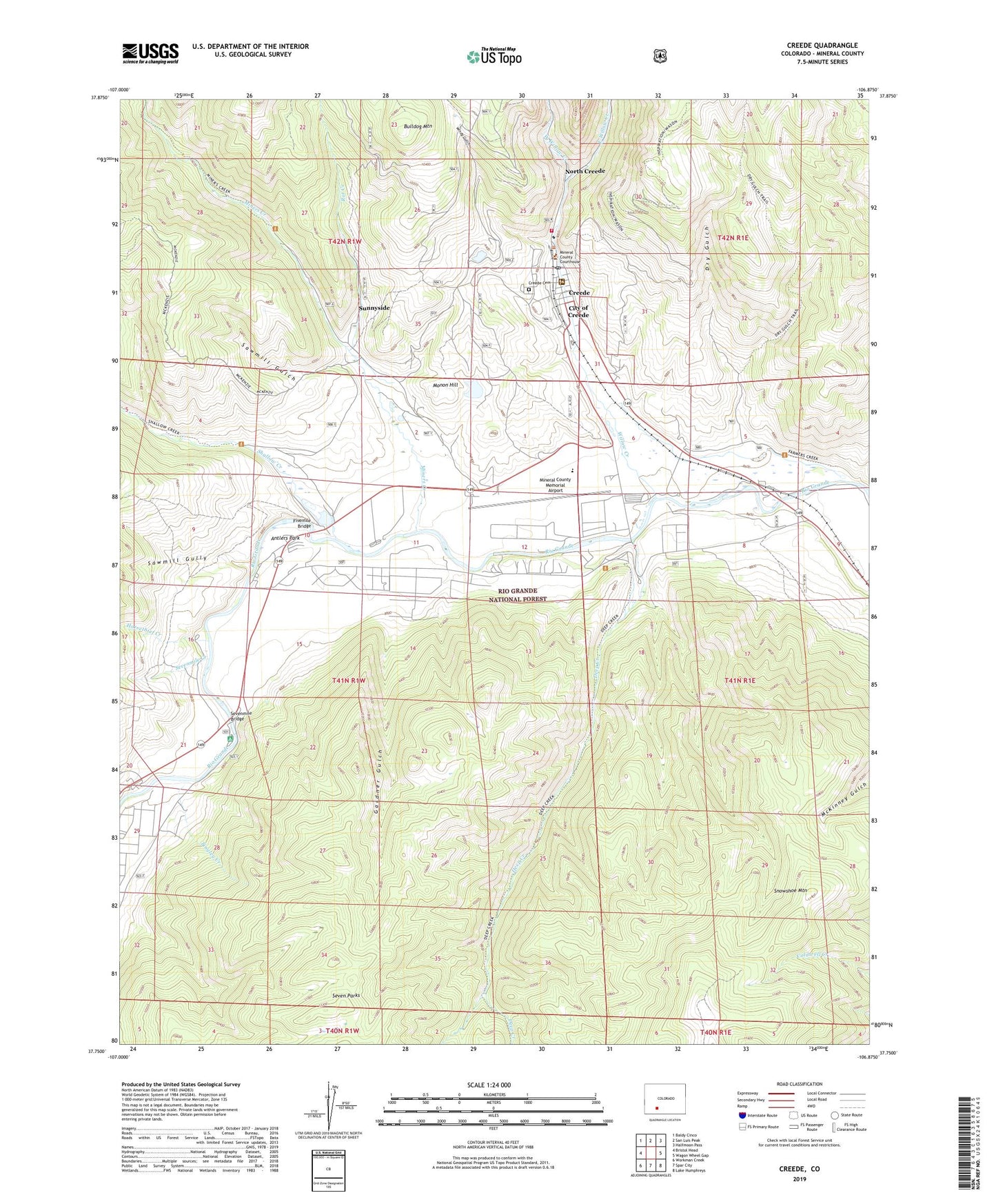
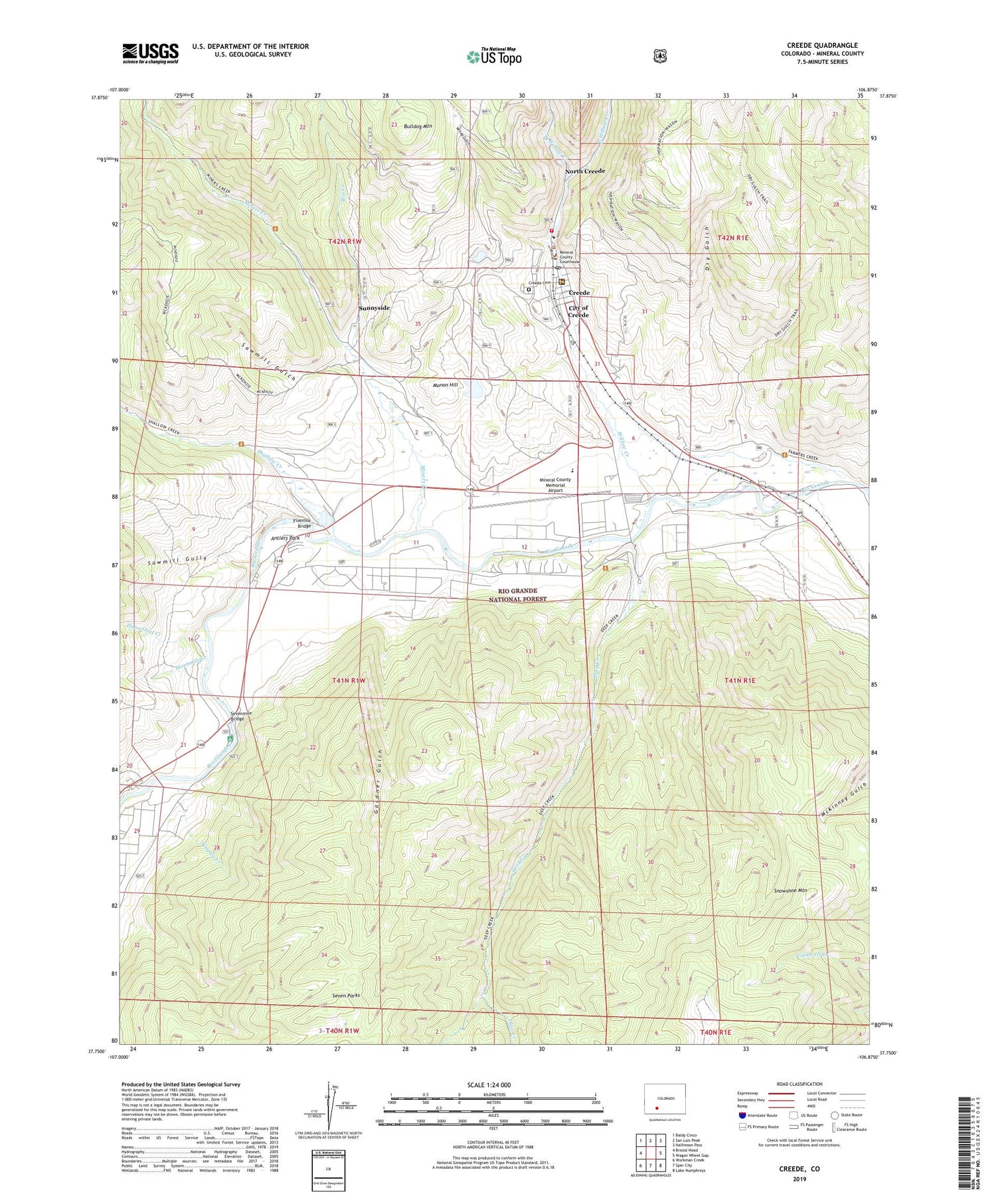
Creede Colorado US Topo Map
Couldn't load pickup availability
Also explore the Creede Forest Service Topo of this same quad for updated USFS data
2022 topographic map quadrangle Creede in the state of Colorado. Scale: 1:24000. Based on the newly updated USGS 7.5' US Topo map series, this map is in the following counties: Mineral. The map contains contour data, water features, and other items you are used to seeing on USGS maps, but also has updated roads and other features. This is the next generation of topographic maps. Printed on high-quality waterproof paper with UV fade-resistant inks.
Quads adjacent to this one:
West: Bristol Head
Northwest: Baldy Cinco
North: San Luis Peak
Northeast: Halfmoon Pass
East: Wagon Wheel Gap
Southeast: Lake Humphreys
South: Spar City
Southwest: Workman Creek
This map covers the same area as the classic USGS quad with code o37106g8.
Contains the following named places: Annabelle Mine, Antlers Park, April Fool Mine, Bethel Mine, Broadacre Lake Dam, Broadacre Lake Reservoir, Bulldog Mine, Bulldog Mountain, Casino Lease Mine, Chama Mine, Colewood Mine, Commodore Mine, Conejos Mine, Copper Lode, Corsair Mine, Creede, Creede Cemetery, Creede Community Church, Creede Post Office, Deep Creek, Dry Gulch, East Willow Creek, Eclat Mine, Emperius Mine, Eunice Mine, Exchequer Mine, Fivemile Bridge, Gardner Gulch, Grande Army Mine, Horsethief Creek, Jackpot Mine, Kansas City Star Mine, Kreutzer Mine, Krutzer Sonata Mine, Lower Homestake Tailings Dam, Lower Homestake Tailings Pond, Mammoth Mine, Manhattan Mine, Manitoba Mine, Marshall Park Campground, Mineral County Ambulance Service, Mineral County Fire Protection District - Station 1, Mineral County Memorial Airport, Mineral County Sheriff's Office, Miners Creek, Molly Mine, Monon Hill, Monon Mine, Monte Carlo Mine, Mustang Mine, Nelson Tunnel Mine, North Creede, Oro y Plata Mine, Overholt Lode, P and E Tunnel Mine, Rat Creek, Sawmill Gulch, Sawmill Gully, Sevenmile Bridge, Sevenmile Creek, Shallow Creek, Sunnyside, Tingley Creek, Town of the City of Creede, Upper Homestake Tailings Pond, Upper Homestake Tailings Pond Dam, Volunteer Mine, Wason Ranch, Wedge Mine, West Willow Creek, Willow Creek, Windsor-Governor Mine, Windy Gulch