MyTopo
San Luis Peak Colorado US Topo Map
Couldn't load pickup availability
Also explore the San Luis Peak Forest Service Topo of this same quad for updated USFS data
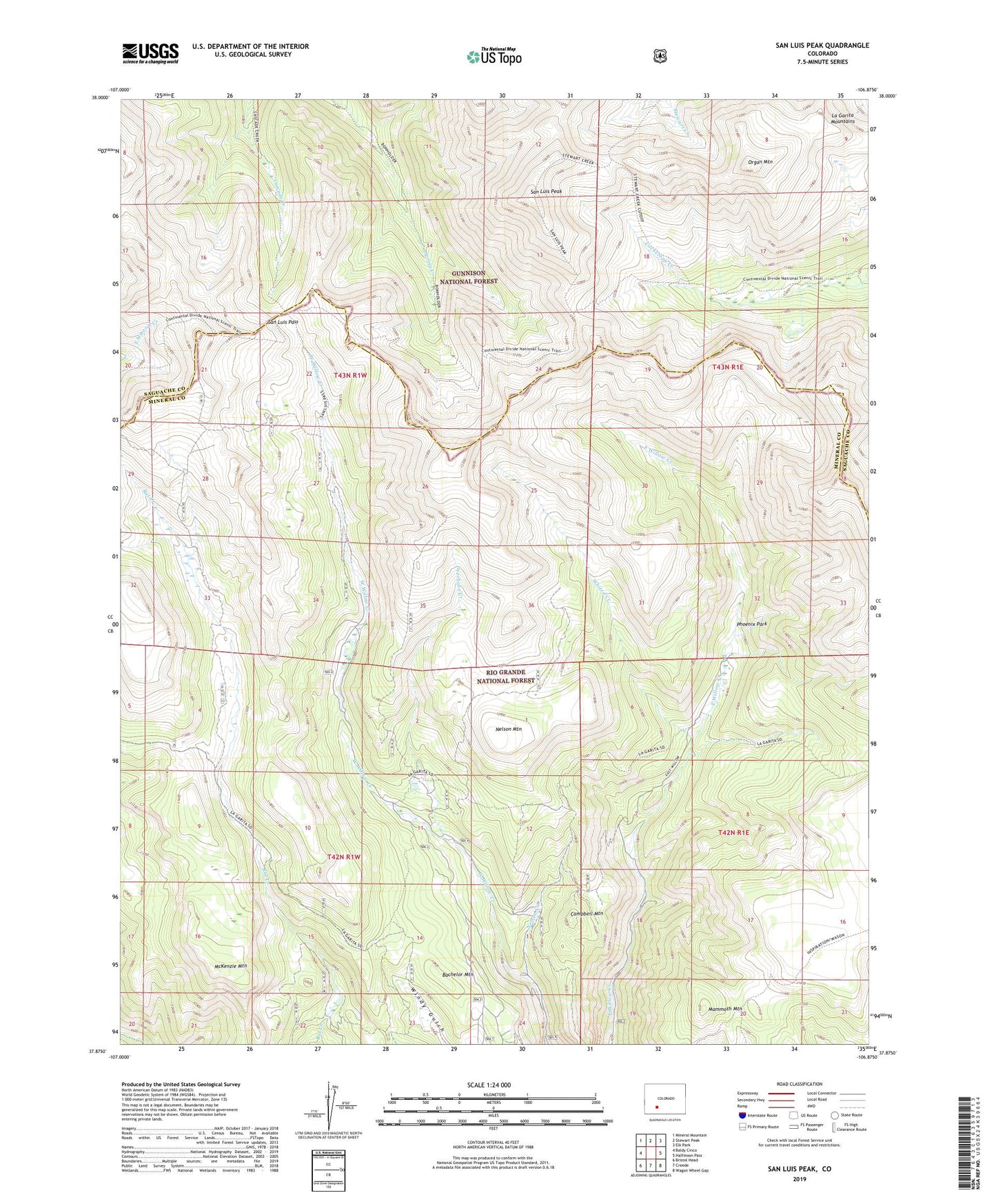
2022 topographic map quadrangle San Luis Peak in the state of Colorado. Scale: 1:24000. Based on the newly updated USGS 7.5' US Topo map series, this map is in the following counties: Mineral, Saguache. The map contains contour data, water features, and other items you are used to seeing on USGS maps, but also has updated roads and other features. This is the next generation of topographic maps. Printed on high-quality waterproof paper with UV fade-resistant inks.
Quads adjacent to this one:
West: Baldy Cinco
Northwest: Mineral Mountain
North: Stewart Peak
Northeast: Elk Park
East: Halfmoon Pass
Southeast: Wagon Wheel Gap
South: Creede
Southwest: Bristol Head
This map covers the same area as the classic USGS quad with code o37106h8.
Contains the following named places: Amethyst Mine, Bachelor, Bachelor Mine, Bachelor Mountain, Beaver Ponds, Berkshire Shaft Mine, Campbell Mountain, Captive Inca Mine, Chance Number Two Mine, Cliff Shaft Mine, Cowboy Johnson Adit Mine, Deerhorn Creek, Equinox Mine, Equity Mine, Ethel Shaft Mine, Frazee Mine, Gateway Adit Mine, Gorma Mine, Granite Mine, Happy Thought Mine, Holy Moses Mine, Homestead Number One Mine, Humphreys Tunnel Mine, Kanawha Mine, La Garita Stock Driveway, Last Chance Mine, Mammoth Mountain, Mary Anderson Mine, McKenzie Mountain, Mexico Mine, Midwest Mine, Nelson Creek, Nelson Mountain, Organ Mountain, Outlet Mine, Palo Alto Tunnel Mine, Park Regent Mine, Phoenix Mine, Phoenix Park, Pittsburgh Mine, Resurrection Tunnel Mine, Ridge Mine, River View Tunnel Mine, Robinson Mine, Runaround Mine, San Luis Pass, San Luis Peak, Silver King Mine, Skyline Trail, Sloan Tunnel Mine, Solomon Mine, Texas Girl Mine, United Mines Shaft, Wason Stock Driveway, Weaver, Werner Arroyo, White Star Mine, Whited Creek, Wooster Mine