
MyTopo
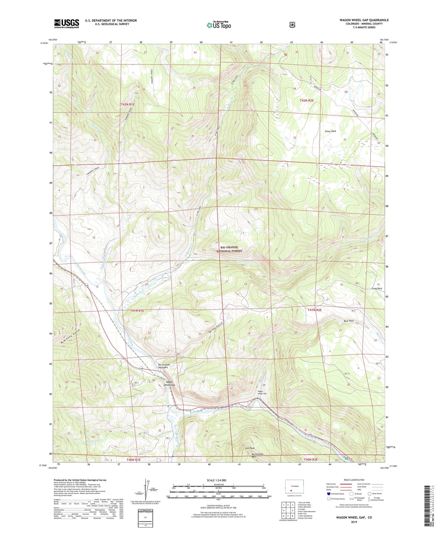
Wagon Wheel Gap Colorado US Topo Map
Couldn't load pickup availability
Also explore the Wagon Wheel Gap Forest Service Topo of this same quad for updated USFS data
2022 topographic map quadrangle Wagon Wheel Gap in the state of Colorado. Scale: 1:24000. Based on the newly updated USGS 7.5' US Topo map series, this map is in the following counties: Mineral. The map contains contour data, water features, and other items you are used to seeing on USGS maps, but also has updated roads and other features. This is the next generation of topographic maps. Printed on high-quality waterproof paper with UV fade-resistant inks.
Quads adjacent to this one:
West: Creede
Northwest: San Luis Peak
North: Halfmoon Pass
Northeast: Mesa Mountain
East: Pool Table Mountain
Southeast: South Fork West
South: Lake Humphreys
Southwest: Spar City
This map covers the same area as the classic USGS quad with code o37106g7.
Contains the following named places: Bellows Creek, Blue Creek, Caldwell Creek, East Bellows Creek, Farmers Creek, Farmers Creek Trail, Fremont School Number 1, Goose Creek, McKinney Gulch, Palisade Campground, Phipps Ranch, Silver Park, Spring Gulch, Ute Peak, Wagon Wheel Gap, Wagon Wheel Gap Post Office, Wagon Wheel Ranch, West Bellows Creek


