
MyTopo
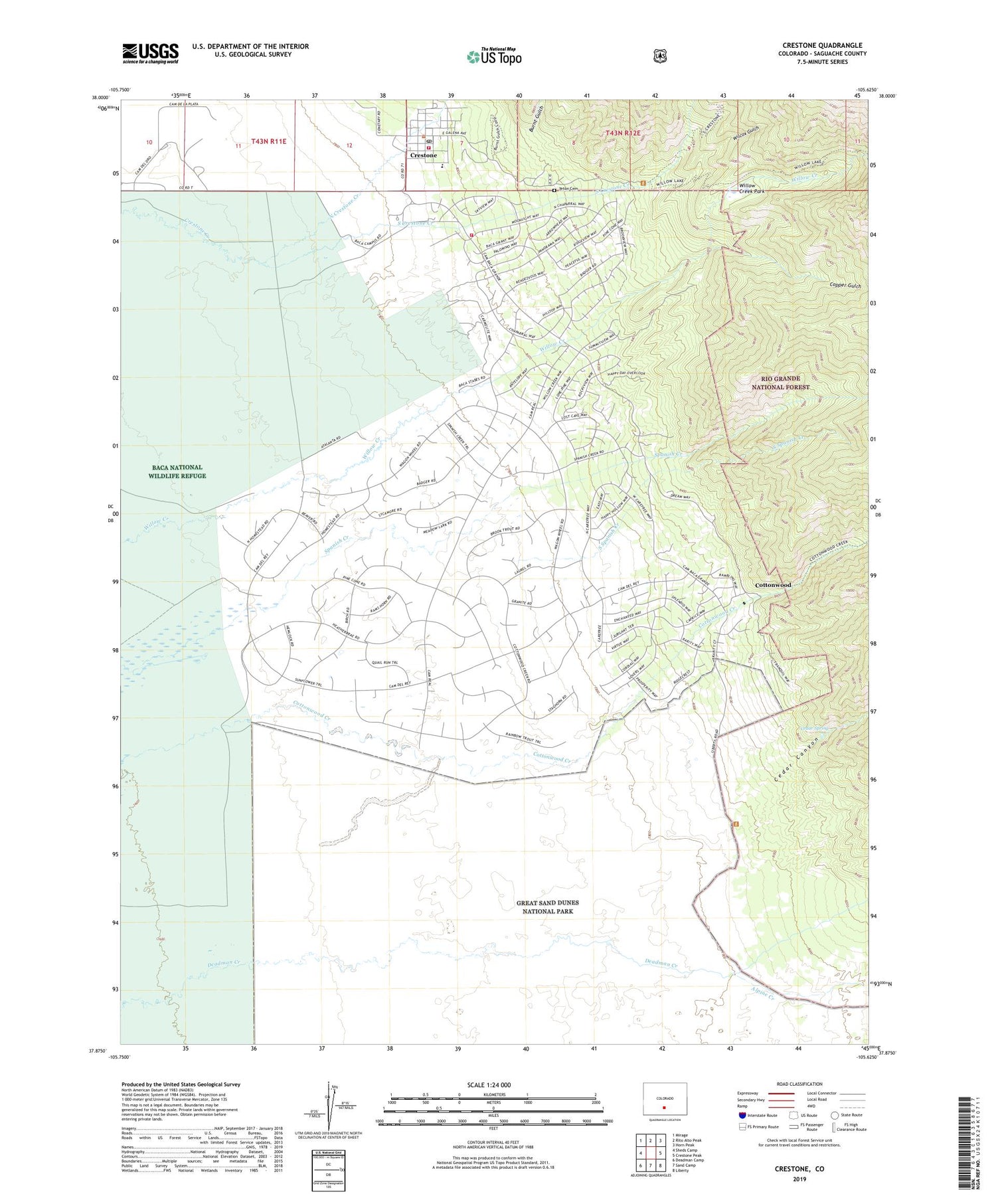
Crestone Colorado US Topo Map
Couldn't load pickup availability
Also explore the Crestone Forest Service Topo of this same quad for updated USFS data
2022 topographic map quadrangle Crestone in the state of Colorado. Scale: 1:24000. Based on the newly updated USGS 7.5' US Topo map series, this map is in the following counties: Saguache. The map contains contour data, water features, and other items you are used to seeing on USGS maps, but also has updated roads and other features. This is the next generation of topographic maps. Printed on high-quality waterproof paper with UV fade-resistant inks.
Quads adjacent to this one:
West: Sheds Camp
Northwest: Mirage
North: Rito Alto Peak
Northeast: Horn Peak
East: Crestone Peak
Southeast: Liberty
South: Sand Camp
Southwest: Deadman Camp
This map covers the same area as the classic USGS quad with code o37105h6.
Contains the following named places: Alpine Camp, Alpine Creek, Baca Grande Volunteer Fire Department, Burnt Gulch, Cedar Canyon, Cedar Spring, Copper Gulch, Cottonwood, Crestone, Crestone Baptist Church, Crestone Fire Department, Crestone Post Office, Luis Maria Baca Number 4, North Crestone Creek, San Luis Valley Tibetan Church, South Crestone Creek, South Spanish Creek, Teton Cemetery, Town of Crestone, Wilcox Gulch, Willow Creek Park


