MyTopo
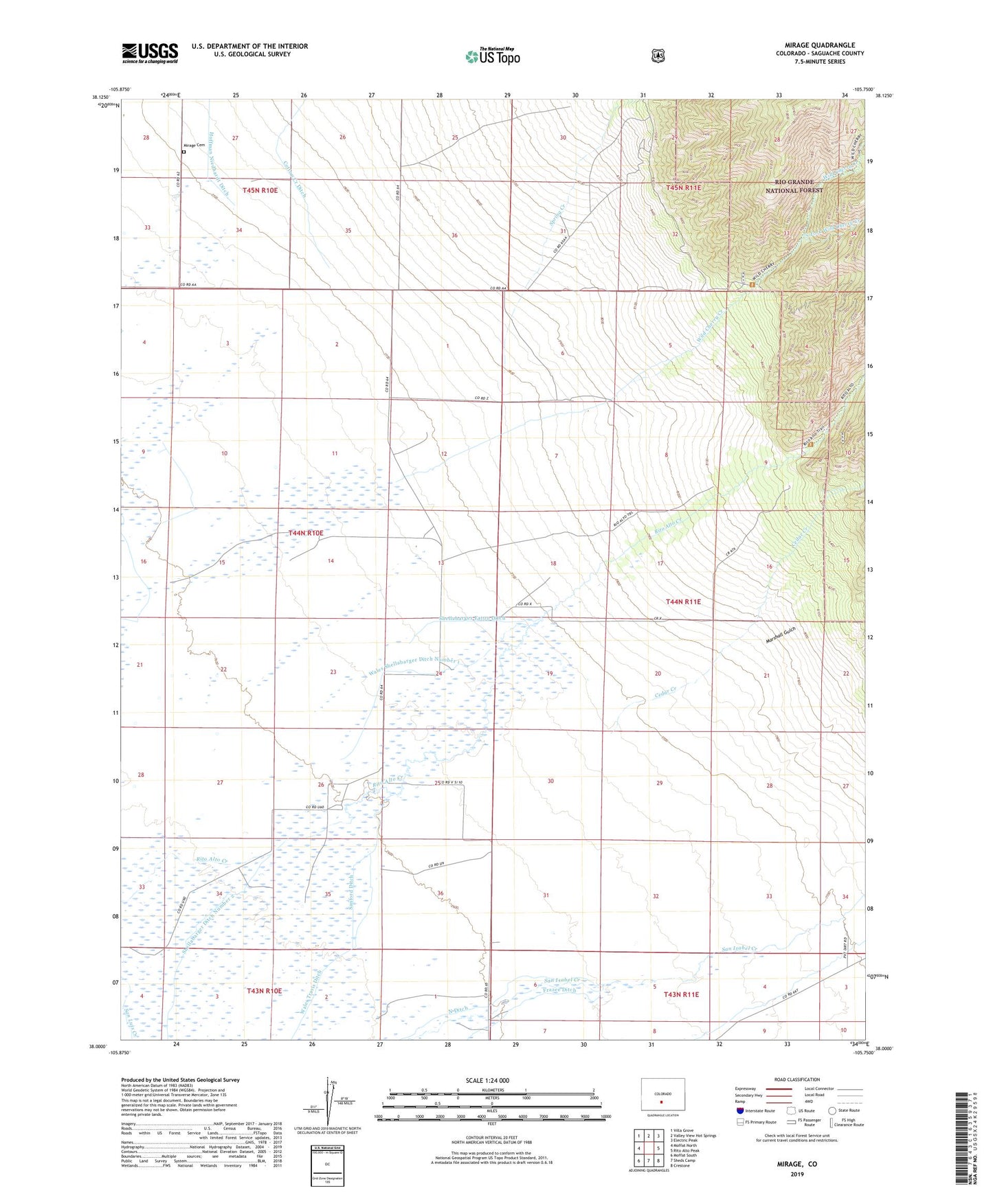
Mirage Colorado US Topo Map
Couldn't load pickup availability
Also explore the Mirage Forest Service Topo of this same quad for updated USFS data
2022 topographic map quadrangle Mirage in the state of Colorado. Scale: 1:24000. Based on the newly updated USGS 7.5' US Topo map series, this map is in the following counties: Saguache. The map contains contour data, water features, and other items you are used to seeing on USGS maps, but also has updated roads and other features. This is the next generation of topographic maps. Printed on high-quality waterproof paper with UV fade-resistant inks.
Quads adjacent to this one:
West: Moffat North
Northwest: Villa Grove
North: Valley View Hot Springs
Northeast: Electric Peak
East: Rito Alto Peak
Southeast: Crestone
South: Sheds Camp
Southwest: Moffat South
This map covers the same area as the classic USGS quad with code o38105a7.
Contains the following named places: Cedar Creek, Copper Head Claim, Elarton Manganese Deposit, Frazee Ditch, Hoffman Niedhardt Ditch, Marshall Gulch, Mirage, Mirage Cemetery, North Ditch, Peterson Ditch Number 1, Rito Alto Church, Sanford Ditch, Shellabarger Ditch Number 2, Shellabarger Eaton Ditch, South Fork Wild Cherry Creek, Spring Creek, Triple T Mine, Wales Shellabarger Ditch Number 1, Wales Travis Ditch, Wild Cherry Creek, ZIP Code: 81143