
MyTopo
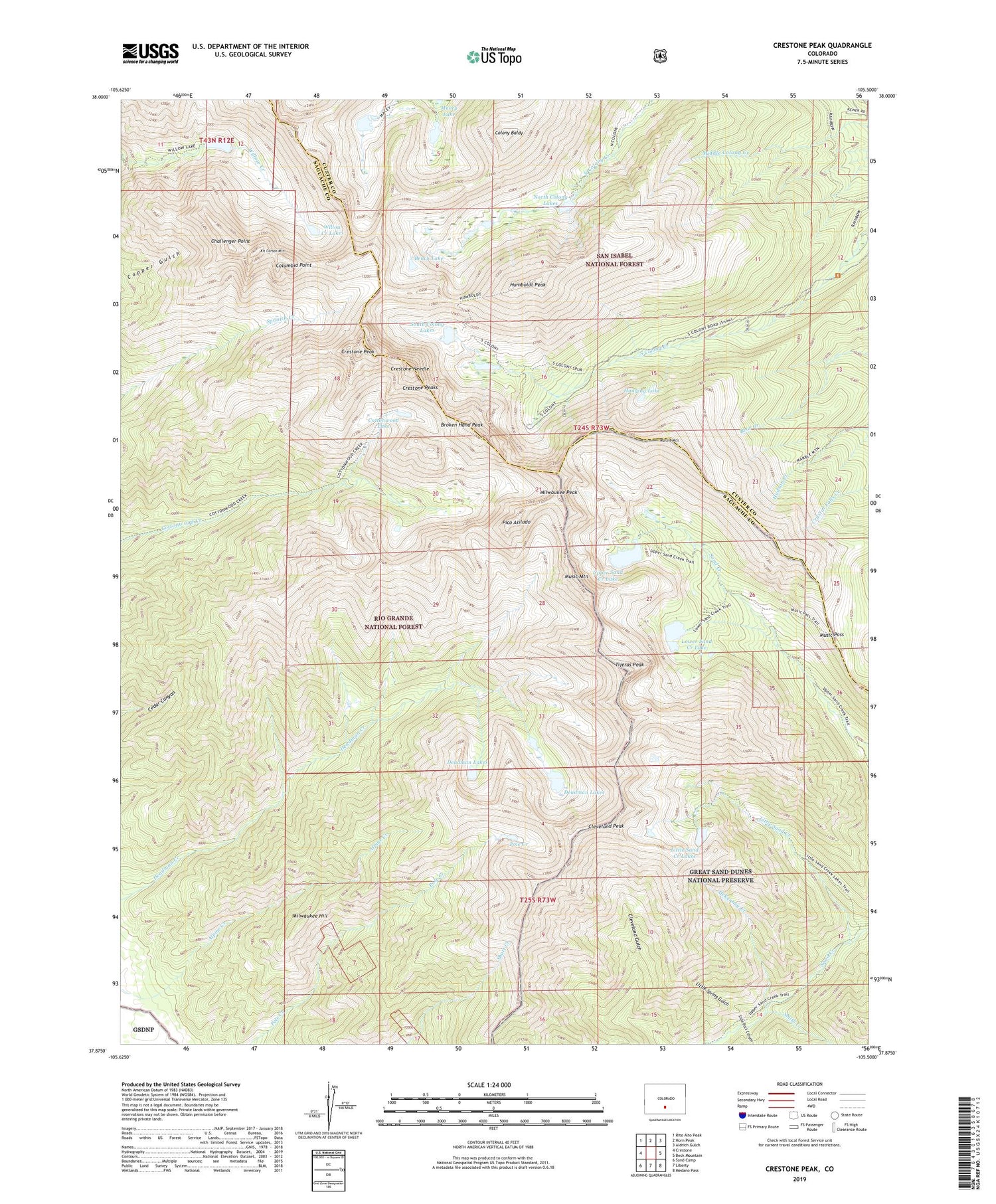
Crestone Peak Colorado US Topo Map
Couldn't load pickup availability
Also explore the Crestone Peak Forest Service Topo of this same quad for updated USFS data
2022 topographic map quadrangle Crestone Peak in the state of Colorado. Scale: 1:24000. Based on the newly updated USGS 7.5' US Topo map series, this map is in the following counties: Saguache, Custer. The map contains contour data, water features, and other items you are used to seeing on USGS maps, but also has updated roads and other features. This is the next generation of topographic maps. Printed on high-quality waterproof paper with UV fade-resistant inks.
Quads adjacent to this one:
West: Crestone
Northwest: Rito Alto Peak
North: Horn Peak
Northeast: Aldrich Gulch
East: Beck Mountain
Southeast: Medano Pass
South: Liberty
Southwest: Sand Camp
This map covers the same area as the classic USGS quad with code o37105h5.
Contains the following named places: Bench Lake, Broken Hand Peak, Challenger Point, Cleveland Peak, Colony Baldy, Columbia Point, Cottonwood Lake, Crestone Mine, Crestone Needle, Crestone Peak, Crestone Peaks, Deadman Lakes, Hanging Lake, Humboldt Peak, Kit Carson Mountain, Little Sand Creek, Little Sand Creek Lakes, Little Spring Gulch, Lower Sand Creek Lake, Macey Lakes, Marble Mountain, McKenney Creek, Milwaukee Hill, Milwaukee Peak, Music Mountain, Music Pass, North Colony Lakes, Pico Aislado, Pole Creek, Pole Creek Lake, Slide Rock Canyon, Smith Creek, South Colony Lakes, Tijeras Peak, Upper Sand Creek Lake, Willow Creek Lakes


