MyTopo
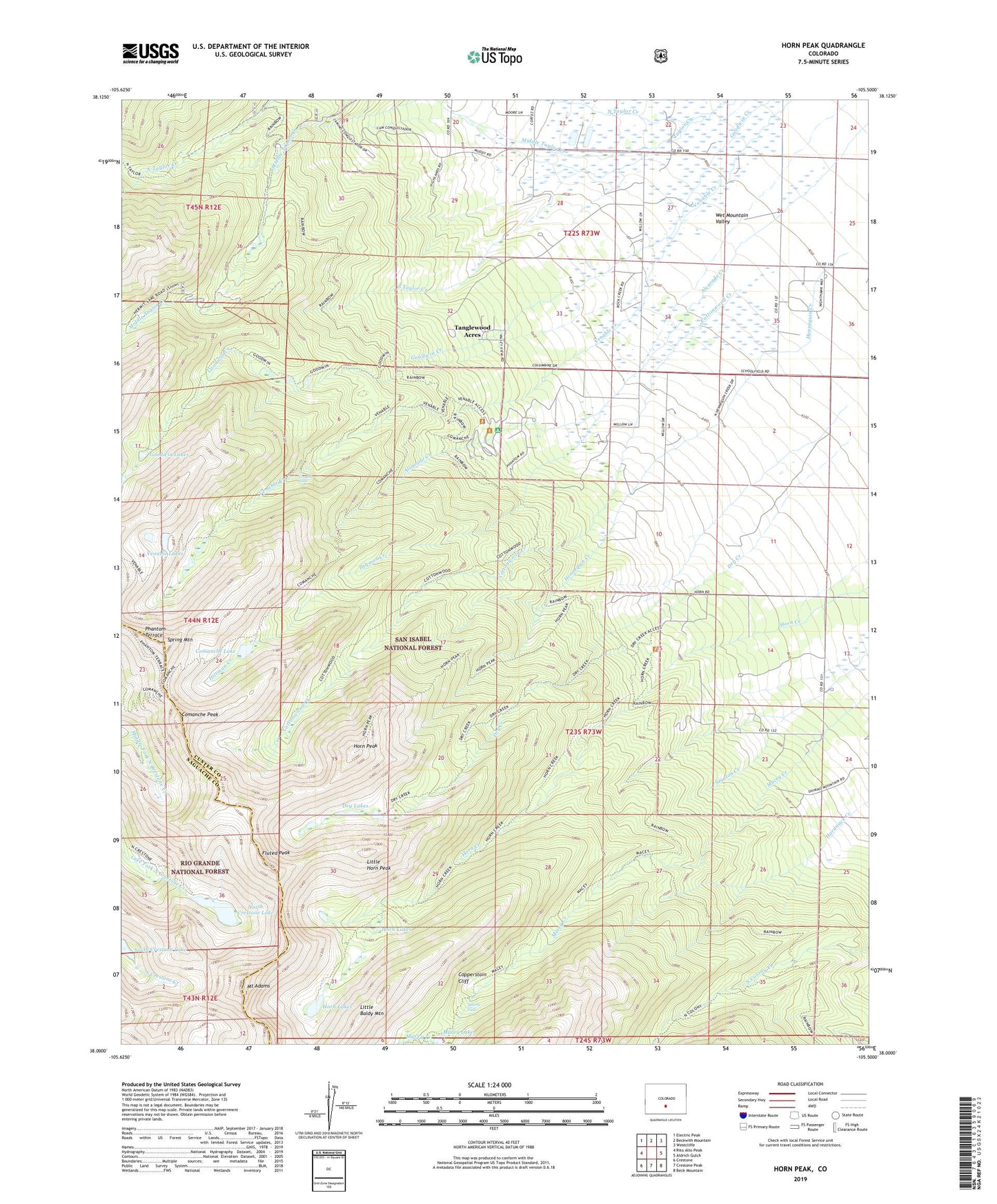
Horn Peak Colorado US Topo Map
Couldn't load pickup availability
Also explore the Horn Peak Forest Service Topo of this same quad for updated USFS data
2022 topographic map quadrangle Horn Peak in the state of Colorado. Scale: 1:24000. Based on the newly updated USGS 7.5' US Topo map series, this map is in the following counties: Custer, Saguache. The map contains contour data, water features, and other items you are used to seeing on USGS maps, but also has updated roads and other features. This is the next generation of topographic maps. Printed on high-quality waterproof paper with UV fade-resistant inks.
Quads adjacent to this one:
West: Rito Alto Peak
Northwest: Electric Peak
North: Beckwith Mountain
Northeast: Westcliffe
East: Aldrich Gulch
Southeast: Beck Mountain
South: Crestone Peak
Southwest: Crestone
This map covers the same area as the classic USGS quad with code o38105a5.
Contains the following named places: Abbots Lodge, Alvarado Picnic Ground, Comanche Lake, Comanche Peak, Conquistador Ski Area, Copperstain Cliff, Cottonwood Creek, Dry Creek, Dry Lakes, Fluted Peak, Goodwin Lakes, Hennequin Creek, Hiltman Creek, Horn Creek Ranch, Horn Lakes, Horn Peak, Legard Ditch Number 5, Little Baldy Mountain, Little Horn Peak, Macey Falls, Macey Lake, Middle Taylor Creek, Mount Adams, North Crestone Lake, North Taylor Creek, Phantom Terrace, Reiser Prairie, South Taylor Creek, Spring Mountain, Tanglewood Acres, Venable Falls, Venable Lakes, Venable-Comanche Trail