MyTopo
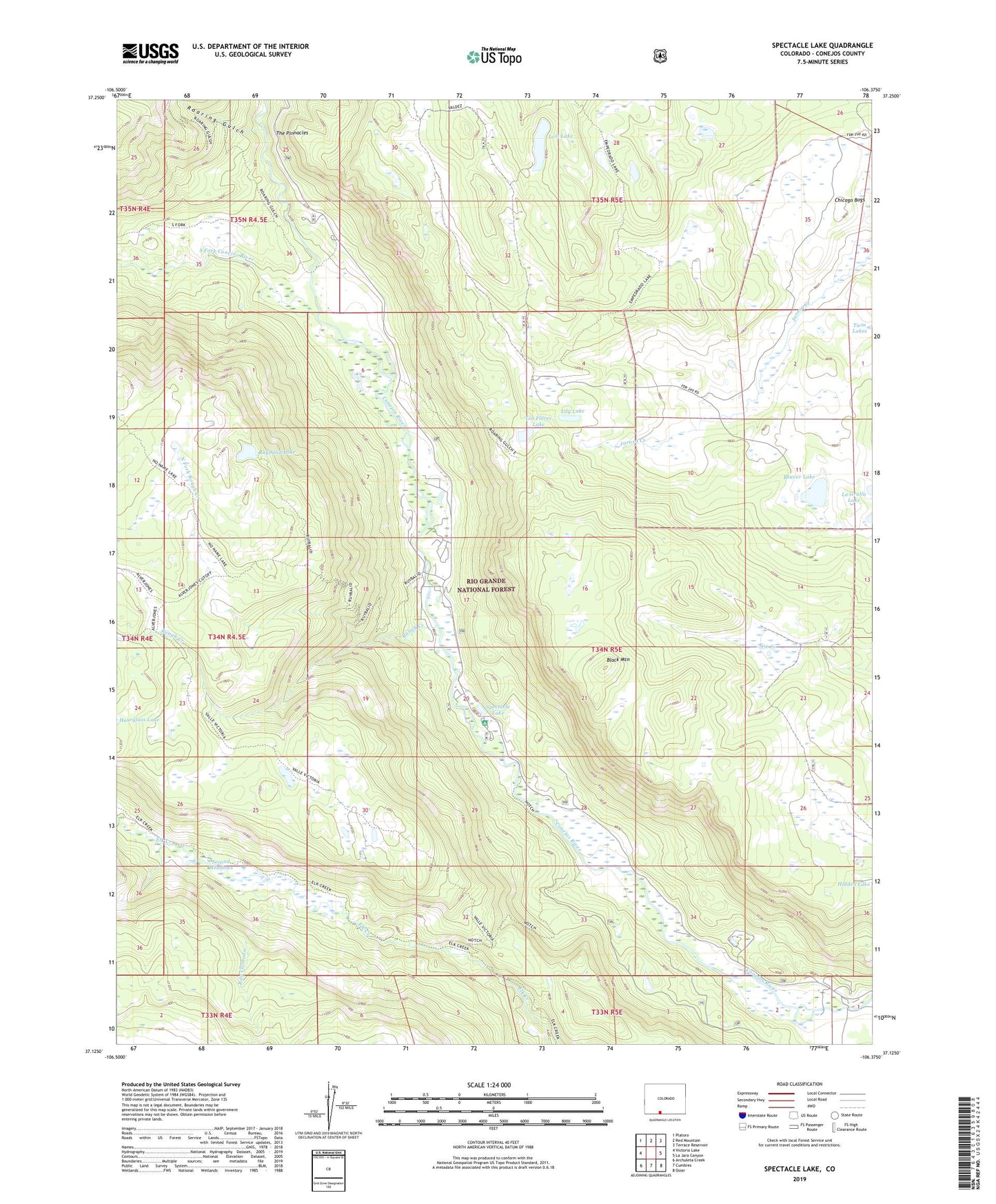
Spectacle Lake Colorado US Topo Map
Couldn't load pickup availability
Also explore the Spectacle Lake Forest Service Topo of this same quad for updated USFS data
2022 topographic map quadrangle Spectacle Lake in the state of Colorado. Scale: 1:24000. Based on the newly updated USGS 7.5' US Topo map series, this map is in the following counties: Conejos. The map contains contour data, water features, and other items you are used to seeing on USGS maps, but also has updated roads and other features. This is the next generation of topographic maps. Printed on high-quality waterproof paper with UV fade-resistant inks.
Quads adjacent to this one:
West: Victoria Lake
Northwest: Platoro
North: Red Mountain
Northeast: Terrace Reservoir
East: La Jara Canyon
Southeast: Osier
South: Cumbres
Southwest: Archuleta Creek
This map covers the same area as the classic USGS quad with code o37106b4.
Contains the following named places: Bancos Cow Camp, Beaver Lake, Black Mountain, Chicago Bogs, Conejos Campground, Conejos Stock Driveway, Lily Lake, Los Flores Lake, Lost Lake, North Fork Rough Creek, Notch Trail, Rainbow Trout Lodge, Rito Colorado, Roaring Gulch, Rocky Mountain Lodge, Rough Creek, Ruybalid Lake, Ruybalid Trail, Second Meadows, South Fork Conejos River, Spectacle Lake, Spectacle Lake Campground, The Pinnacles, Thomas Ranch