MyTopo
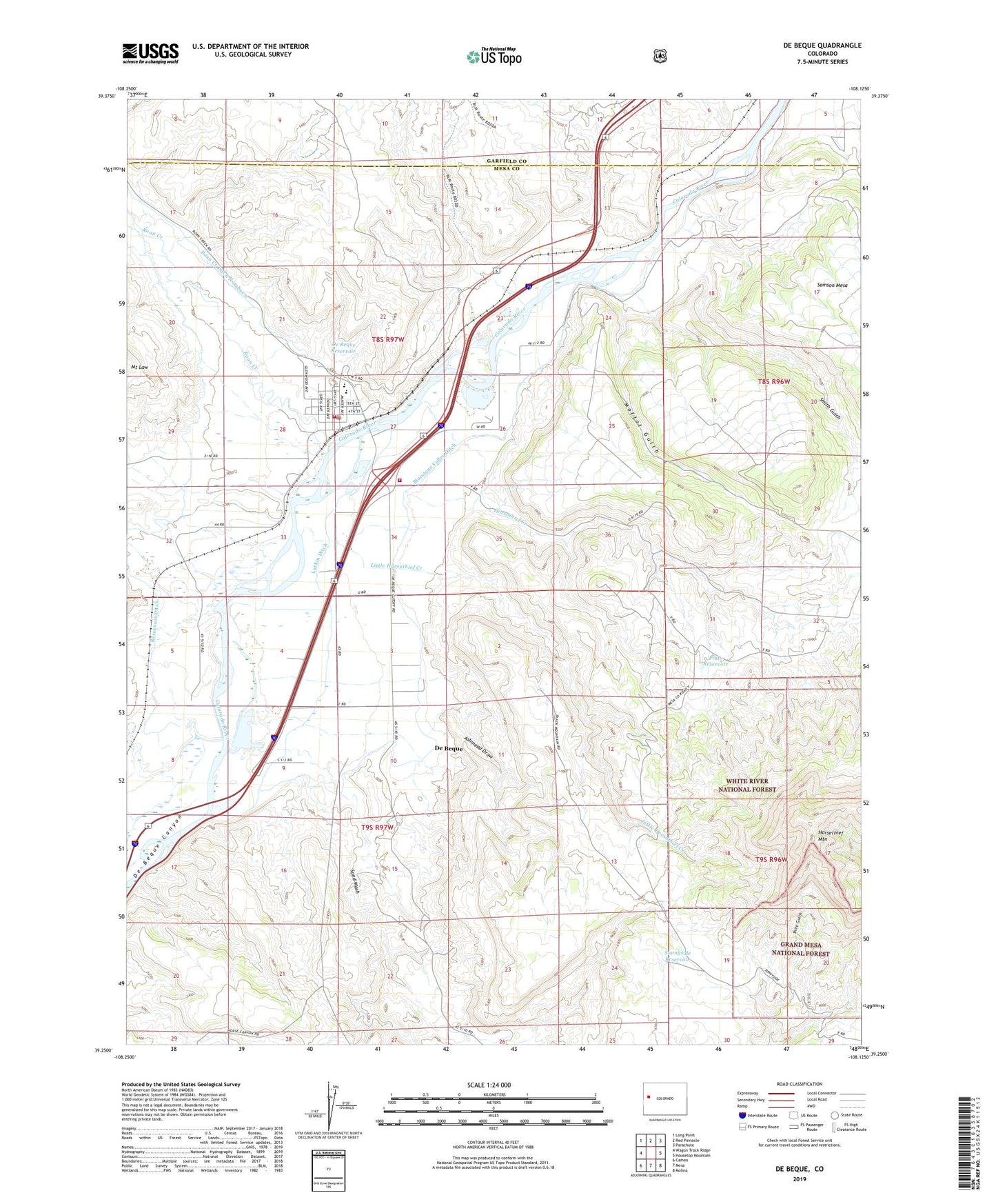
De Beque Colorado US Topo Map
Couldn't load pickup availability
Also explore the De Beque Forest Service Topo of this same quad for updated USFS data
2022 topographic map quadrangle De Beque in the state of Colorado. Scale: 1:24000. Based on the newly updated USGS 7.5' US Topo map series, this map is in the following counties: Mesa, Garfield. The map contains contour data, water features, and other items you are used to seeing on USGS maps, but also has updated roads and other features. This is the next generation of topographic maps. Printed on high-quality waterproof paper with UV fade-resistant inks.
Quads adjacent to this one:
West: Wagon Track Ridge
Northwest: Long Point
North: Red Pinnacle
Northeast: Parachute
East: Housetop Mountain
Southeast: Molina
South: Mesa
Southwest: Cameo
This map covers the same area as the classic USGS quad with code o39108c2.
Contains the following named places: Ashmead Draw, Bluestone Valley Ditch, De Beque, De Beque Fire Protection District, De Beque Post Office, De Beque Reservoir, Horsethief Creek, Horsethief Mountain, Larkin Ditch, Little Horsethief Creek, Moffat Gulch, Nichols Pit, Piute Reservoir, Reservoir Ditch, Roan Creek, Roan Creek Ditch Number 2, Sand Wash, Smith Gulch, Sunnyside Reservoir, Town of De Beque